Sign up or log in to your Spatialnode account.

Takes less than a few seconds.

Louisville, KY Housing Density

Sean Willis
Sean Willis•

October 20, 2023

Louisville, KY Housing Density

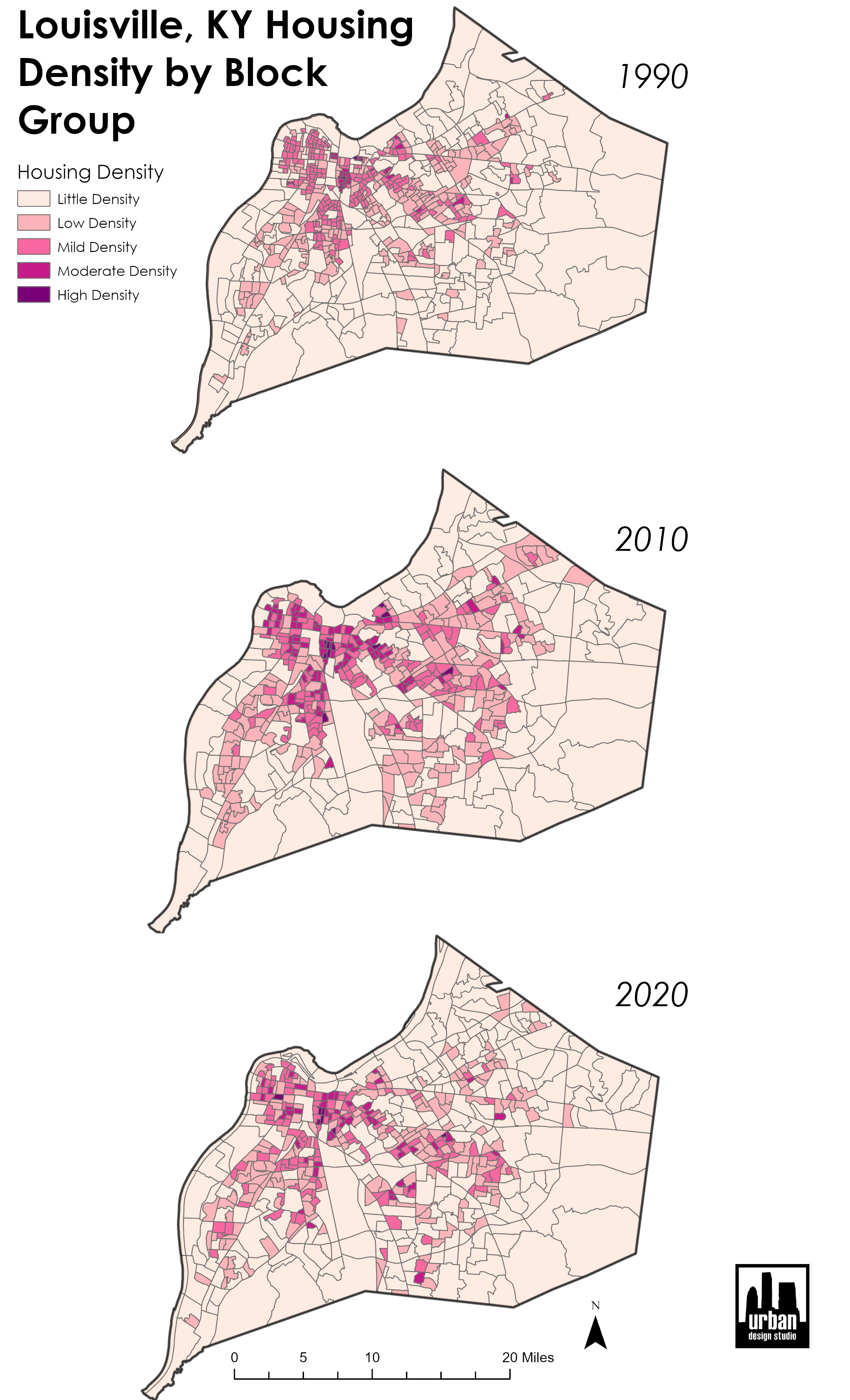
Used census data to calculate density of housing units per census block


Plug-ins used

N/A

tags

ArcGIS ProdensityHousing

More by Sean Willis

Canopy Cover and Heat Severity
79
JCPS District 4 Tree Plantings
43
Jefferson County Tax Income
61
Intersection Collisions in Louisville
21
Priority Planting in Louisville, KY
123
TreesLouisville JCPS Plantings
45
Old Louisville Property Tax Income
17
Canopy Cover by Zip Code
127
Waste Container Inventory
22
Louisville Light Rail Proposal
89
Tree Canopy in Redlined Districts
125
TARC Stops by Headway
15

You might also like

Climate Change and Action in Australia
Claire Kippe
Climate Change and Action in Australia
Claire KippePro
4
Concetração de óbitos de Covid-19 (2020)
WILLIAN S. SANTOS 🇧🇷
Concetração de óbitos de Covid-19 (2020)
WILLIAN S....
15
Denver Center
Adam O Dolce
Denver Center
Adam O Dolce
77
SUITABILITY MAP
Marvin Ayeh
SUITABILITY MAP
Marvin Ayeh
14
Surface Temperature
Obed Asare Amuzu
Surface Temperature
Obed Asare Amuzu
20
CROP MAP OF PART OF IKOT ESSIEN VILLAGE
Edidiong Ekrikpo
CROP MAP OF PART OF IKOT ESSIEN VILLAGE
Edidiong Ekrikpo
12
Lubigi Wetland Vulnerability Map Uganda
Akor, Daniel Enechojo
Lubigi Wetland Vulnerability Map Uganda
Akor, Daniel Enechojo
93
PRAD
Simone Malhado da Silva
PRAD
Simone Malhado...
11
LAND USE LAND COVER, MACHAKOS COUNTY2022
MOSES MWANIA MULYUNGI
LAND USE LAND COVER, MACHAKOS COUNTY2022
MOSES MWANIA MULYUNGI
153
Proposta de Ampliação do PMNI Memorial D
Williane de Vasconcelos Meneses
Proposta de Ampliação do PMNI Memorial D
Williane de...
14
Digital elevation modelling
Onyeakagbuna Amos
Digital elevation modelling
Onyeakagbuna Amos
3
Satellite Imagery
Bertrand Lobo
Satellite Imagery
Bertrand Lobo
25

Join the community!

We're a place where geospatial professionals showcase their works and discover opportunities.

Sign Up for free