
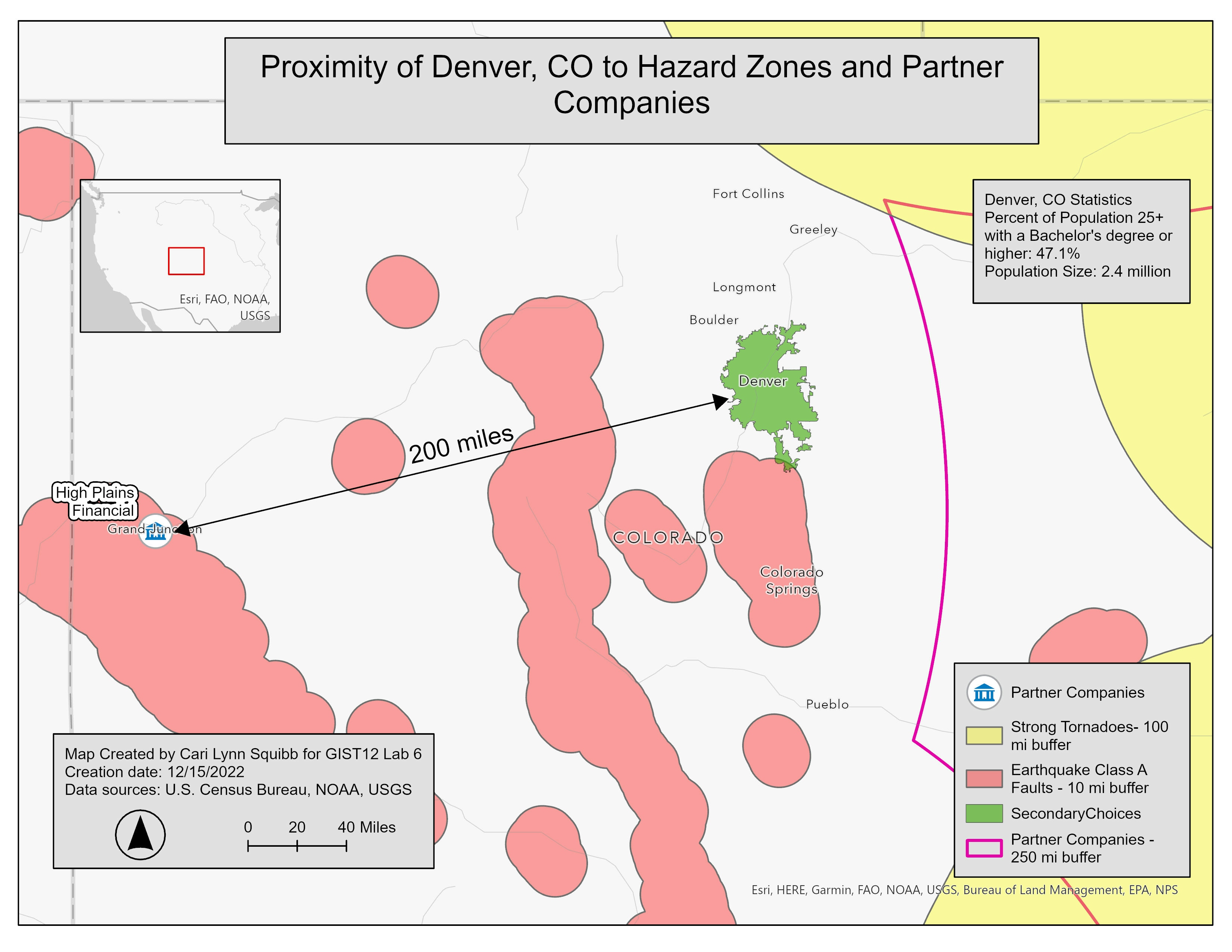
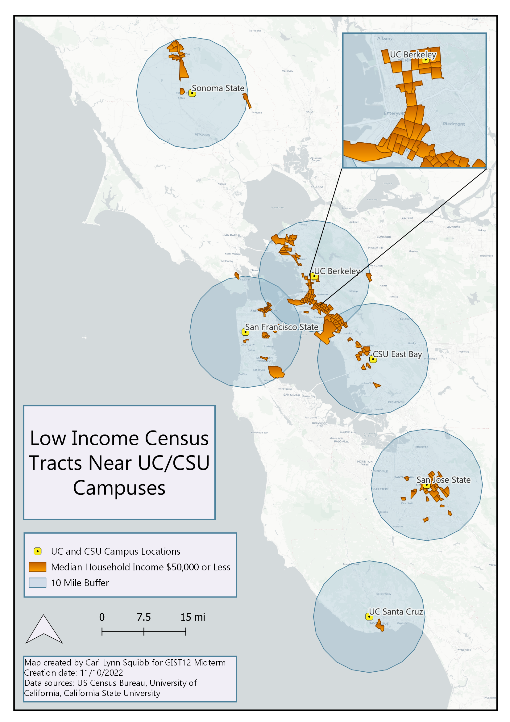
Map made for final project in Introduction to Geospatial Technology class at Foothill College. The purpose of the lab was to locate large cities that were close to partner companies but were not subject to various natural disasters (earthquakes, tornadoes, and hurricanes) in the continental United States. The exercise required multiple definition queries, buffering, selecting by location, map making, and creating a story map to showcase our analyses. This map was made to highlight why Denver, CO should be included in the list of possible large cities despite it's proximity to a fault buffer.
Final Project for GIST12
Tools used
ArcGIS OnlineArcGIS Pro
Plug-ins used
None
tags
ArcGIS ProSpatial Analysis
More by Cari Lynn Squibb


You might also like


Join the community!
We're a place where geospatial professionals showcase their works and discover opportunities.