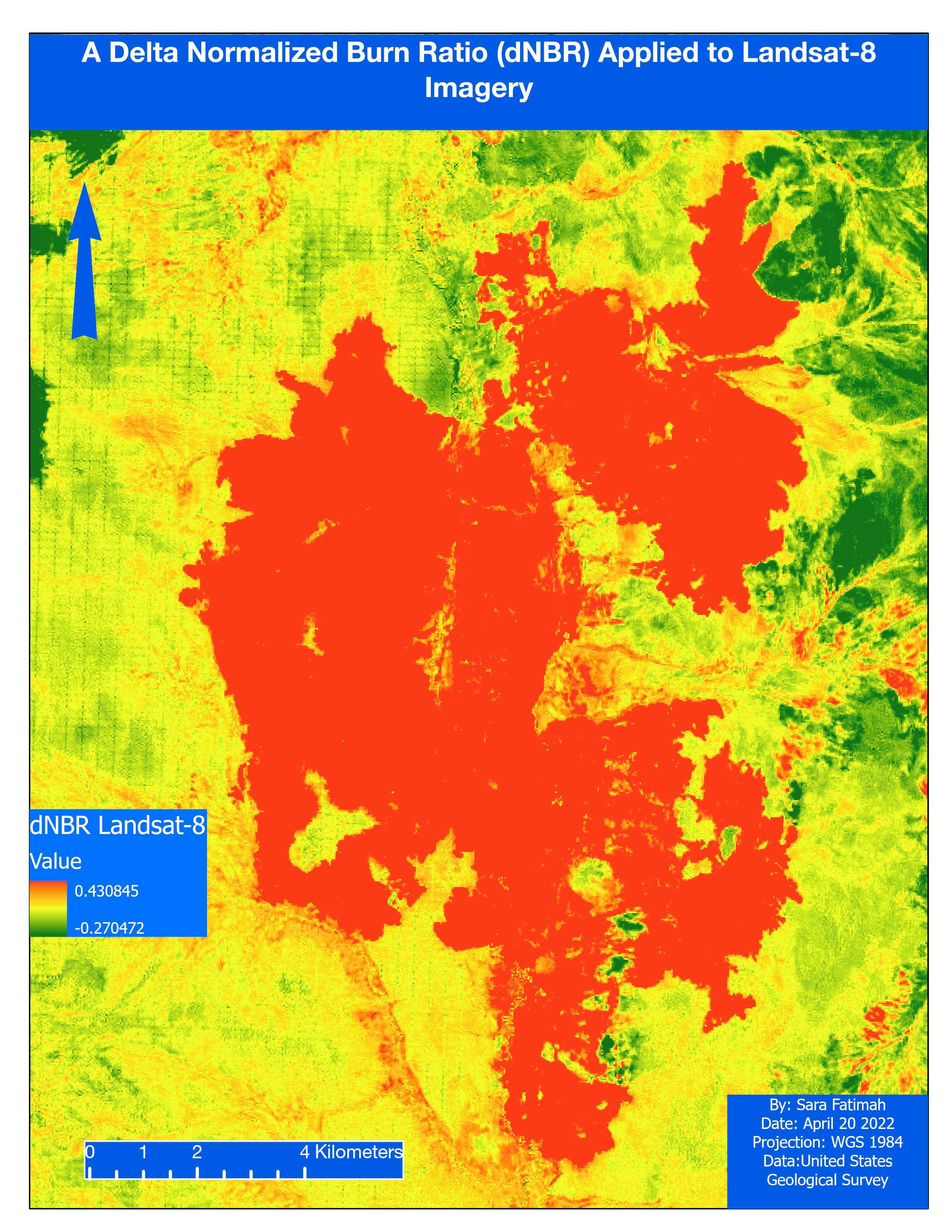
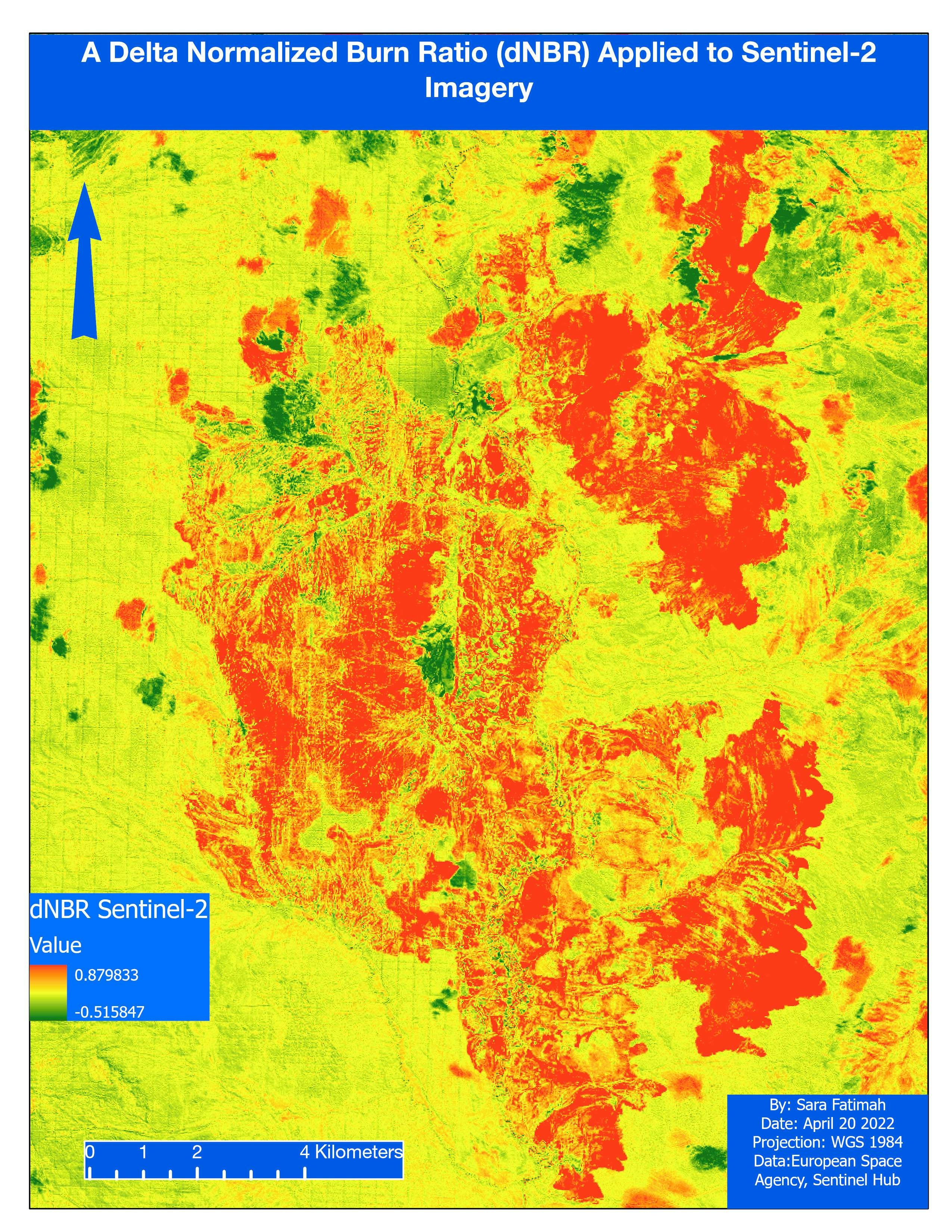
Map made for an Open Source GIS class.
Software used: QGIS
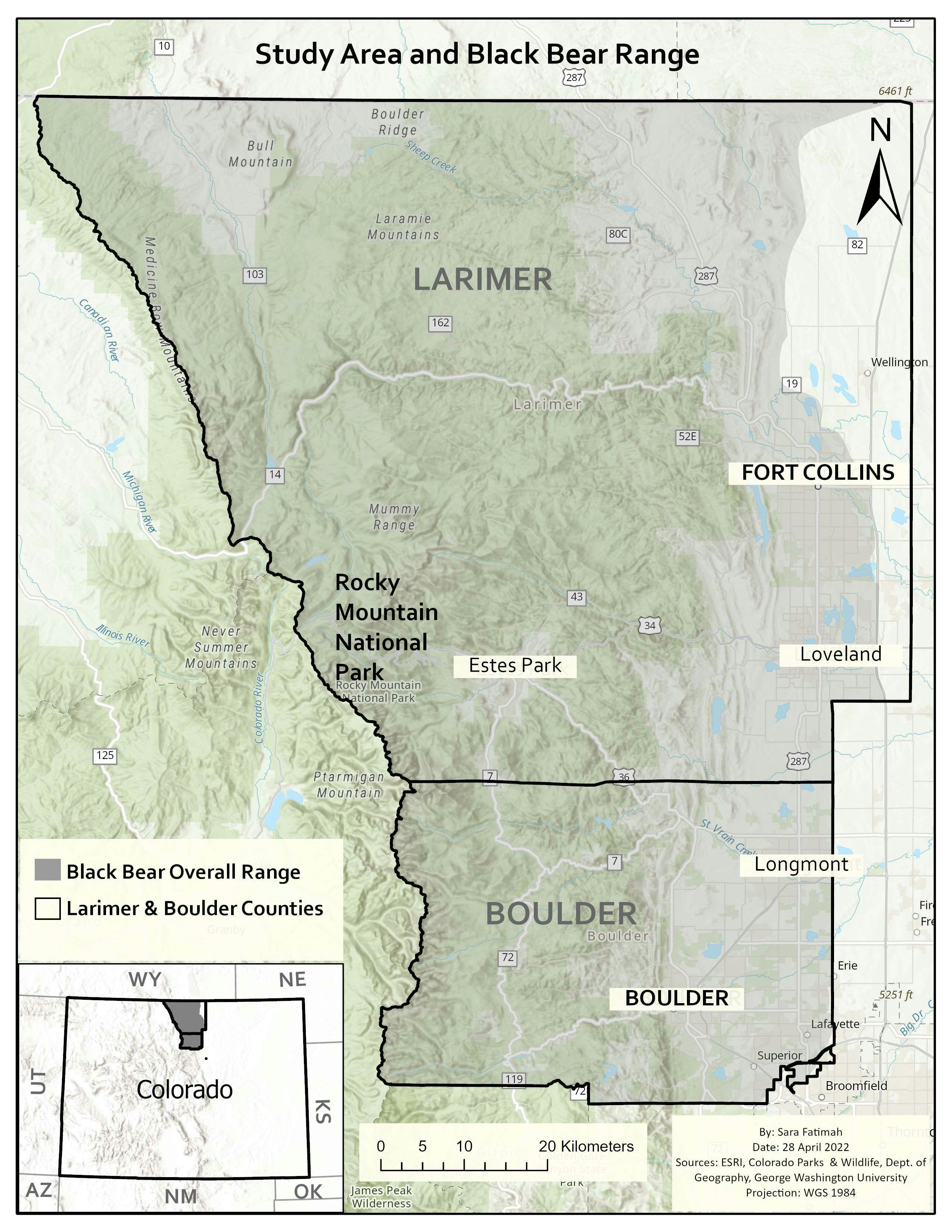
Sage-grouse habitat
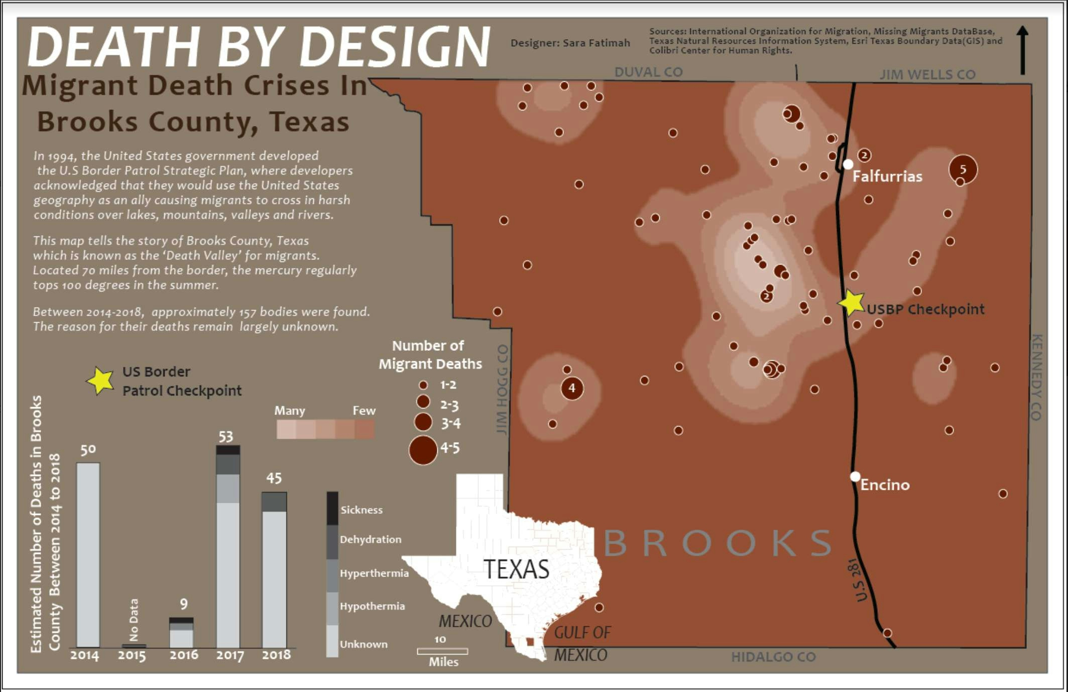
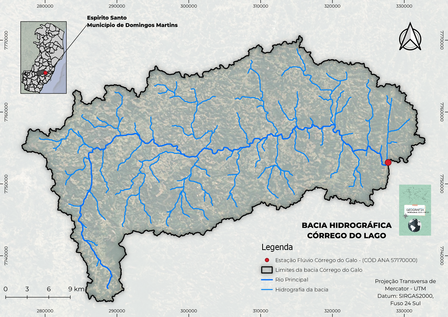
Map made for an Open Source GIS class.
Software used: QGIS
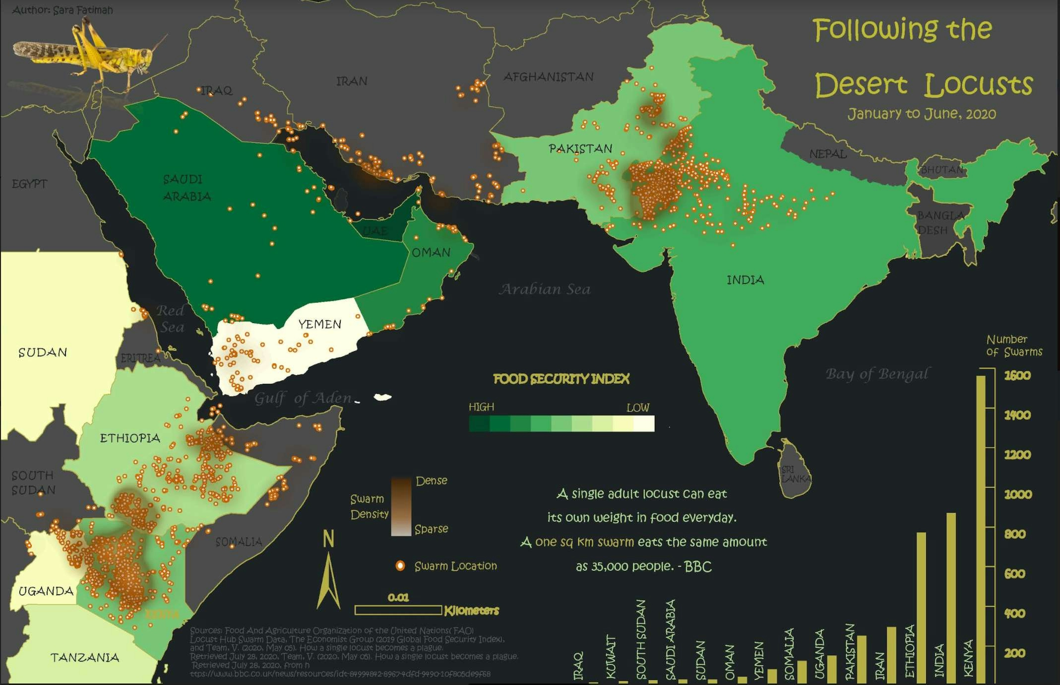
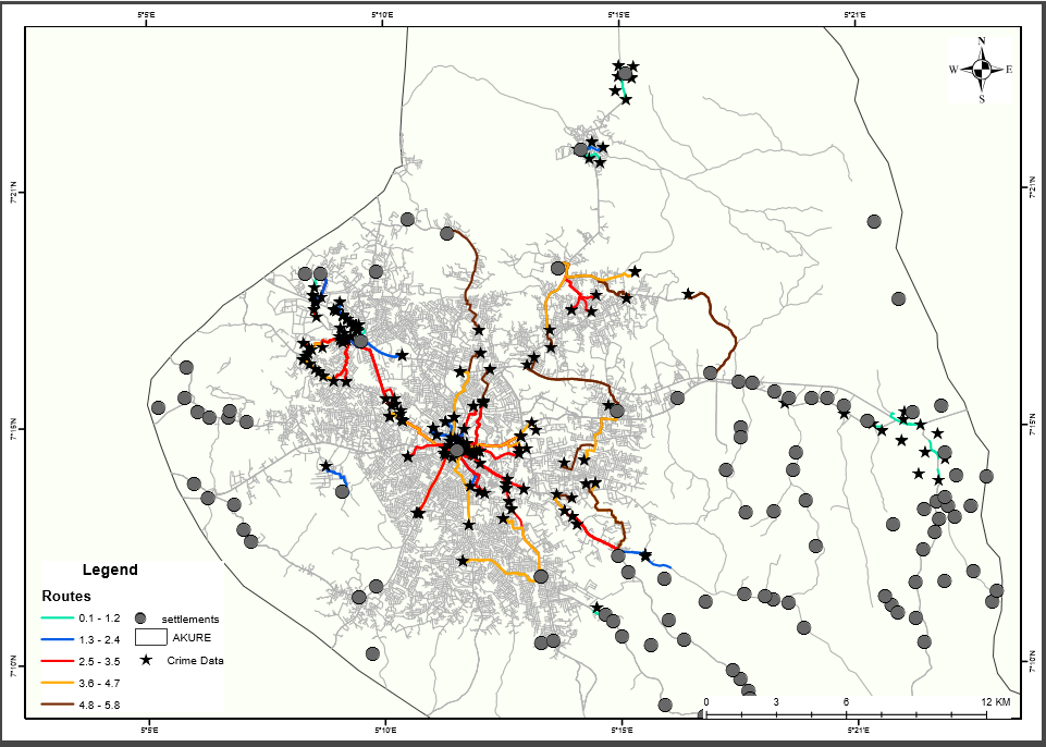
More by Sara Fatimah
You might also like
We're a place where geospatial professionals showcase their works and discover opportunities.