Sign up or log in to your Spatialnode account.

Takes less than a few seconds.

3D model of part of Nigeria

Oswald Geospatial analyst
Oswald Geospatial analyst•

September 30, 2023

3D model of part of Nigeria

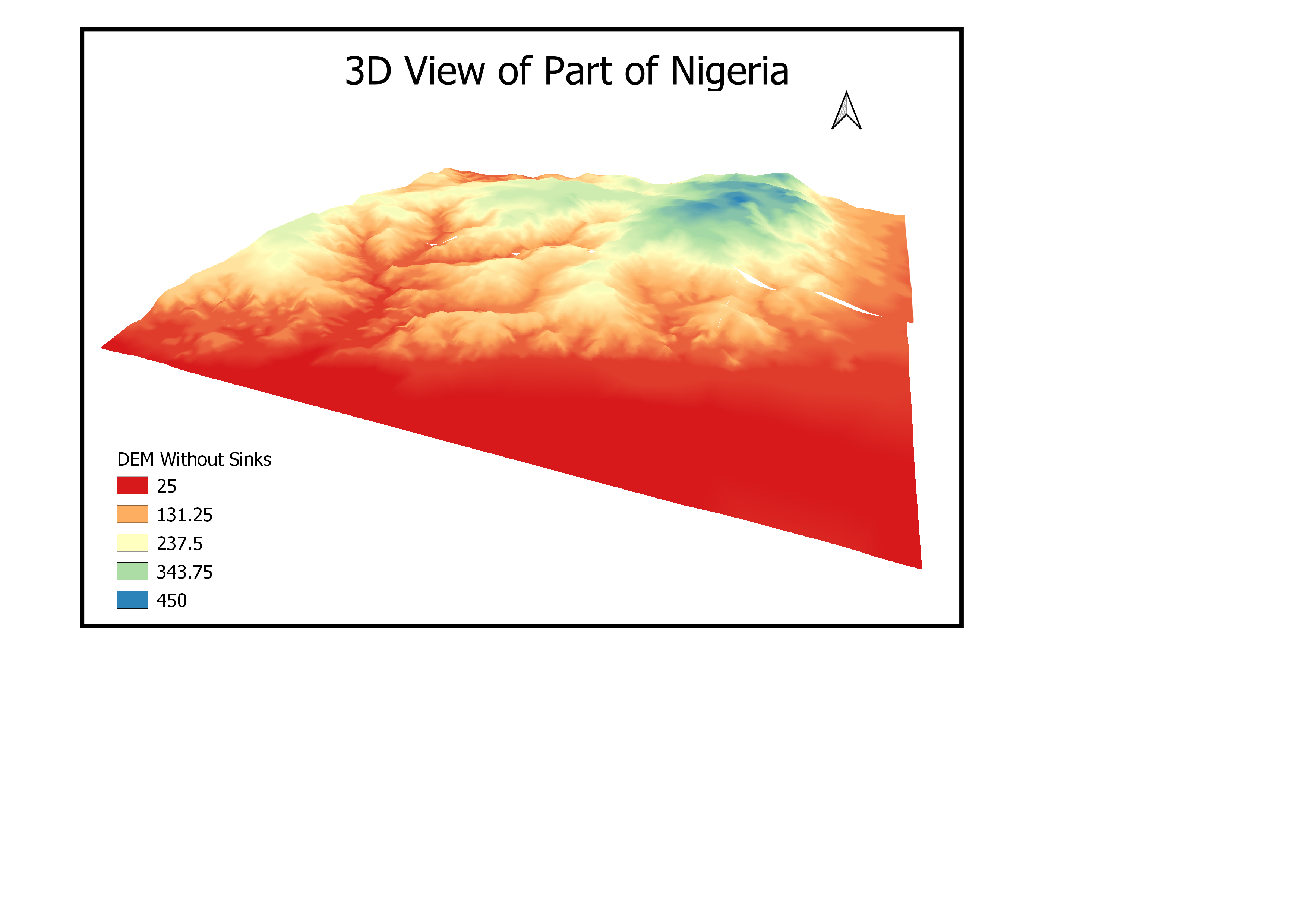
Visualization of the 3D elevation model of part of Nigeria


Plug-ins used

Google Elevation API

tags

Data VisualizationElevationQGISSpatial Modelling

More by Oswald Geospatial analyst

Voters Participation map
13
Population classification of Laos
9

You might also like

PA Corn Production & Yield
Keran Nkongolo
PA Corn Production & Yield
Keran NkongoloPro
10
Map of economically vulnerable household
Esther Ayomide Adeniji
Map of economically vulnerable household
Esther Ayomide Adeniji
60
Tectonic & Lithological Map - CTFB & IBR
Niroj Shrestha
Tectonic & Lithological Map - CTFB & IBR
Niroj Shrestha
12
Bairros, Regiões de Londrina
WILLIAN S. SANTOS 🇧🇷
Bairros, Regiões de Londrina
WILLIAN S....
1.4K
Clusters of Indigenous Langs in Canada
Cedric Phillips
Clusters of Indigenous Langs in Canada
Cedric Phillips
4
Mapo analítico declividade Sergipe
Aristoteles Fernandes da Silva Filho
Mapo analítico declividade Sergipe
Aristoteles Fernandes...
35
Densidade demográfica - Baixadas
Maria Gabriela Menegussi
Densidade demográfica - Baixadas
Maria Gabriela Menegussi
9
Mapa Hipsométrico
LUIZ DINIZ DE ABREU DUARTE
Mapa Hipsométrico
LUIZ DINIZ...
41
California and its Major Urban Areas
Hugo He
California and its Major Urban Areas
Hugo He
14
enumeration area map
caleb omondi
enumeration area map
caleb omondi
13
Idaho Pasture land and Beef Cows
Keran Nkongolo
Idaho Pasture land and Beef Cows
Keran NkongoloPro
12
Densidade populacional do Ceará
David Salomão Lemba
Densidade populacional do Ceará
David Salomão Lemba
8

Join the community!

We're a place where geospatial professionals showcase their works and discover opportunities.

Sign Up for free