Sign up or log in to your Spatialnode account.

Takes less than a few seconds.

Voters Participation map

Oswald Geospatial analyst
Oswald Geospatial analyst•

September 30, 2023

Voters Participation map

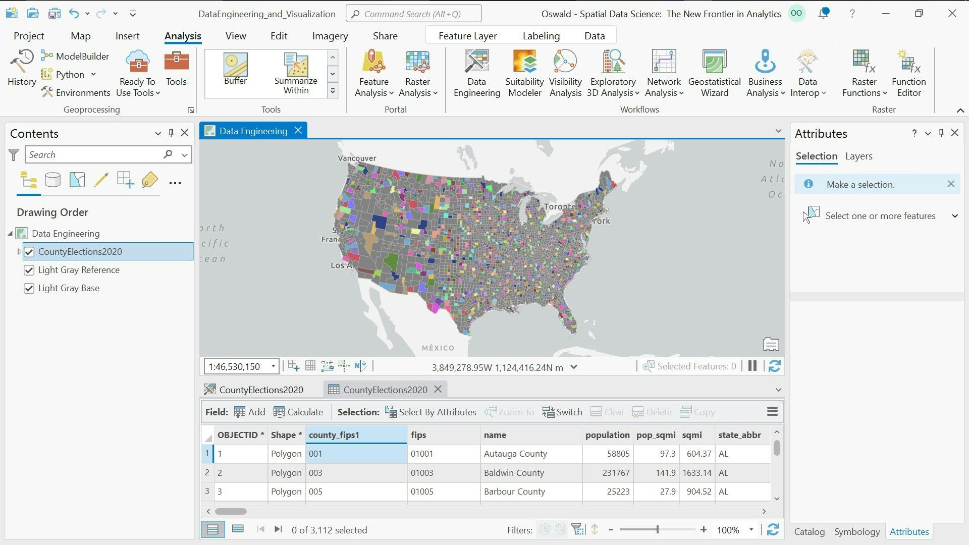
Visualization of voters participation in 2015 - 2022 presidential elections in United States.


Plug-ins used

ArcGIS ProData Visualization

tags

ArcGIS ProData Visualizationelections GISpopulation

More by Oswald Geospatial analyst

Population classification of Laos
6
3D model of part of Nigeria
11

You might also like

KERIO VALLEY SOIL LOSS USING RUSLE
John Wahome Gathoni
KERIO VALLEY SOIL LOSS USING RUSLE
John Wahome Gathoni
94
Class Project -Point 1 to Point B route
Dane Lewandowski
Class Project -Point 1 to Point B route
Dane Lewandowski
11
Troop Travel - Meeting Suggestion
Kevin Potgieter
Troop Travel - Meeting Suggestion
Kevin Potgieter
655
Shropshire elevation
Millie Brand
Shropshire elevation
Millie Brand
18
Map of Itapetininga - São Paulo
Willian Kenzo de Sousa Kudo
Map of Itapetininga - São Paulo
Willian Kenzo...
2
Wildfire Propagation using ABM
Kevin Le
Wildfire Propagation using ABM
Kevin Le
12
Dwellings in the City of Calgary
Ibe Ezuma
Dwellings in the City of Calgary
Ibe Ezuma
5
Inundações em Bairros de Porto Alegre/RS
Milena Azevedo
Inundações em Bairros de Porto Alegre/RS
Milena Azevedo
11
La Carte de Relief du District d'Abidjan
NJEUGEUT MBIAFEU AMANDINE CARINE
La Carte de Relief du District d'Abidjan
NJEUGEUT MBIAFEU...
68
Índice NDVI, Olho d'Água do Casado, AL
Johnson Sarmento de O. Nascimento
Índice NDVI, Olho d'Água do Casado, AL
Johnson Sarmento...
30
Land Use Change SE Pennsylvania
Alexandria Hahn
Land Use Change SE Pennsylvania
Alexandria Hahn
22
Floresta Nacional de Ipanema, Iperó - SP
DOUGLAS HENRIQUE MANOEL PEREIRA
Floresta Nacional de Ipanema, Iperó - SP
DOUGLAS HENRIQUE...
11

Join the community!

We're a place where geospatial professionals showcase their works and discover opportunities.

Sign Up for free