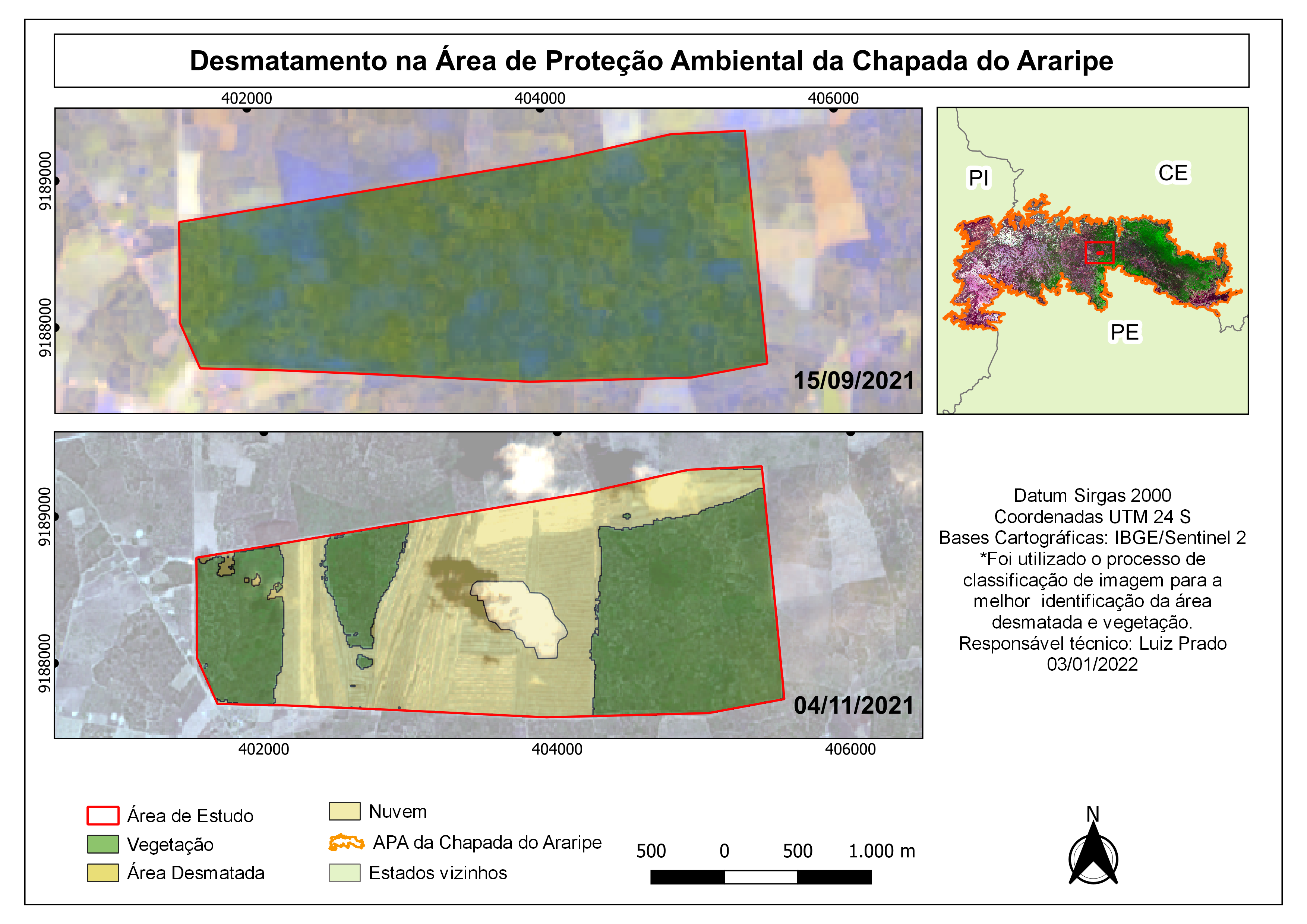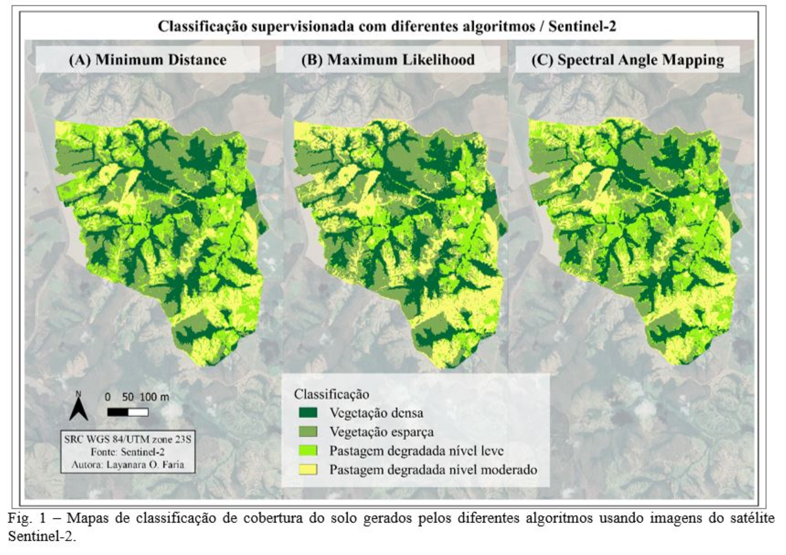
One of the application of GIS in Ecology is the effective monitoring and conservation of natural features, with the help of high spatial-temporal satellite imagery, monthly forest evaluation is made possible.
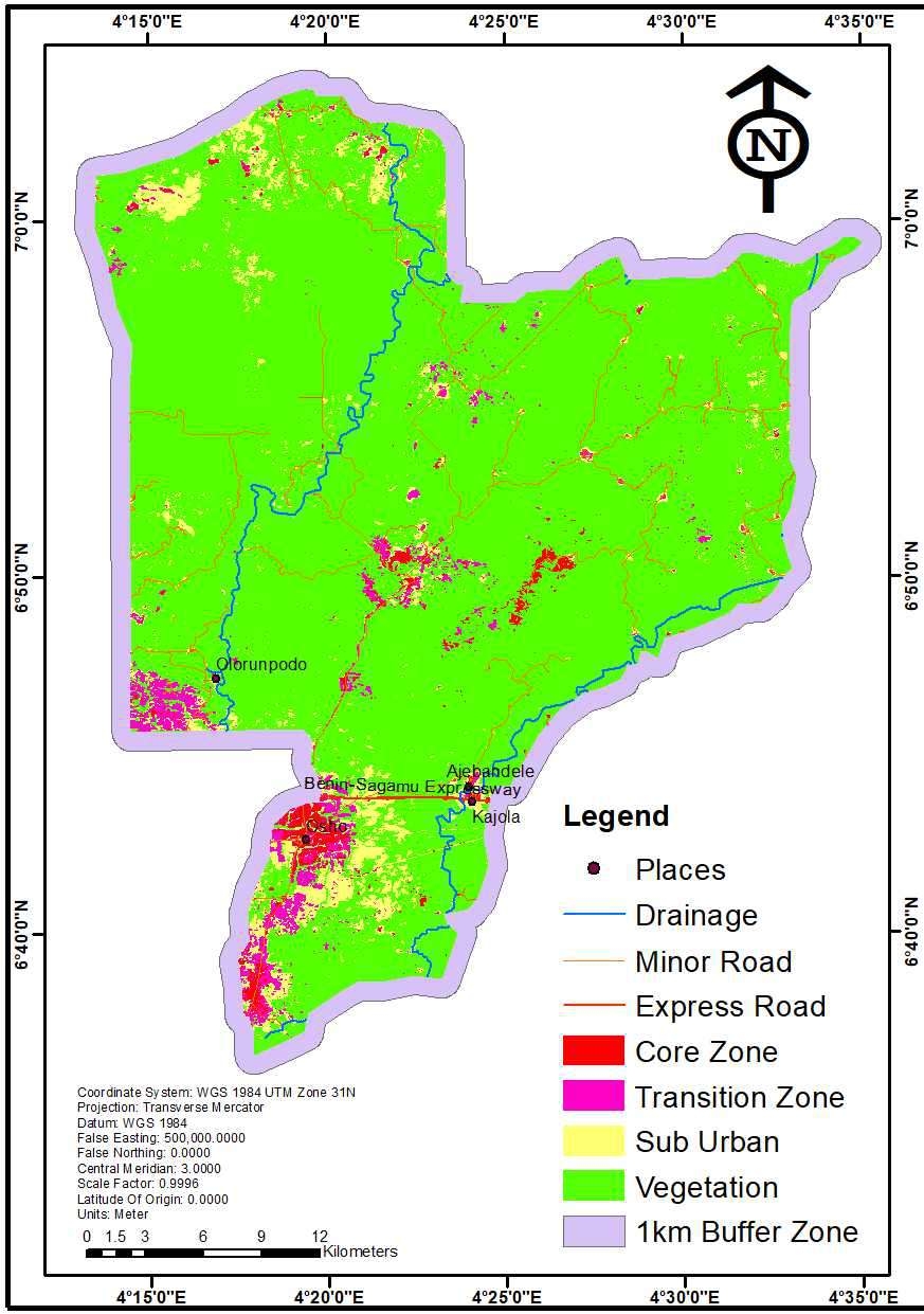
This project gave a spatial information about the update of Omo forest located in Ijebu Ode, Ogun state.
The map provides the information about the area the have experienced transition, that means a change in land use, this can inform the conservationist of identifying illegal development in the forest early.