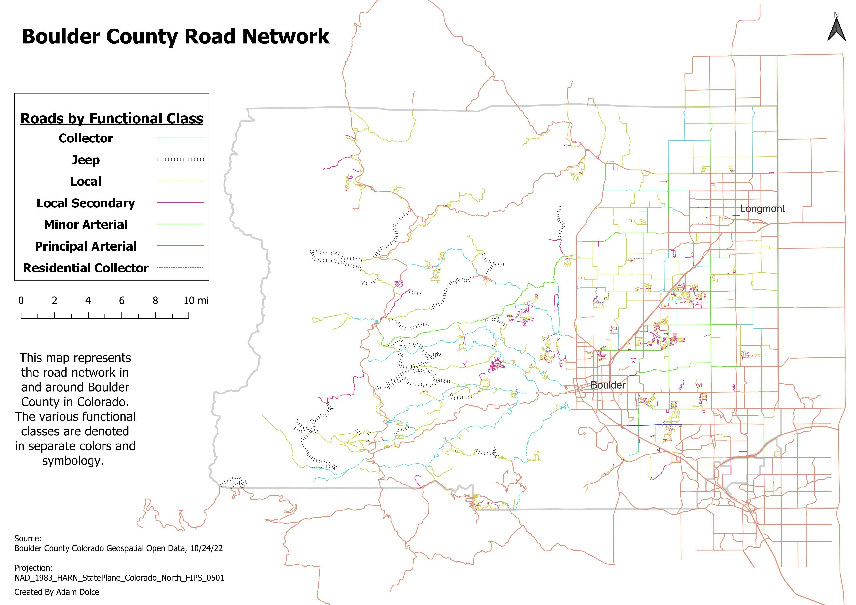
Drone technology is one the 21st century innovation, and the advert of drone as created so many advancement in so many professional fields, such as Effective Topographical Survey, Accusation of High Spatial and temporal resolution imagery at low cost, Monitoring and Evaluation, sales delivery, reconnaissance Survey, Emergency Fire Service, Event coverage, Sporting, and many others.
The drone innovation can also be used for illicit purpose, such assassination's, spy and many others, so many country in the world as varying, laws guiding the use of drone, in other to have maximum control of their security system and protect its citizen privacy.
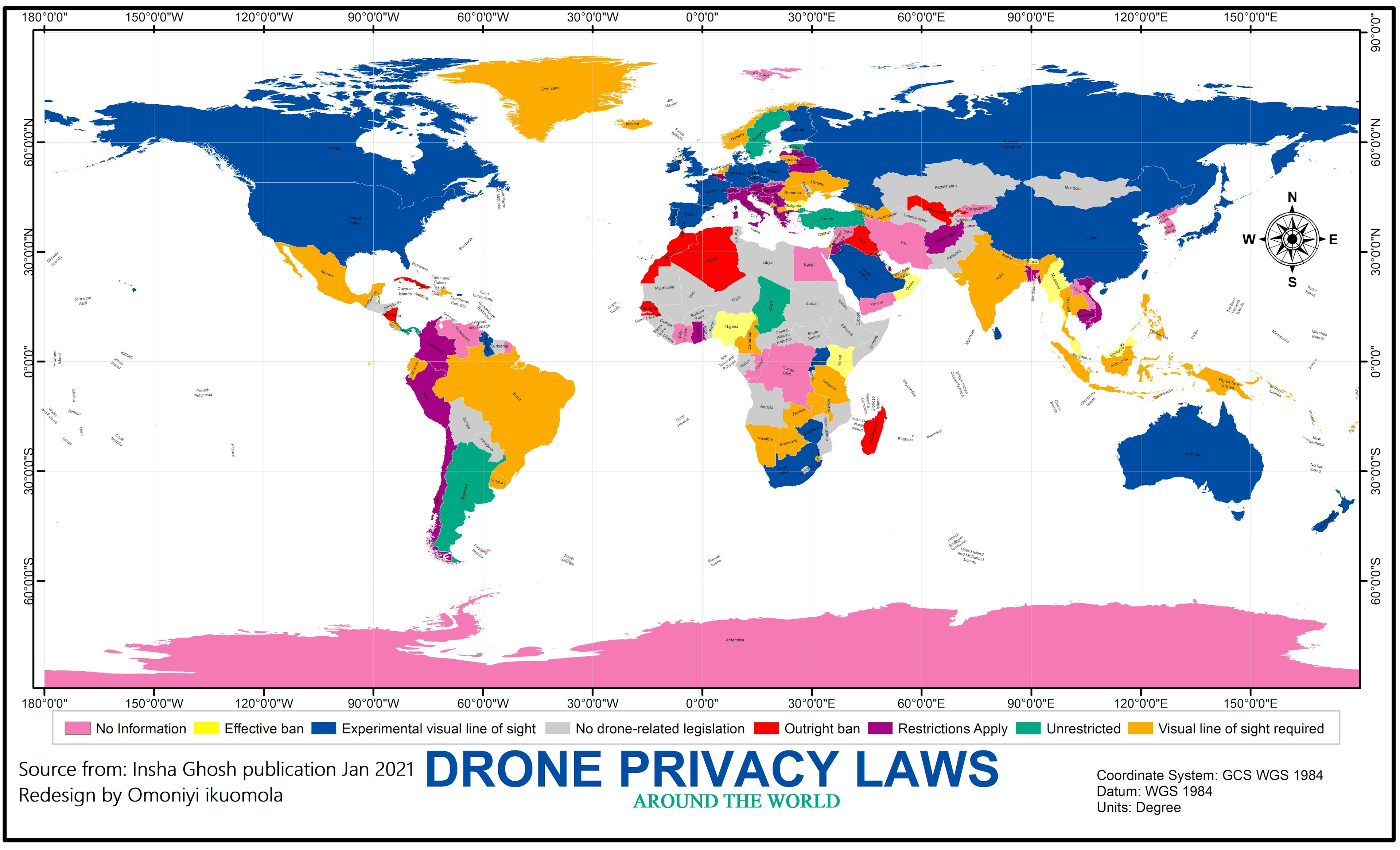
This Project gave a spatial display of drone privacy law of countries with color codes.
Base on the information gathered Drone privacy law falls between the seven categories below.
- Outright ban: it means no usage for any reason.
- Effective ban: formal process for commercial drone.
- Restrictions Apply (Such as drone registration or licensing, additional observers required, no commercial usage etc...)
- Visual line of sight required
- Experimental visual line of sight (experiments where drones fly beyond the line of sight are allowed)
- Unrestricted (when flying away from private property and airports under 500ft/150metres height and with drones weighing less than 250g)
- No drone- related legislation.
No drone related legislation is more in the Central Africa to East Africa, than other part of the world, The North America, Most Asian, Australia, and some part of Europe, law on drone regulation is to be in the experimental line of sight.
In Nigeria, there is an effective ban on drone, that means before drone is used for commercial, legal process and approval must be made. drone can be use if it does breach the privacy of others, and not for commercial.
So before you use that drone, check the project map, to know if you are permitted, and do the needful to avoid penalties
Data sources from Insha Gosh Publication.