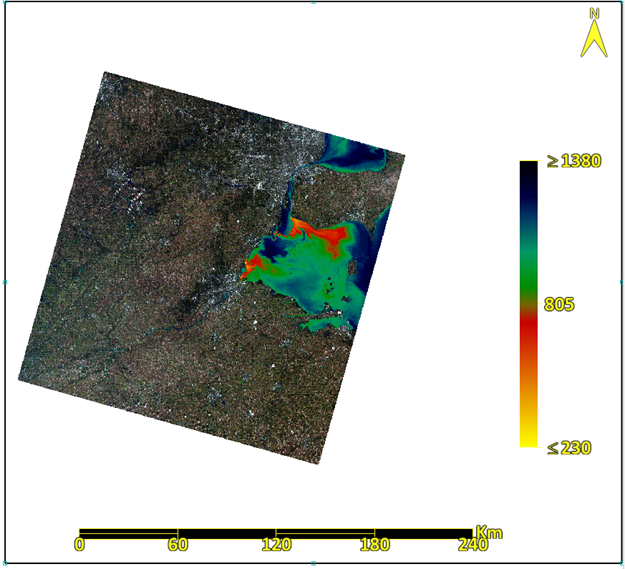
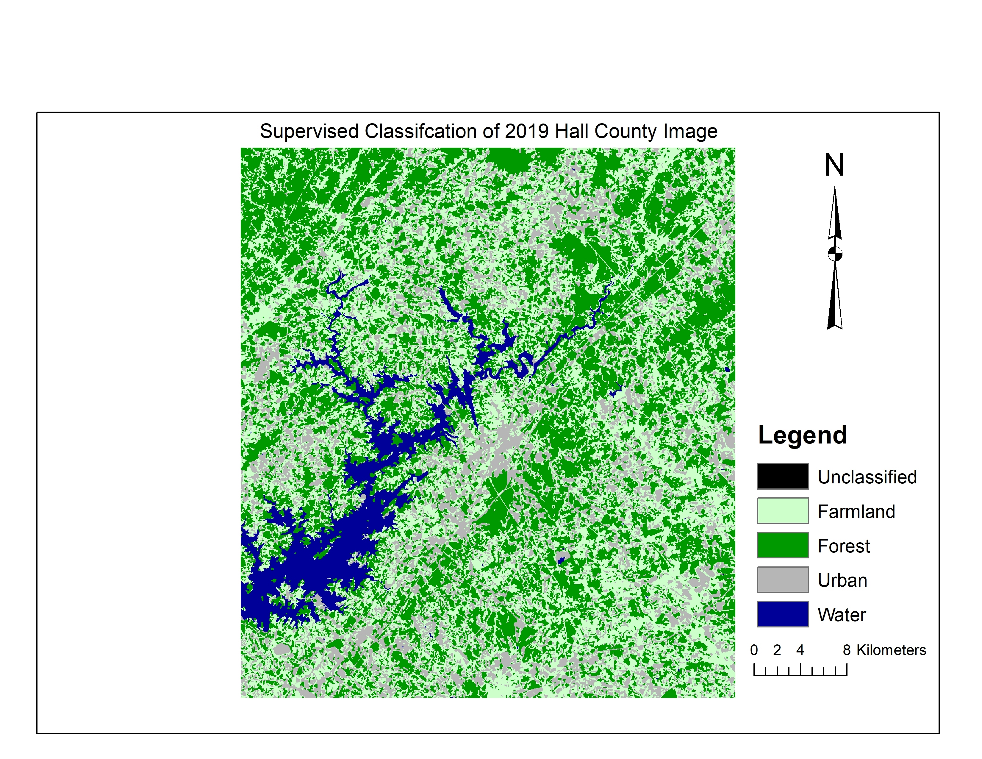
Mount Helen Eruption Map


Tools used
ArcGIS ProENVI
Plug-ins used
ArcGIS Pro
tags
ENVIEsri


You might also like


.svg "Keran Nkongolo")


Join the community!
We're a place where geospatial professionals showcase their works and discover opportunities.
Mount Helen Eruption Map
You might also like
We're a place where geospatial professionals showcase their works and discover opportunities.