Sign up or log in to your Spatialnode account.

Takes less than a few seconds.

Outlier analysis

Kolawole Arowoogun
Kolawole Arowoogun•

December 04, 2021

Outlier analysis


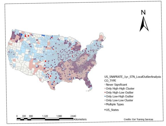
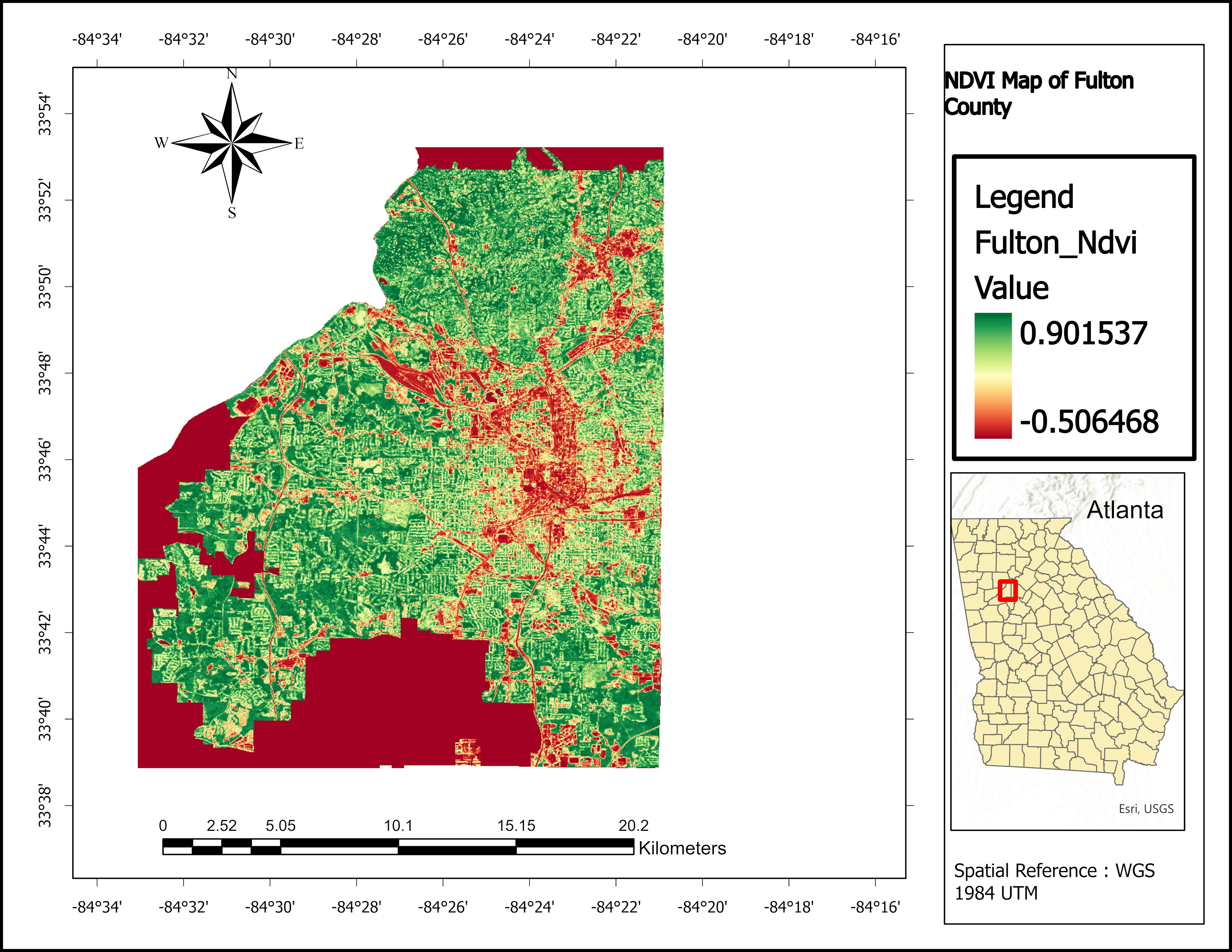
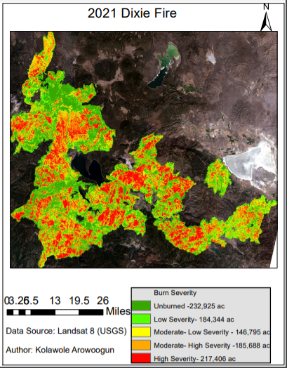
Outlier analysis for the US SNAP program. 

Data source: ESRI spatial data science


Tools used

ArcGIS OnlineArcGIS ProEsri

Plug-ins used

ArcGIS Online

tags

ArcGIS Pro

More by Kolawole Arowoogun

Supervised Classification Map of Hall County, Georgia
240
Outlier analysis
Outlier analysis
618
Hotspot
Hotspot
611
NDVI Map of Fulton County
74
Visualizing 2016 US Election
248
Map of Tract and census population data
35
Supervised classification image of Hall County, Georgia
254
Mount Helen Eruption Map
255
Mapping 2021 Dixie wildfire.
293
Algae bloom
Algae bloom
630
Suitability analysis
397

You might also like

Percent of Sales by Block Group
Jason Boatjri
Percent of Sales by Block Group
Jason Boatjri
21
OWABI WILDLIFE TRAIL MAPPING
Emmanuel Opoku
OWABI WILDLIFE TRAIL MAPPING
Emmanuel Opoku
3
3D Elevation Map of West Sumatera
Muhammad Rifqy
3D Elevation Map of West Sumatera
Muhammad Rifqy
123
3D Map of Naperville
FELIX OMOLLO
3D Map of Naperville
FELIX OMOLLO
50
Critical Minerals in Quebec - Canada
Miriela Ulloa Santana
Critical Minerals in Quebec - Canada
Miriela Ulloa Santana
107
UPDATE OF AWKA STREET GUIDE MAP
John Maduabuchukwu
UPDATE OF AWKA STREET GUIDE MAP
John Maduabuchukwu
33
Hidrografia do PARNA Catimbau
Matheus Maciel
Hidrografia do PARNA Catimbau
Matheus Maciel
17
TRENDS IN ATMOSPHERIC CO2
Temidayo Fabiyi
TRENDS IN ATMOSPHERIC CO2
Temidayo Fabiyi
13
Mapa de Fragilidade Emergencial
RODRIGO DE ARAUJO BELOTE
Mapa de Fragilidade Emergencial
RODRIGO DE...
55
Mapa de Localização de Brotas - SP
Henrique Cesar Bitencourt
Mapa de Localização de Brotas - SP
Henrique Cesar Bitencourt
155
Mapping of cities and air polution
Ani Pearn
Mapping of cities and air polution
Ani Pearn
16
SUITABILITY MAP
Marvin Ayeh
SUITABILITY MAP
Marvin Ayeh
14

Join the community!

We're a place where geospatial professionals showcase their works and discover opportunities.

Sign Up for free