Sign up or log in to your Spatialnode account.

Takes less than a few seconds.

Outlier analysis

Kolawole Arowoogun
Kolawole Arowoogun•

December 05, 2021

Outlier analysis

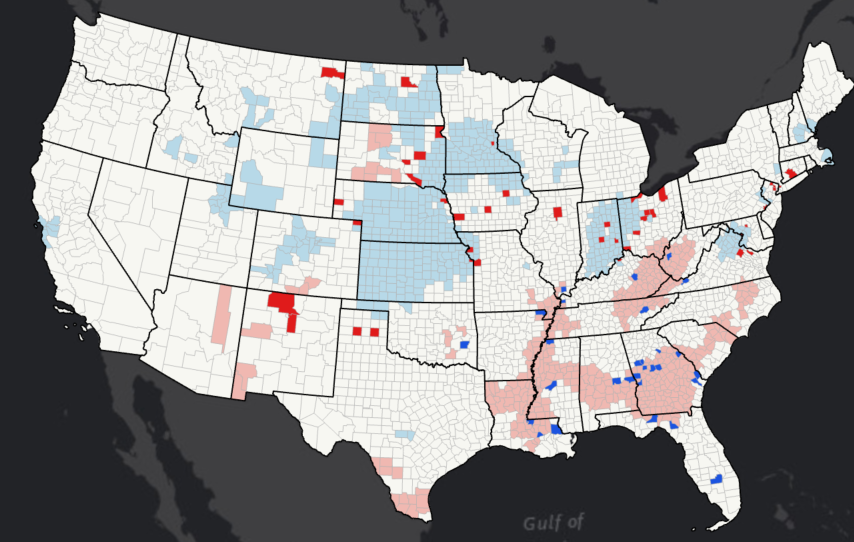
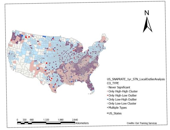
Local outlier analysis of SNAP participation in US counties

Data source: ESRI spatial data science
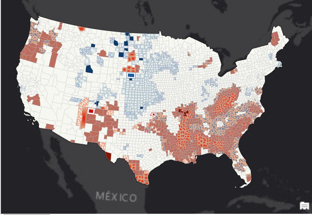

Tools used

ArcGIS OnlineArcGIS Pro

Plug-ins used

ArcGIS Online

tags

ArcGIS ProEsri

More by Kolawole Arowoogun

Algae bloom
Algae bloom
628
Visualizing 2016 US Election
248
Suitability analysis
396
Map of Tract and census population data
35
Supervised Classification Map of Hall County, Georgia
240
NDVI Map of Fulton County
73
Mapping 2021 Dixie wildfire.
292
Outlier analysis
Outlier analysis
601
Mount Helen Eruption Map
254
Hotspot
Hotspot
610
Supervised classification image of Hall County, Georgia
254

You might also like

La Carte de Relief du District d'Abidjan
NJEUGEUT MBIAFEU AMANDINE CARINE
La Carte de Relief du District d'Abidjan
NJEUGEUT MBIAFEU...
81
| AEROLEVANTAMENTO - REURB |
Diogo Henrique Rodrigues Junior
| AEROLEVANTAMENTO - REURB |
Diogo Henrique...
47
Water Basins Twin Cities
Ethan Barsness
Water Basins Twin Cities
Ethan Barsness
10
Câmeras DERSP
Matheus Amaral Prates
Câmeras DERSP
Matheus Amaral Prates
22
Protected areas of Costa Rica
Millie Brand
Protected areas of Costa Rica
Millie Brand
23
Locate Countries Game.
Joseph Thuha
Locate Countries Game.
Joseph Thuha
909
Spatial modeling of Tree Canopy Cover
Jill Derwin
Spatial modeling of Tree Canopy Cover
Jill Derwin
40
Geostatistical Analysis of COVID19 cases
Joseph Aro
Geostatistical Analysis of COVID19 cases
Joseph Aro
103
Overlap between the SDMs of C. furcoides
Philip Russo
Overlap between the SDMs of C. furcoides
Philip Russo
399
Hipsometria
Márcio Marques de Alencar Arraes
Hipsometria
Márcio Marques...
46
Topographical Map of Lagos Mainland
Emeka Ude
Topographical Map of Lagos Mainland
Emeka Ude
86
Mapa de distribuição arbórea
Rogério Gusmão Junior
Mapa de distribuição arbórea
Rogério Gusmão Junior
23

Join the community!

We're a place where geospatial professionals showcase their works and discover opportunities.

Sign Up for free