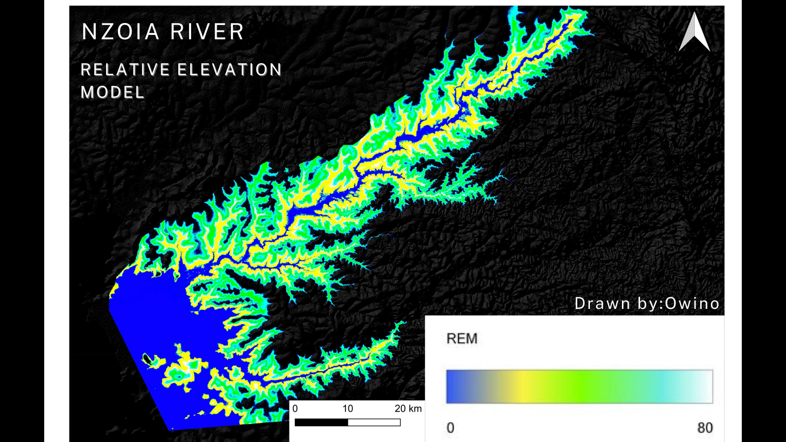
I recently completed a comprehensive spatial analysis to assess wildfire impacts across Canada provinces from the year 1986 to 2022, leveraging Geographic Information Systems (GIS) technology. In 2023, Canada experienced one of its most devastating wildfire seasons on record, with widespread impacts felt across the country. The sheer scale of the fires was staggering, as Canada recorded its highest fire burn, leaving communities, ecosystems, and wildlife in its wake. According to Natural Resources Canada, 'more than 6,132 fires had torched 16.5 million hectares of land in September 2023, equivalent to an area larger than Greece and more than double the 1989 record'.
This analysis aimed to delve deeper into understanding the spatial distribution and severity of these wildfires, particularly across different provinces spanning almost four decades. Here's a breakdown of my workflow:
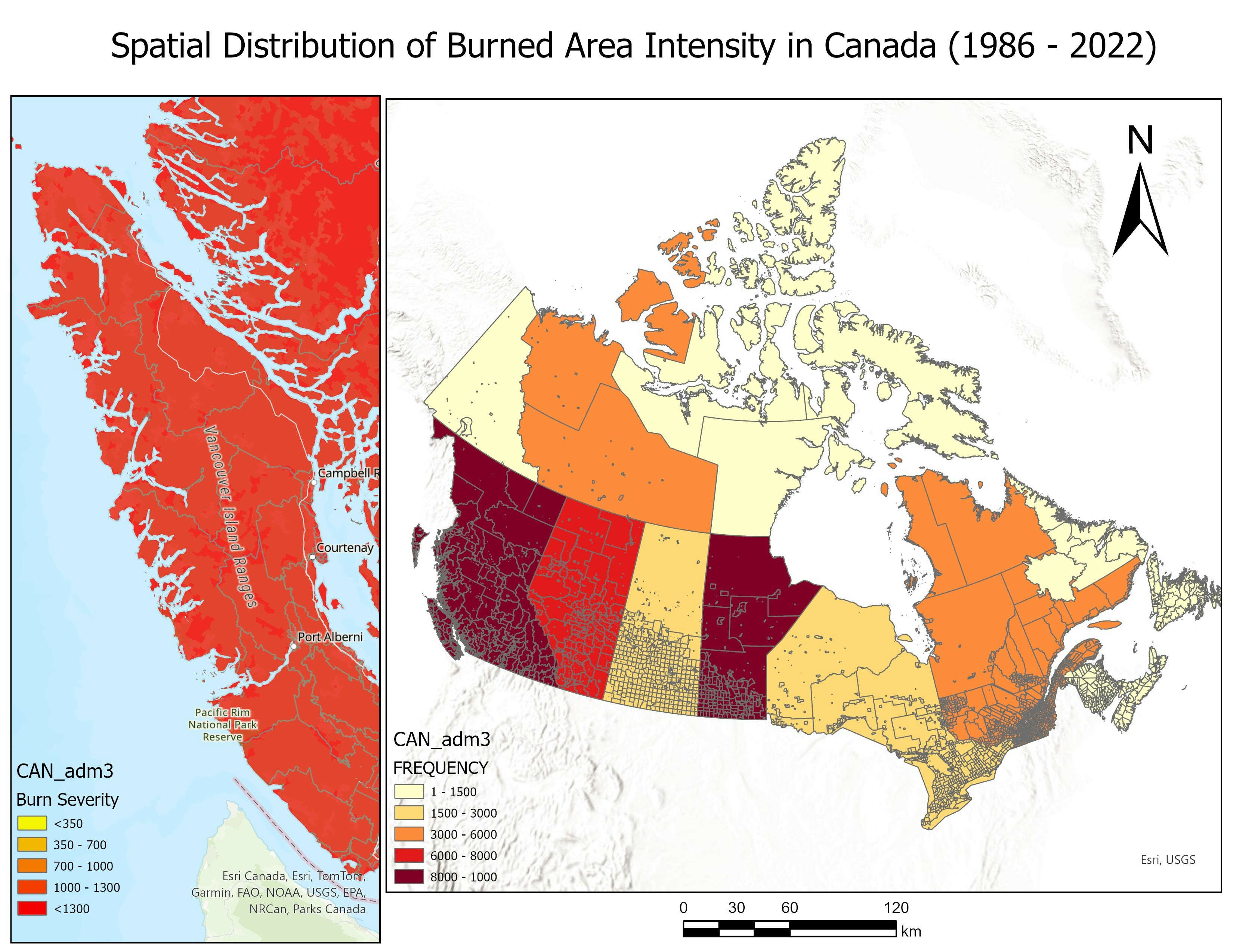
🗺️ Spatial Join: I performed a spatial join between burned area data and administrative boundary layers, integrating wildfire information with geographic regions.
📊 Aggregated Statistics: Utilizing the "Summary Statistics" tool, I calculated aggregated statistics such as mean burn class for each provinces. This provided valuable insights into the spatial distribution and severity of wildfires.
🎨 Visualization: With the aggregated statistics in hand, I created thematic maps to visualize the spatial variation in burned area intensity. Using graduated colors, I effectively communicated the severity of wildfire impacts.
📈 Analysis & Communication: The resulting maps served as powerful communication tools, enabling stakeholders and decision-makers to understand the spatial patterns of wildfire impacts. This project shows the immediate impacts of the wildfire outbreak and the importance of leveraging GIS technology for proactive mitigation and management strategies.
Data source: Natural Resources Canada - National Burned Area Composite, Diva GIS - Canada Administrative boundary
Feel free to engage with your thoughts and insights.