
post-verified, modified, and shape-correction to create data deliverables (PDF)
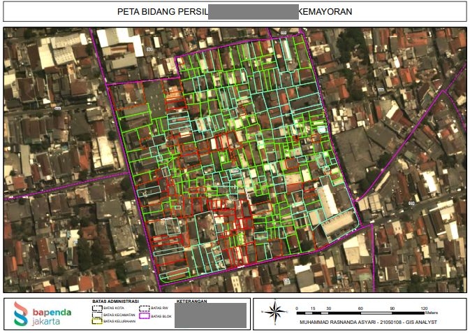
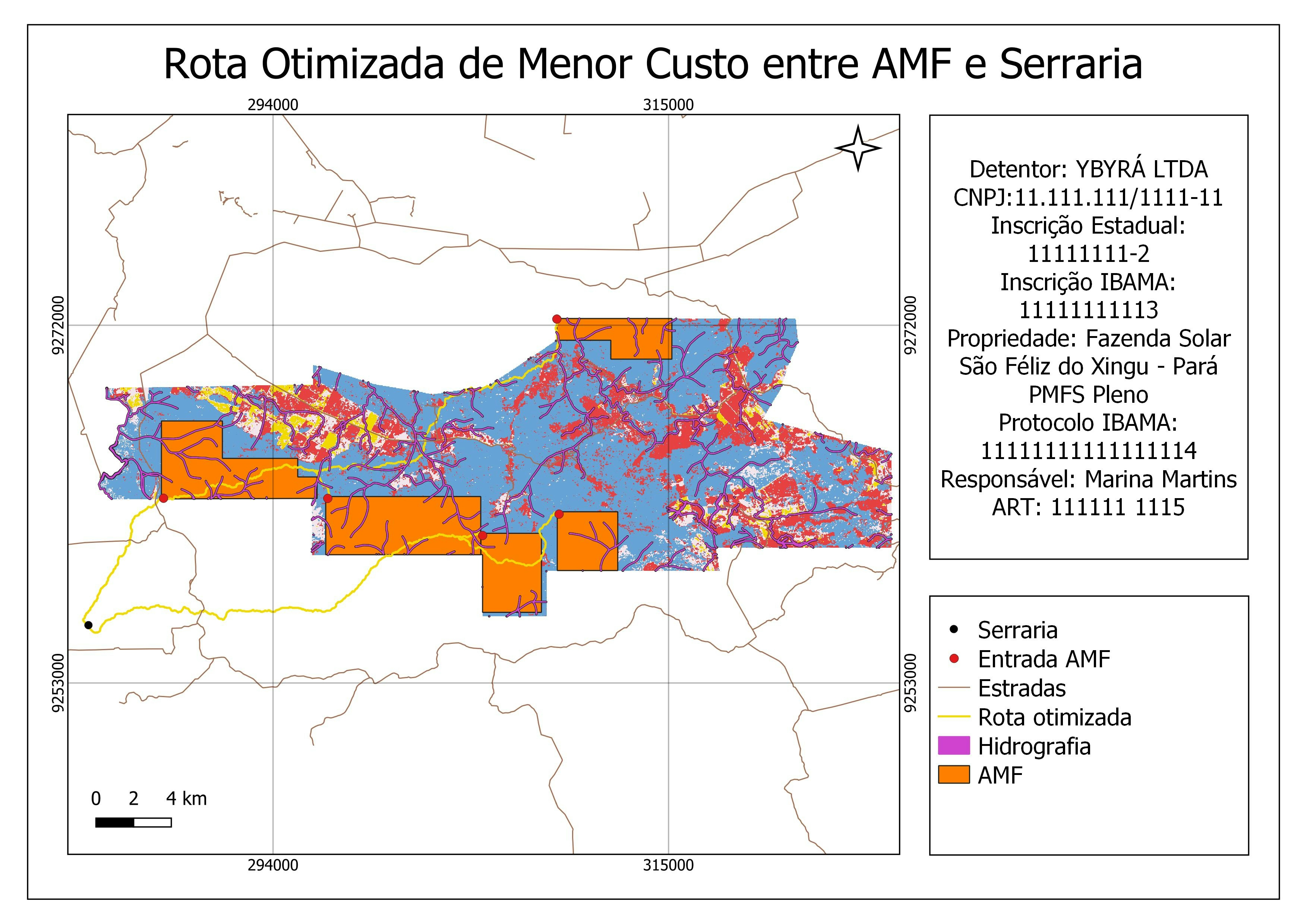
Persil (Landplot) Map
Plug-ins used
Shape Tools
tags
ArcGIS
More by Rasnanda


You might also like


.png&w=3840&q=100)


Join the community!
We're a place where geospatial professionals showcase their works and discover opportunities.