
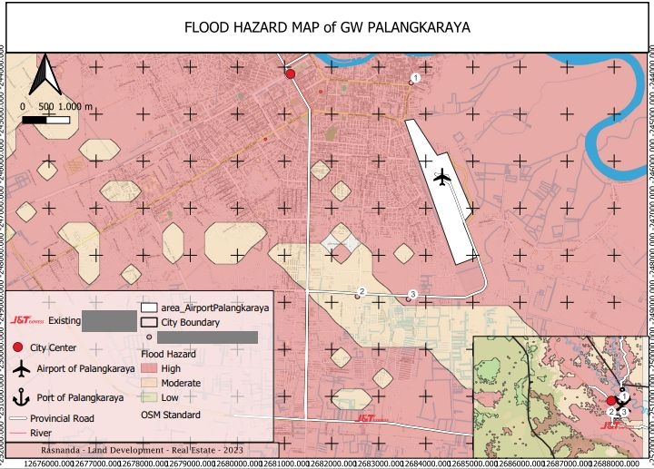
flood Hazard-map (using weight overlay from 5 parameter (elevation, slope, river distance, river length, landcover)
Flood Hazard Map of Palangkaraya
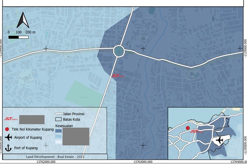
Plug-ins used
DEMOpenTopography DEM DownloaderSlopeWeighted Overlay
tags
Spatial analyst
More by Rasnanda


You might also like


.svg "Keran Nkongolo")


Join the community!
We're a place where geospatial professionals showcase their works and discover opportunities.