Land Cover Mapping with Python

Bertrand Lobo
Bertrand Lobo

May 04, 2022

Land Cover Mapping with Python

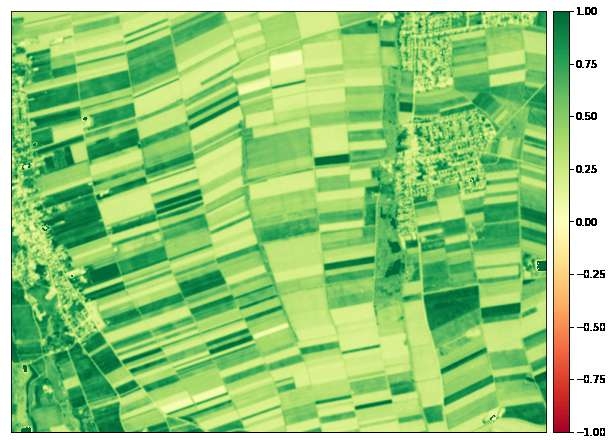
Using Sentinel-2 data for agricultural fields in Munich, Germany to map various indices like Vegetation, Soil, Moisture, Water, Geology in Jupyter Notebooks.

A foundation for training basic models with a sample data set to perform further machine learning techniques.

Demo

Tools used

PythonRemote Sensingsentinel-2

Plug-ins used

Data VisualizationGDALPython

tags

AgricultureMachine LearningRemote SensingSpatial Data Science#SpatialNode

You might also like

Join the community!

We're a place where geospatial professionals showcase their works and discover opportunities.