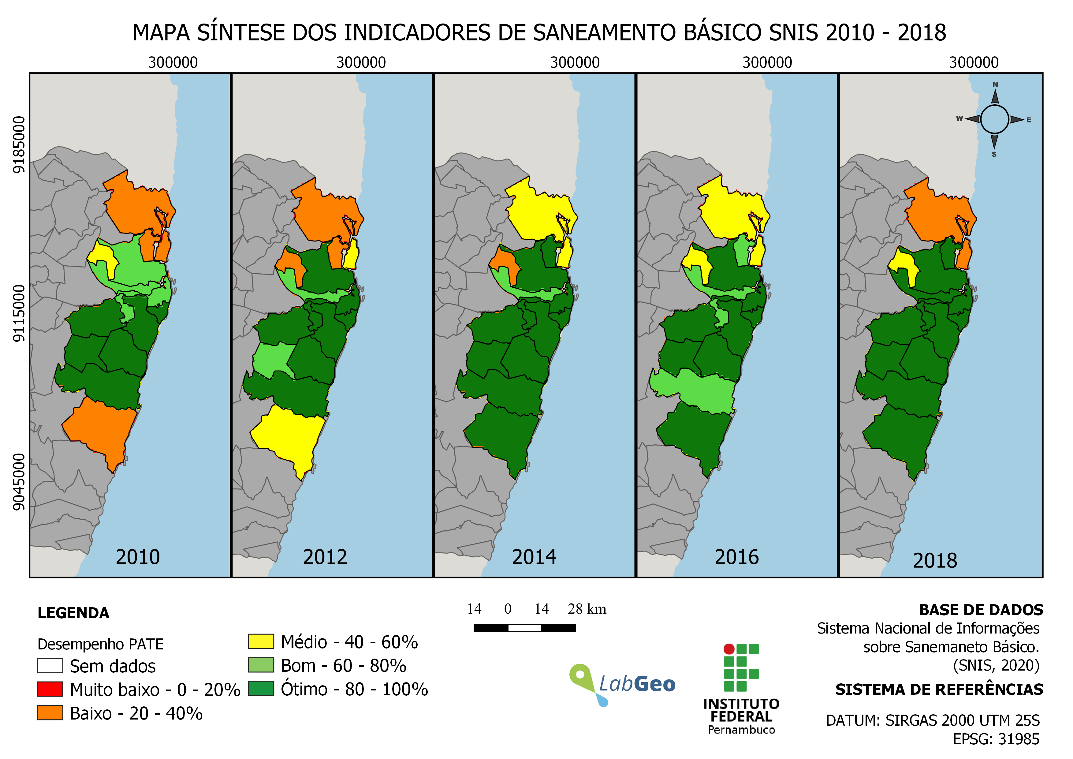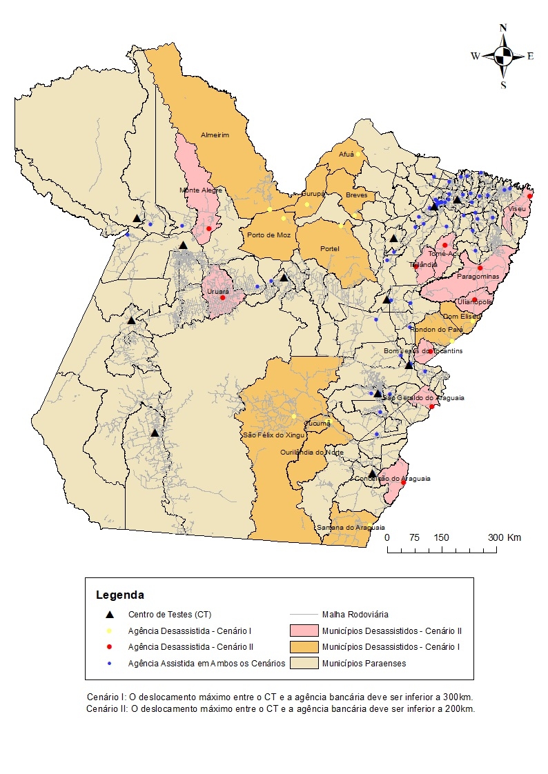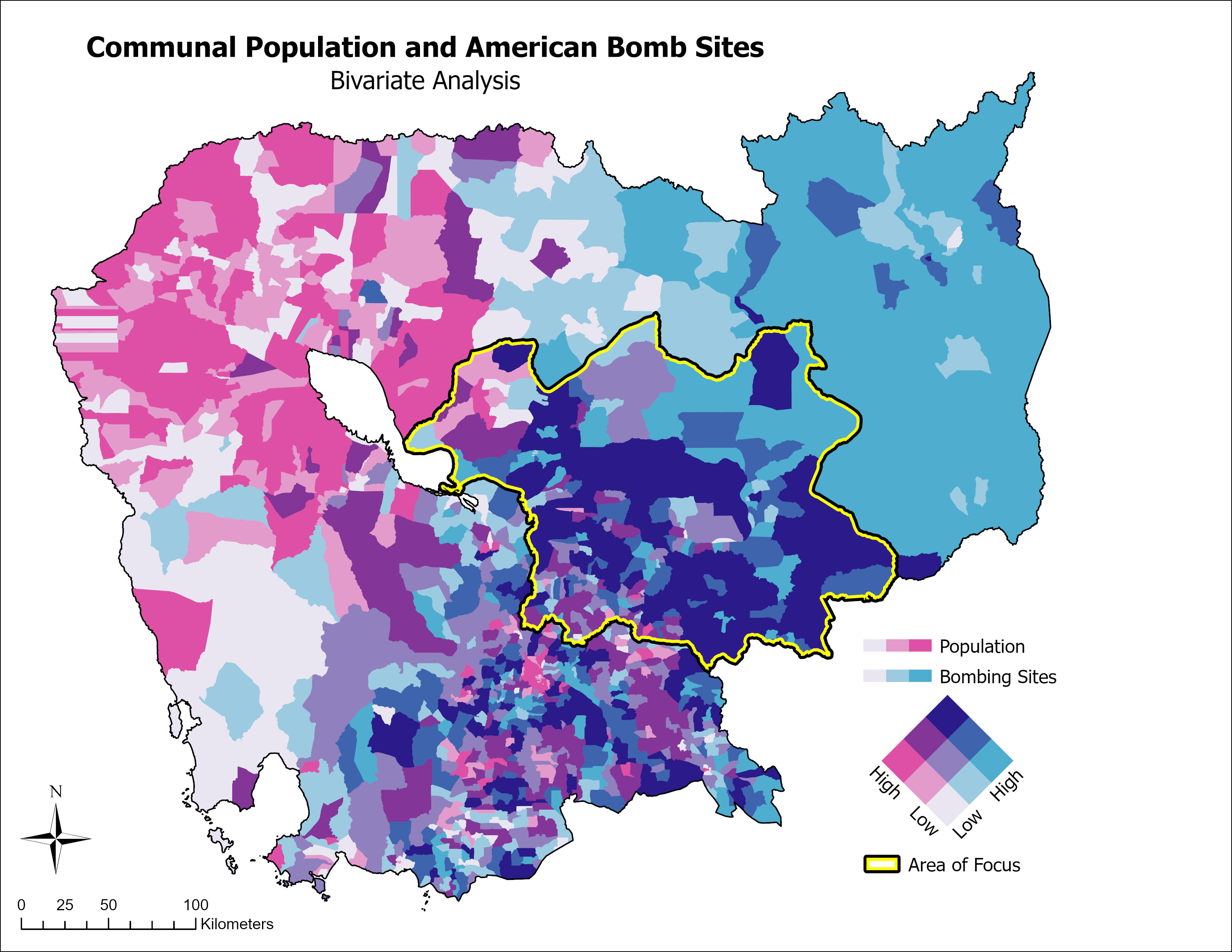


This map was created for my first GIS project analyzing Explosive Remnants of War (ERW) contamination and its proximity to Rural schools in Cambodia. To narrow down the scope of my analysis, I utilized a bivariate symbology to weigh higher population communities (in Cambodia this was at the Commune level) with areas that saw high amounts of bombing raids during the American bombing campaigns from 1965-1975 (from official point data released by the US State Department). The areas in purple show Communes that are both high in population, and have a high count of documented American bombing sites. The polygon with the yellow border is the Focus area that I settled on, as it is a combination of four provinces that contained the largest cluster of purple Communes.
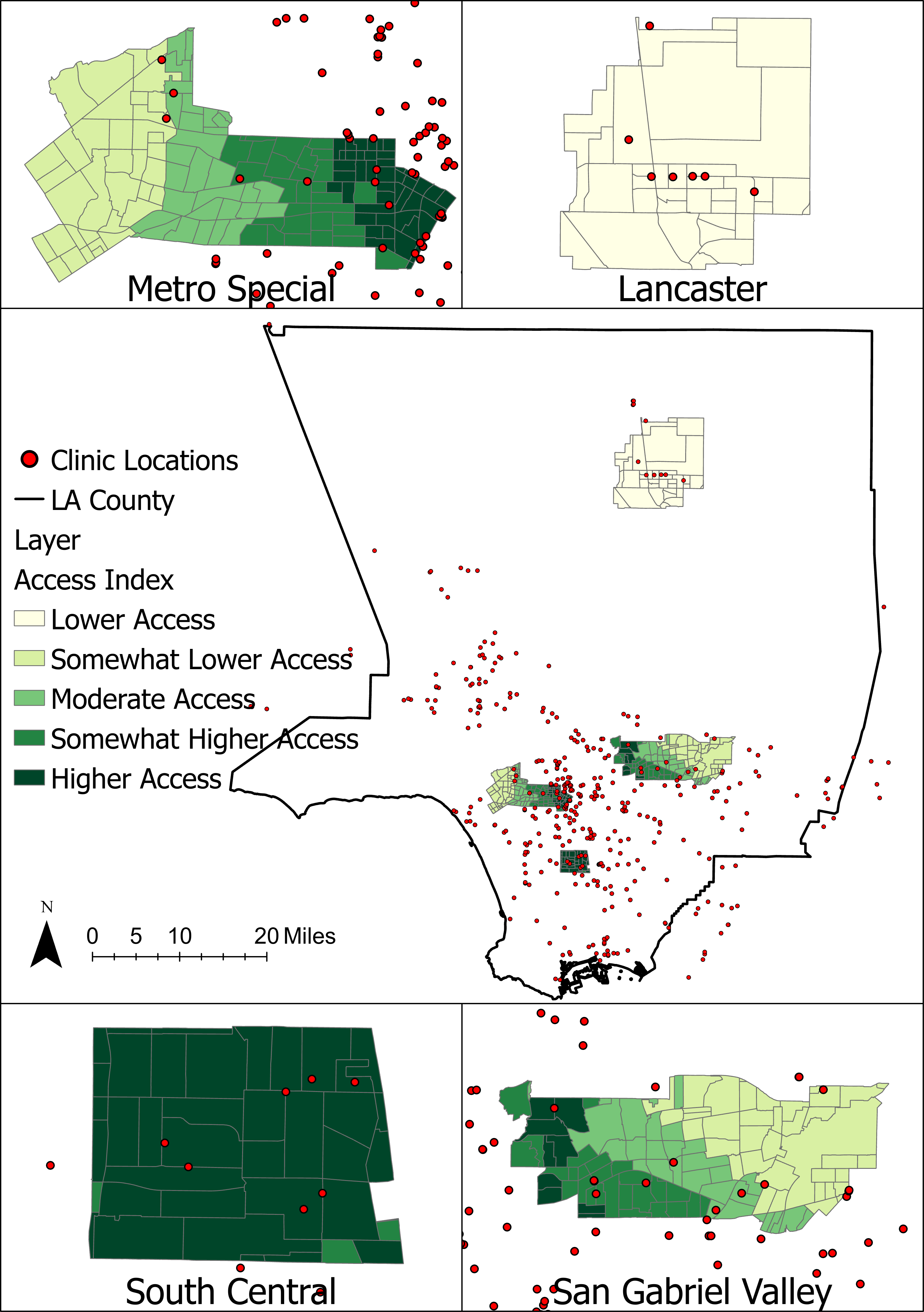
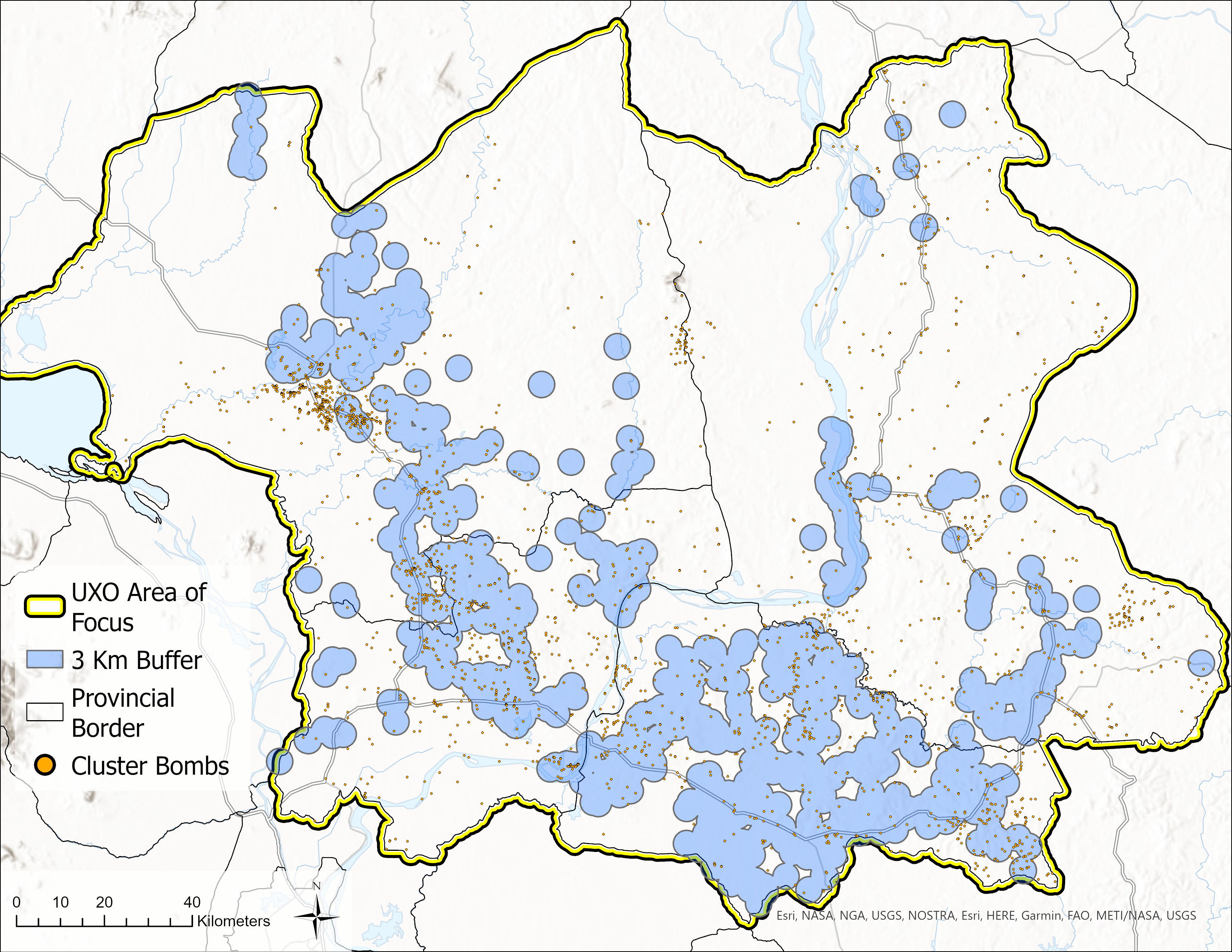
In the following maps, the focus area of my analysis is shown in more detail. The red points symbolize documented ERW contamination, the yellow is documented American cluster bomb sites, while the blue areas are a 3 kilometer buffer around schools that were classified as rural. My research during this project showed that children are most likely to be killed, rather than maimed, by landmines and unexploded ordnance and are often at greater risk of encountering ERW as they play in the land around their homes and schools. A survey that I took of rural schools in Cambodia in 2021 documented most students either walk or bike to school in rural communities, with many of them travelling up to 3 kilometers to get there. With these facts in mind, I wanted to visualize the proximity of ERW contamination within 3 kilometers of rural schools to show how prominent this threat is.
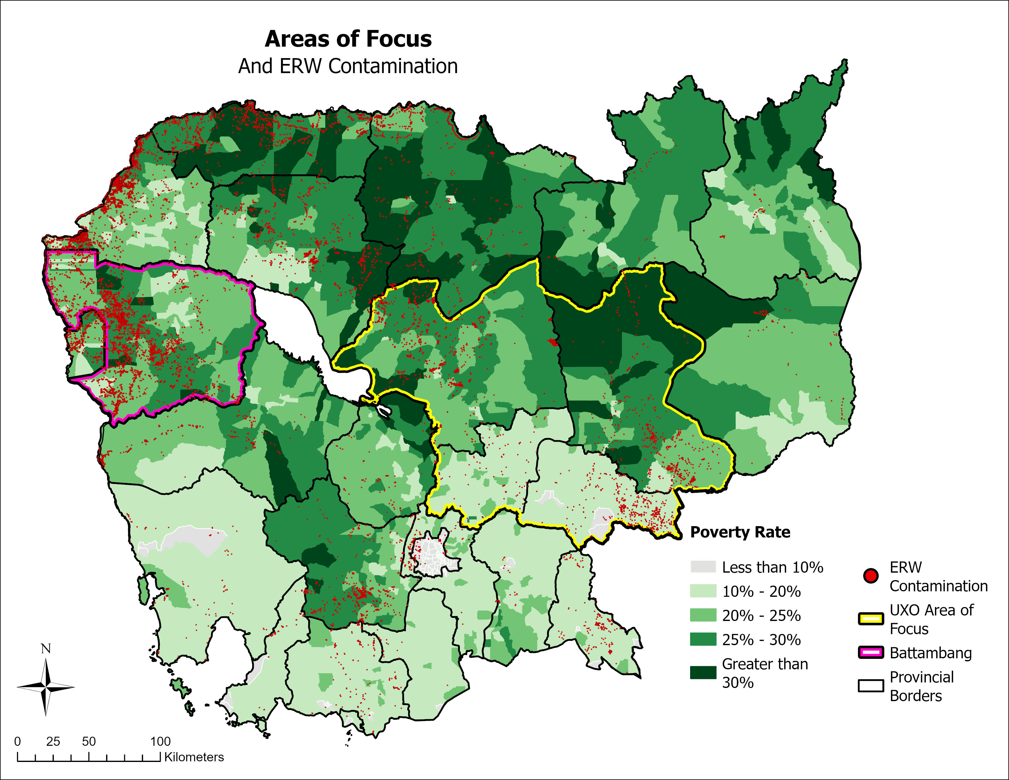
Additionally, I included a map showing facts about the American Bombing Campaign in Cambodia, as well as a commune poverty data and EWR contamination country wide that was included in the complete analysis.