
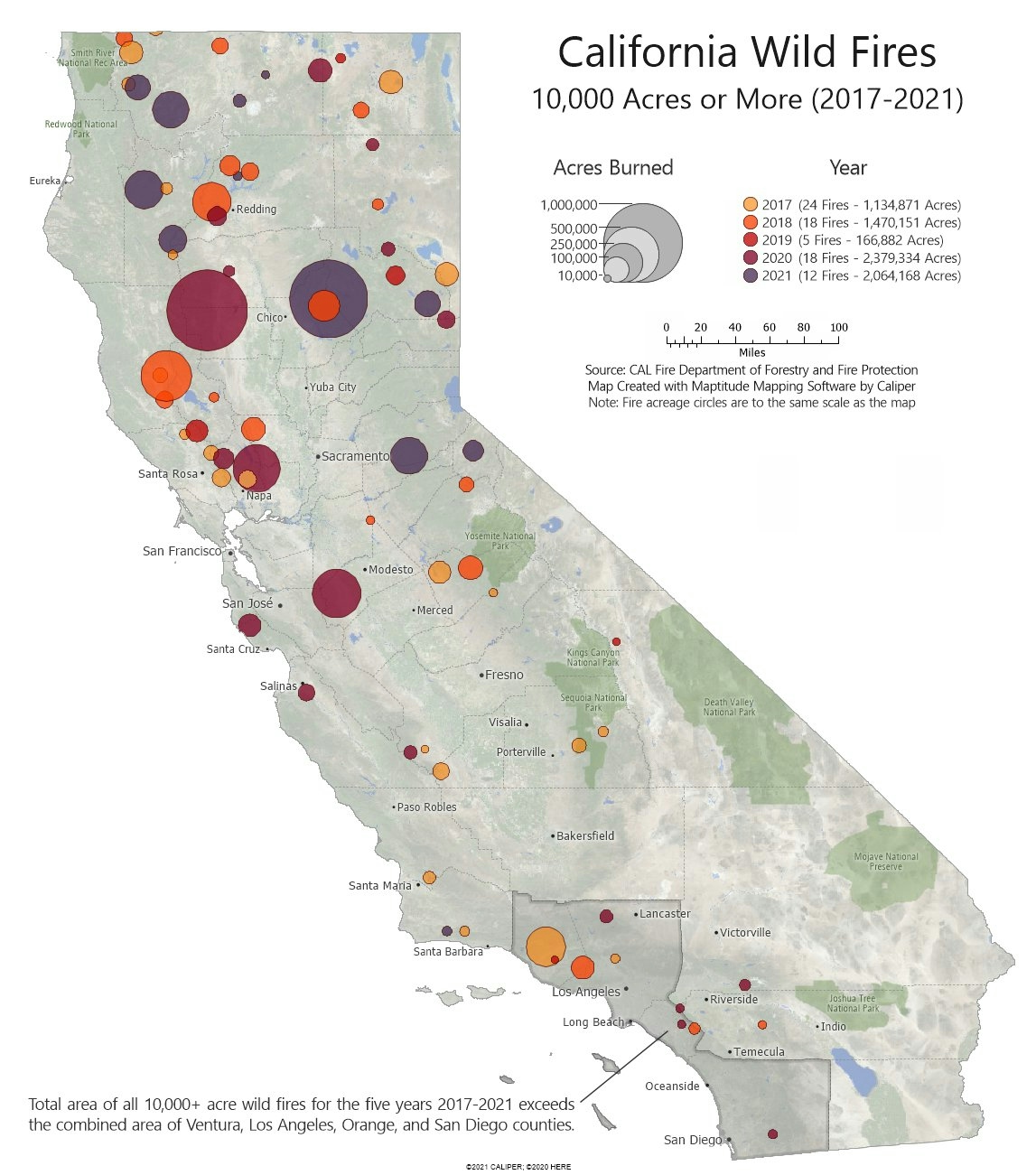
Fire data were obtained from CalFIRE and geocoded. Buffers were created around each fire to create circular areas that encompass the acreage of the fire as reported by CalFIRE. Buffers were tagged with the year of the fire for creating the color theme. Finally, the acreage of the fires was aggregated and counties were filtered to find counties that were of a comparable area.
California Wild Fires 2017-2021
Tools used
maptitude
tags
#mappychallenge
You might also like


Join the community!
We're a place where geospatial professionals showcase their works and discover opportunities.