Sign up or log in to your Spatialnode account.

Takes less than a few seconds.

GEO For Good 2021 - WildFire Animation

Noel Png
Noel Png•

January 24, 2022

GEO For Good 2021 - WildFire Animation

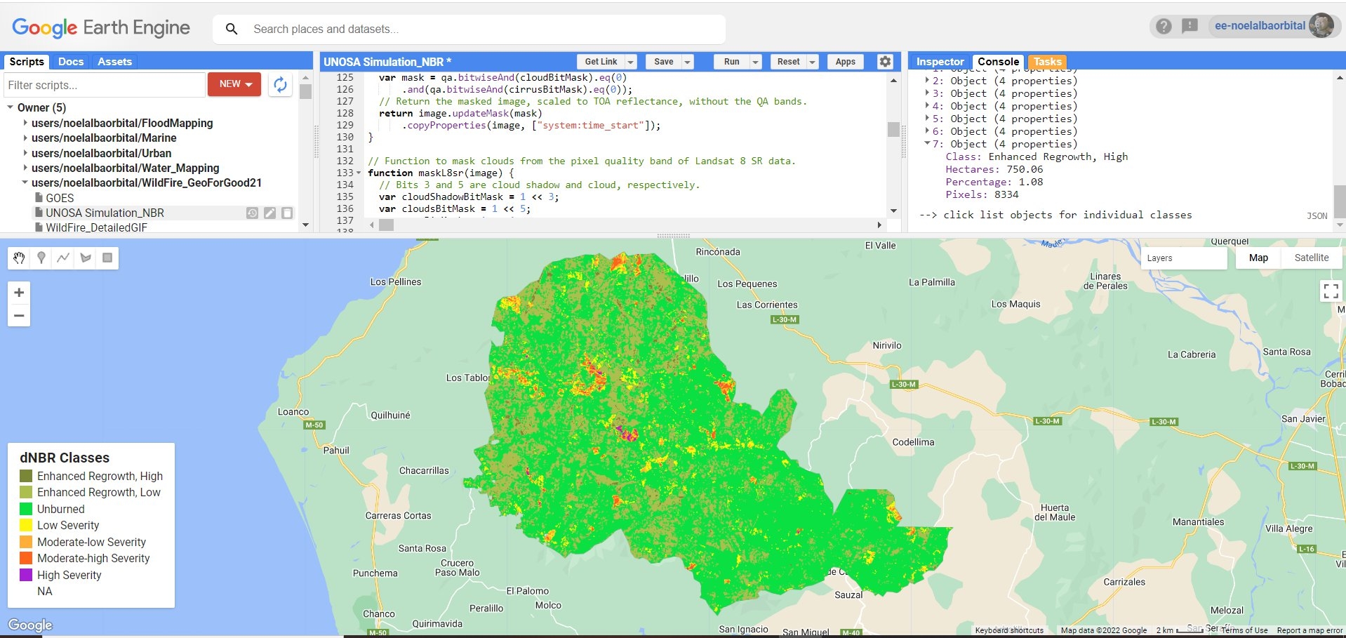
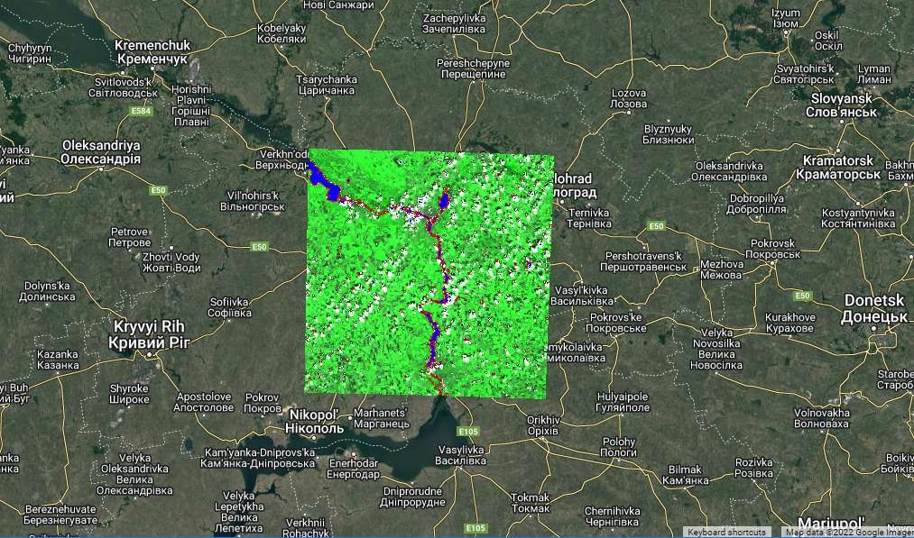
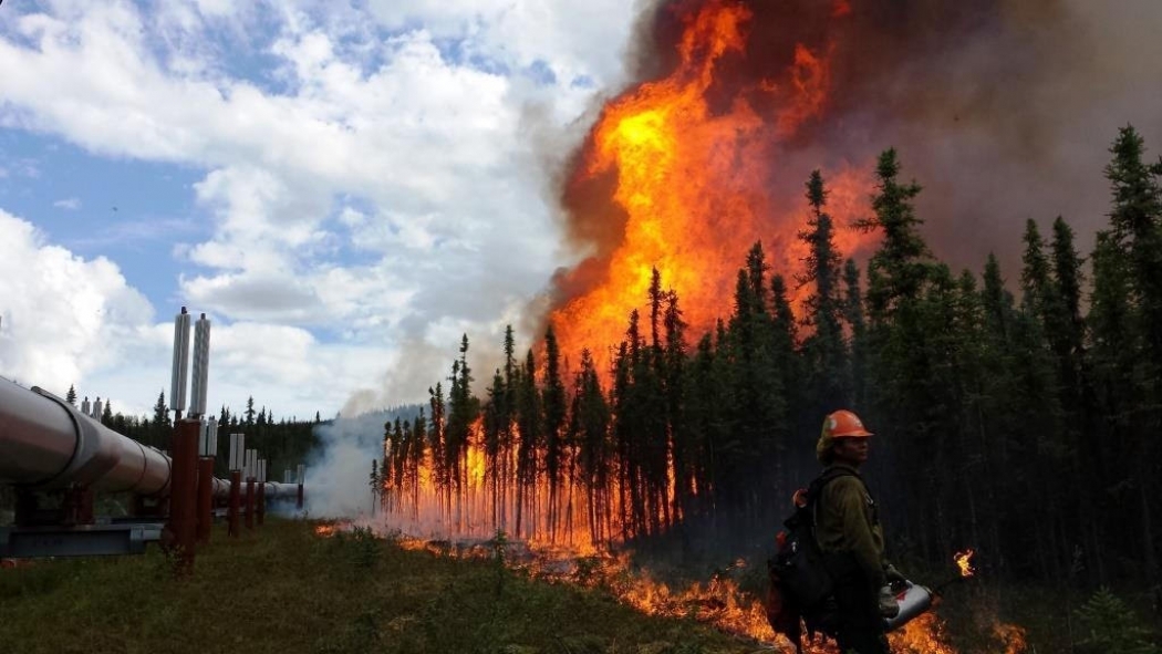
Join me in my journey as I learn how to visualize wildfires over a time period using different datasets made available in Google Earth Engine.


Reference: https://www.youtube.com/watch?v=IDRN61JSdGs

Demo

Tools used

Google ColabGoogle Earth Engine(GEE)

tags

geemap

More by Noel Png

Flood Assessment using SAR (Sentinel 1)
21
Introduction to Burn Severity Mapping
189
Digital Elevation Model : Mountain
44
Ukraine: Dnieper river - City of Kherson
72
Burn Severity Index: NBR
234
Mapping of hospitals within Cambodia
37

You might also like

Elevation Model Demo Map
TIAGO LANDIM GOULART DE OLIVEIRA
Elevation Model Demo Map
TIAGO LANDIM...
16
Wyoming Active Oil and Gas Wells
Keran Nkongolo
Wyoming Active Oil and Gas Wells
Keran NkongoloPro
31
Mapa de localização - PNM
Gabriel Henrique Braga Matos
Mapa de localização - PNM
Gabriel Henrique...
79
Detect Vegetation Cover Change with NDVI
Moez Labiadh
Detect Vegetation Cover Change with NDVI
Moez Labiadh
883
Lake Minocqua Eurasian Water Milfoil
Jeremy Meerstein
Lake Minocqua Eurasian Water Milfoil
Jeremy Meerstein
6
Mapping Georeferencing Stinchfield Woods
Yuxin (Sienna) He
Mapping Georeferencing Stinchfield Woods
Yuxin (Sienna) He
23
Jaguar corridors Orinoco basin- Colombia
Angela Mejia
Jaguar corridors Orinoco basin- Colombia
Angela Mejia
10
Digital Elevation Model of Oyo State.
Olawuyi Abolade Pelumi
Digital Elevation Model of Oyo State.
Olawuyi Abolade Pelumi
34
Indicações Geográficas, RS
Rayanne Cardoso
Indicações Geográficas, RS
Rayanne Cardoso
3
Classificação de Solos do Amazonas, BR
Hildeberto Macêdo
Classificação de Solos do Amazonas, BR
Hildeberto Macêdo
6
Fire Vulnerability Analysis - Raster
Cedar Bachmann
Fire Vulnerability Analysis - Raster
Cedar BachmannPro
2
Administrative Map
Kareem Hakeem Akinlabi
Administrative Map
Kareem Hakeem Akinlabi
19

Join the community!

We're a place where geospatial professionals showcase their works and discover opportunities.

Sign Up for free