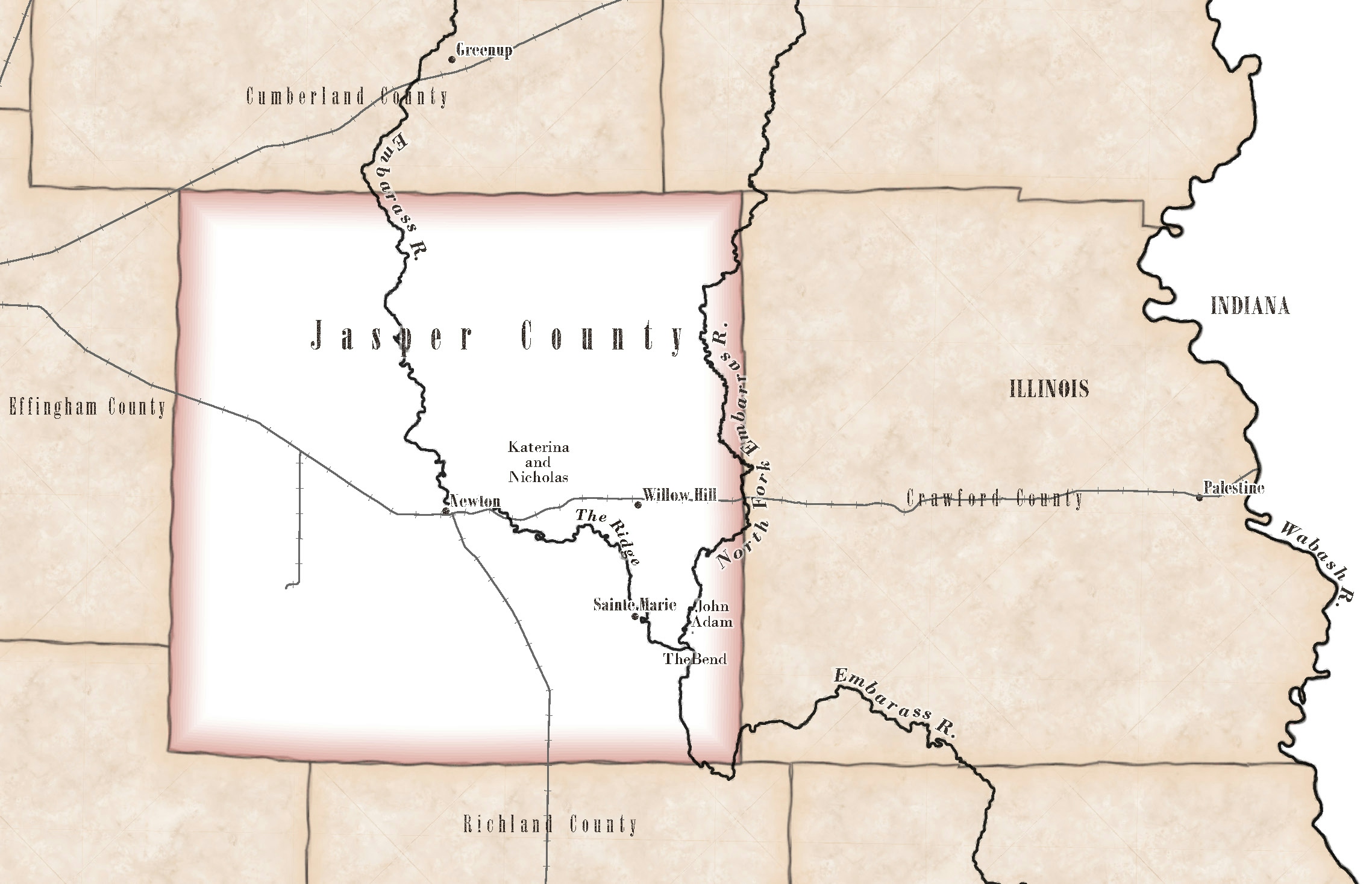
My father's family is from Jasper County, Illinois, and he is writing an historical fiction based loosely on the early generations. This is a reference map I prepared for him with select communities, rivers, and locales that he identified as significant in his storytelling. The map also includes the location of the original land holdings of both his maternal and paternal ancestors. We spent time at the county courthouse together reviewing tract books to find those legal descriptions.
I had a lot of fun reviewing the public GIS data available from the State of Illinois, Jasper County, and other public agencies. I found georeferenced historical photos, aerial imagery from 1938, historical land cover data, original surveyor patent maps, and more. I stretched my skills with identifying the correct projections and transformations, annotation, editing a generalized hydrography dataset to better follow the meandering rivers, and selecting cartography design that I hope evokes those mid-19th century surveyors maps while also preserving legibility.
The biggest challenge I found was in deciding what to include in this one map. The desired extent is relatively expansive, and the points of interest are concentrated in a small area. This was prepared for inclusion with submittal of the book draft to the publisher. So - we await feedback to determine next steps. I would like to be able to provide more content that will allow for more detail. In addition, I am preparing a StoryMap with detailed locale maps, photos we have taken, georeferenced historic photos, and interviews with current family members in the area.


.png&w=3840&q=100)