Sign up or log in to your Spatialnode account.

Takes less than a few seconds.

Proximity Analysis

Jesse Kato
Jesse Kato•

April 21, 2022

Proximity Analysis

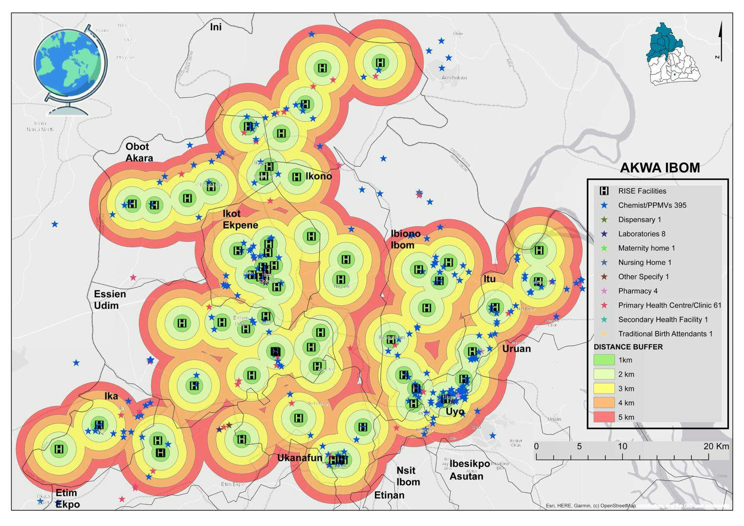
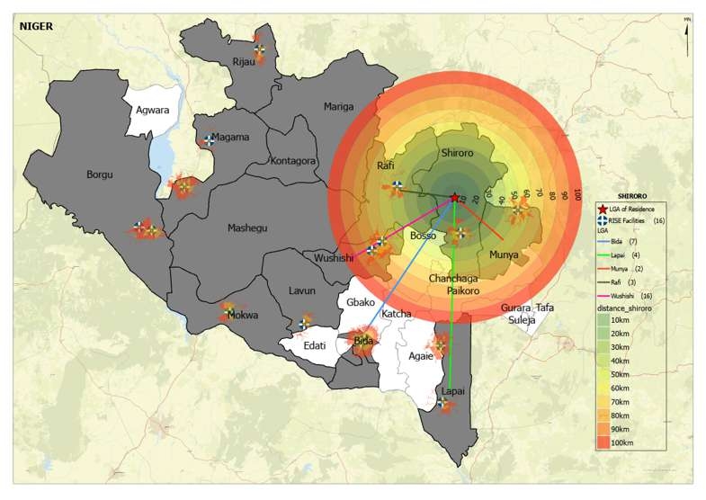
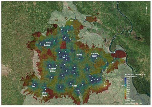
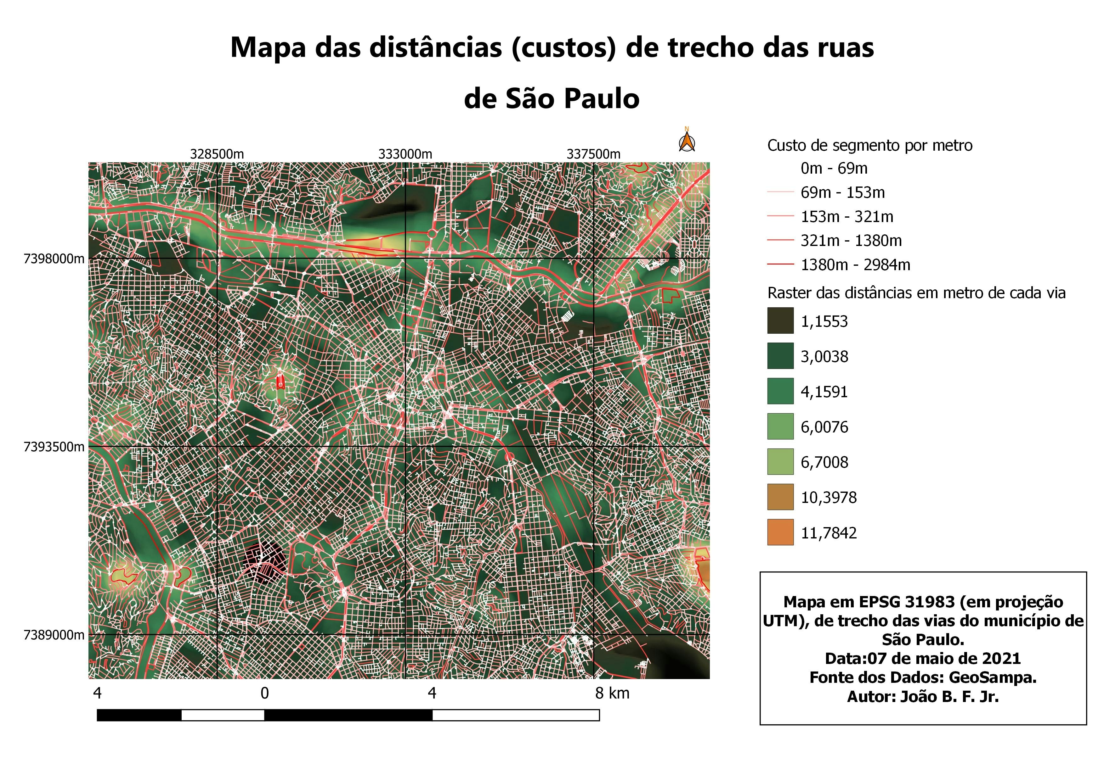
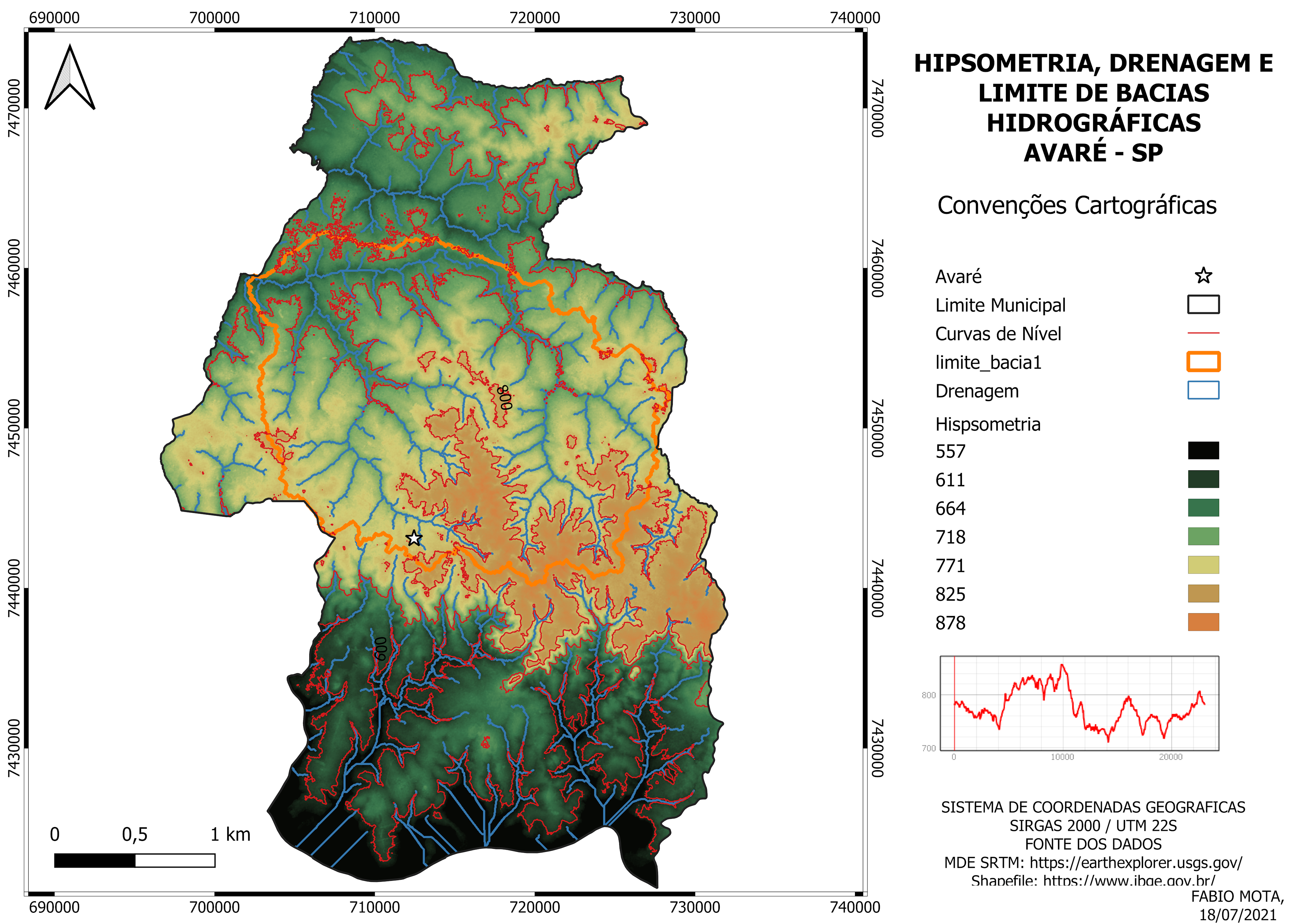
Proximity Analysis using multiple Ring Buffers


Tools used

ArcMapbuffer

Plug-ins used

ArcMapbuffermultiple ring Buffers

tags

BuffersJckatoJhpiego NigeriaRISE

More by Jesse Kato

Simple data Model BI
113
Nigeria Covid-19  Dashboard
Nigeria Covid-19 Dashboard
122
Saturation Map
Saturation Map
37
Space-Time Cube Hot Spot Analysis
110
Saturation comparism
37
Power Bi DashBoard Mock Up
245
Storms in the United States
241
Power BI Drill Down Exercise
120
State Wide Flow Map
State Wide Flow Map
20
Quality Health Care
Quality Health Care
28
Flow and Proximity Analysis
20
Basic KPI Report
Basic KPI Report
27

You might also like

Continuous Voter Registration Centers
Ismail Olayinka Olajide
Continuous Voter Registration Centers
Ismail Olayinka Olajide
16
Redistricting Plan 1-Collin County
Richard Wierengo
Redistricting Plan 1-Collin County
Richard Wierengo
12
Shaded relief map of Nigeria
Balogun Temitope
Shaded relief map of Nigeria
Balogun Temitope
657
Mapa de Declividade
RODRIGO DE ARAUJO BELOTE
Mapa de Declividade
RODRIGO DE...
29
Classification of Tehama County, CA fire
Cole Feyen
Classification of Tehama County, CA fire
Cole Feyen
11
Wildfire Rescue Station Locations
Emily Colgan
Wildfire Rescue Station Locations
Emily Colgan
8
MAPA GENERAL DE SAN MIGUEL DE VELASCO
GUSTAVO ABEL CACERES MARTINEZ
MAPA GENERAL DE SAN MIGUEL DE VELASCO
GUSTAVO ABEL...
68
Mapa vintage do sul da Europa
Lucas de Siqueira Cardinelli
Mapa vintage do sul da Europa
Lucas de...
29
MAPA MULTIESCALAR DE LOCALIZAÇÃO UIRAÚNA
Jonatha Iuri
MAPA MULTIESCALAR DE LOCALIZAÇÃO UIRAÚNA
Jonatha Iuri
97
Suitable Bobcat Habitats in Vermont
Maddy Peck
Suitable Bobcat Habitats in Vermont
Maddy Peck
8
Multidimensional Raster Predictive Model
Zach Torres
Multidimensional Raster Predictive Model
Zach Torres
82
Historical Wildfires in British Columbia
Max Lessard
Historical Wildfires in British Columbia
Max Lessard
27

Join the community!

We're a place where geospatial professionals showcase their works and discover opportunities.

Sign Up for free