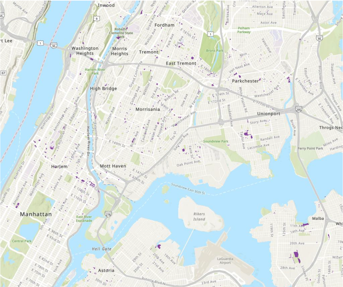
The goal of this project is to identify areas most in need of public restrooms. Many areas are serviced by public restrooms from city parks, but these are few in number and in poor states. Some community districts are vastly underserved and rely on only a handful of park restrooms. This project aims to fill in the need for free 24/7 access to hygienic public restrooms within a 0.25 radius for all while not discriminating against the disabled and homeless.
All boroughs fall short of the 0.25-mile criteria
Half of all shelters in the city fall short of the criteria as well
Community districts have restrooms ranging from 2 to 18 per 100,000 people
Although Brooklyn ranks 2nd in the closest observed mean distance
between restrooms, it is the most underserved borough


.png&w=3840&q=100)


.svg "Keran Nkongolo")