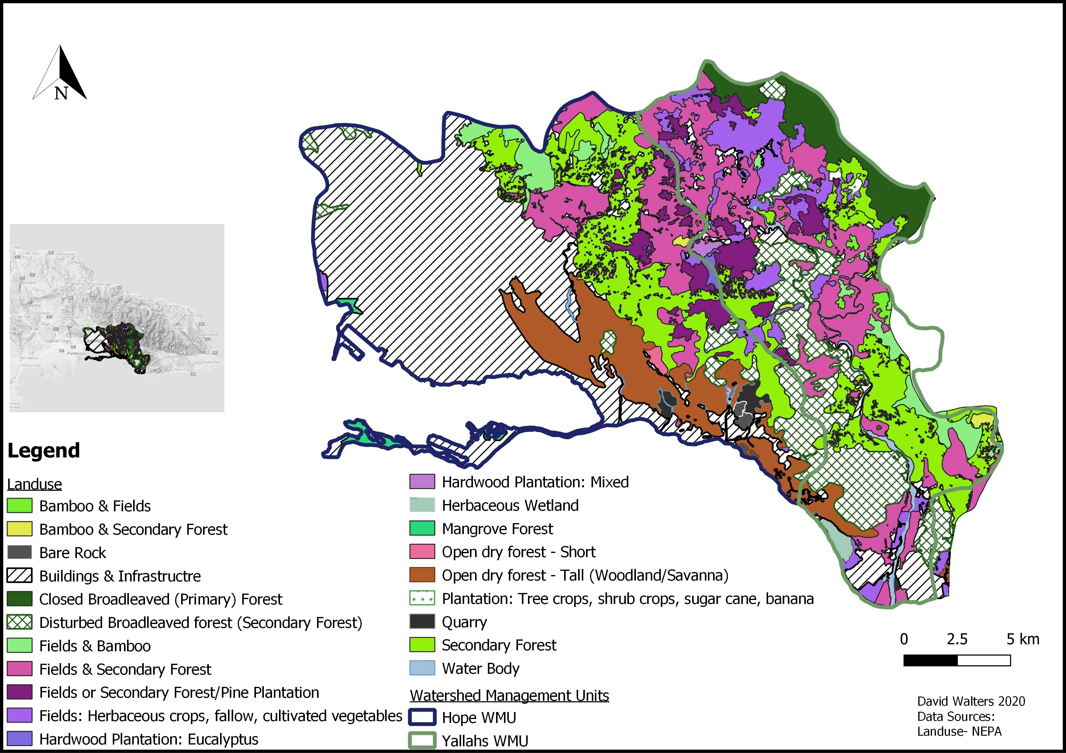
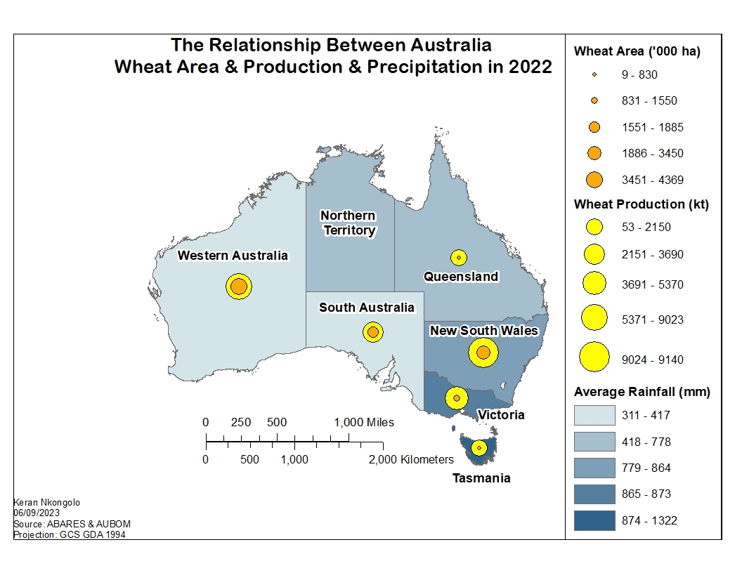
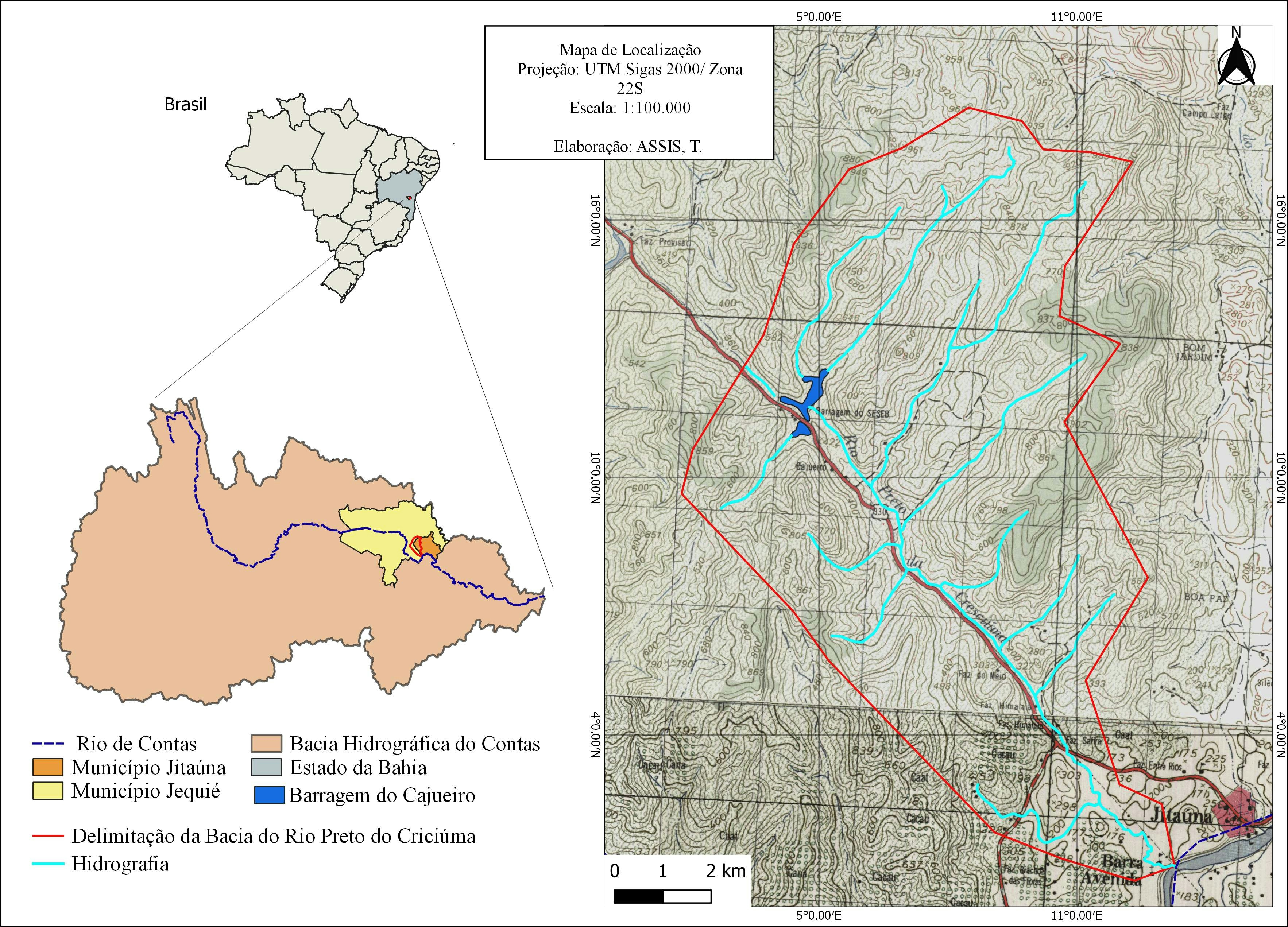
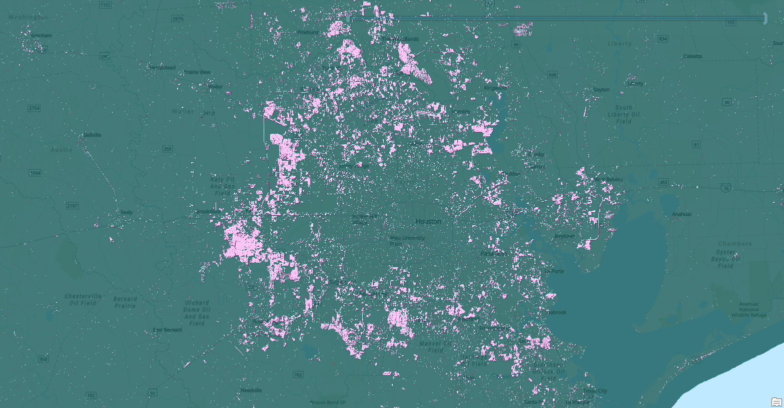
Sign up or log in to your Spatialnode account.

Takes less than a few seconds.

Watershed Landuse

David Walters
David Walters•

October 26, 2021

Watershed Landuse
This shows the various land use types within two Jamaica's most important watersheds. Data is from the National Environment and Planning Agency.

Tools used

QGIS

Plug-ins used

QGIS

tags

QGIS

You might also like

Spatial Assessment Public Restrooms NYC
Metehan Demirkol
Spatial Assessment Public Restrooms NYC
Metehan Demirkol
21
Quantificação da Severidade de Queimada
Breno Nunes
Quantificação da Severidade de Queimada
Breno Nunes
551
Industrial Sites in Urban Growth Rings
Cole Feyen
Industrial Sites in Urban Growth Rings
Cole Feyen
12
MAPA DE LOCALIZAÇÃO  BACIA HIDROGRÁFICA
Breno Nunes
MAPA DE LOCALIZAÇÃO BACIA HIDROGRÁFICA
Breno Nunes
503
SRTM of Tanga Region (Tanzania)
Hemed Lungo
SRTM of Tanga Region (Tanzania)
Hemed Lungo
161
Normalized Difference Vegetation Index
Motunrayo Adeyemi
Normalized Difference Vegetation Index
Motunrayo Adeyemi
31
Criticidade de estradas florestais
Carla Américo
Criticidade de estradas florestais
Carla Américo
4
Population Density Map of Arkansas
Martin Nuñez Igarzabal
Population Density Map of Arkansas
Martin Nuñez Igarzabal
56
Artigos por sub-bacias
Murilo Silva
Artigos por sub-bacias
Murilo Silva
14
Índices Morfométricos: Bacia Mangabal
Ana Carolina Paula do Amaral
Índices Morfométricos: Bacia Mangabal
Ana Carolina...
1
Analysis of LULC along ABJ-KAD Rail
Lawrence Akpoterai
Analysis of LULC along ABJ-KAD Rail
Lawrence Akpoterai
77
The Climates of the World
WILLIAN S. SANTOS 🇧🇷
The Climates of the World
WILLIAN S....
46

Join the community!

We're a place where geospatial professionals showcase their works and discover opportunities.

Sign Up for free