Introduction
In recent years, the convergence of geospatial technology and artificial intelligence (AI) has revolutionized how we perceive, analyze, and interact with spatial data. From automating mundane tasks to extracting profound insights from massive datasets, AI transforms how geospatial professionals work. They are increasingly harnessing the power of AI to derive insights, make predictions, and solve complex spatial problems.
To stay ahead and thrive in this evolving industry, upskilling with essential AI skills is no longer optional; it is essential for professionals seeking to excel in this dynamic field.
This article explores the top AI skills geospatial professionals should consider adding to their repertoire and how these skills can empower them to succeed in the future.
AI encompasses various technologies, including:
AI encompasses a broad spectrum of technologies that enable machines to mimic human cognitive functions such as learning, reasoning, and problem-solving.
The integration of AI techniques with geospatial workflows has unlocked unprecedented capabilities.
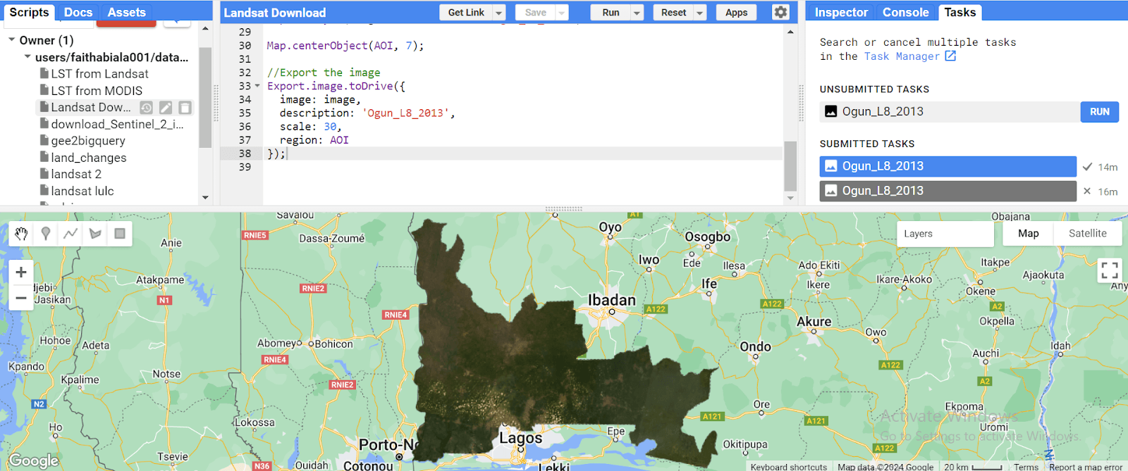
Machine Learning (ML): Machine learning algorithms can classify land cover, predict urban growth patterns, detect changes in vegetation, and even analyze satellite imagery for disaster response.
Deep Learning: Deep learning models excel at image recognition tasks, enabling the automated extraction of features from aerial and satellite imagery with remarkable accuracy.
Essential AI Skills for Geospatial Professionals:
Foundational AI Knowledge:
Grasping fundamental AI concepts like algorithms, data, and model training is essential for effective application.
This includes:
Understanding the different types of ML algorithms, like regression, classification, clustering, etc., and their capabilities.
Grasping the concept of artificial neural networks and their application in tasks like image recognition and object detection is valuable, as is the ability to work with deep learning frameworks like TensorFlow or Python, especially in areas like image and remote sensing analysis.
Data Science Fundamentals:
Geospatial data often comes in large volumes and diverse formats. Proficiency in data manipulation, cleansing, and preprocessing is crucial for preparing datasets for analysis.
Geospatial professionals should be adept at using tools like Python libraries (e.g., pandas, numpy) to explore, manipulate, and analyze spatial data.
Programming Languages:
Coding skills are becoming increasingly important for geospatial professionals. Proficiency in languages like Python, with its extensive libraries like TensorFlow and PyTorch, or R for data wrangling, analysis, and visualization.
Geospatial AI Tools and Libraries:
Several specialized geospatial AI tools and libraries are readily available for various tasks like spatial analysis, feature extraction, and image classification. Popular options include:
GeoPandas: This library extends Pandas, a popular data analysis tool, to work seamlessly with geospatial data.
Rasterio: This library allows efficient reading, writing, and manipulation of raster data, commonly used in remote sensing and environmental analysis.
Geospatial Machine Learning Libraries: Several libraries, like Arcpy and ArcGIS API for Python, are designed specifically for applying ML algorithms to geospatial data.
Benefits of Upskilling with AI:
Increased Efficiency and Productivity: AI automates repetitive tasks, freeing up time for higher-level analysis and decision-making.
Enhanced Data Analysis: AI helps to uncover hidden patterns and trends in geospatial data, leading to better insights and informed decision-making.
Improved Problem-Solving: AI tackles complex geospatial challenges that were previously intractable with traditional methods.
Career Advancement: AI skills are in high demand, opening doors to new job opportunities and career advancement.
Conclusion
As the geospatial field continues to evolve, embracing AI skills presents boundless opportunities for innovation and empowers geospatial professionals to unlock new possibilities in spatial data analysis, visualization, and problem-solving.