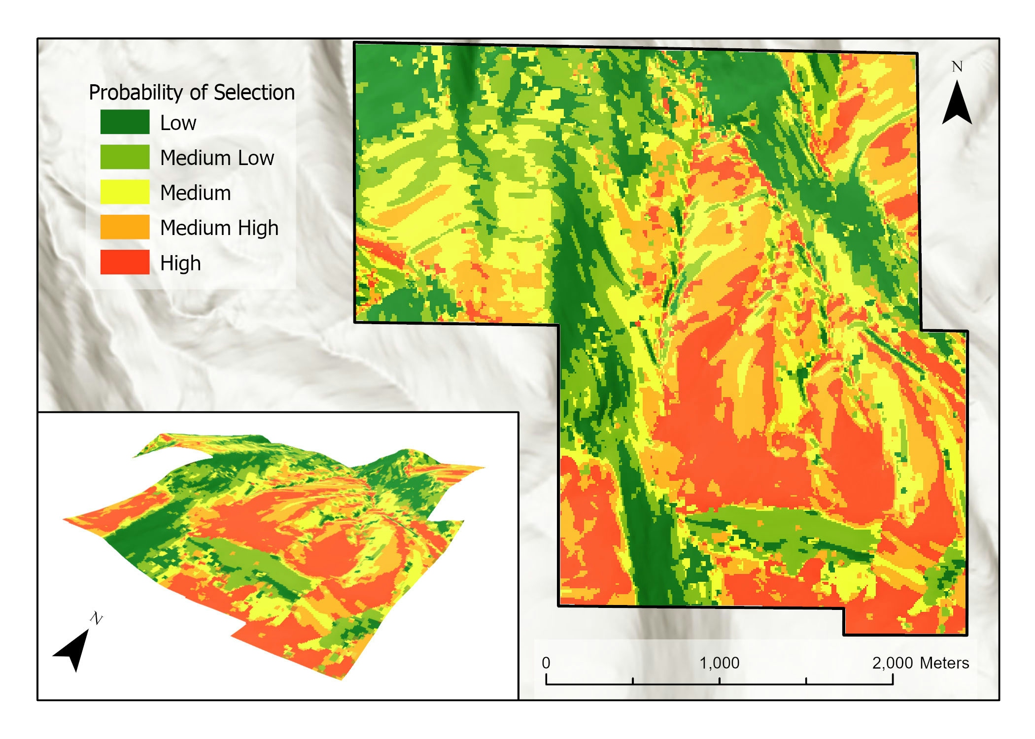
Study Area
1,012 total hectares near Scofield Reservoir (39.91° -111.16° N, 109 39.88°, -111.12° E) in Utah County, Utah, USA. Elevation ranging from 2,191 to 2,550m.
Data Collection
Six GPS collars with a modified i-gotU GT-600 GPS unit were placed on six ewes from a herd of 600 adult sheep, yielding 20,958 GPS data points.
Generated 20,958 additional random points to ensure adequate characterization of the study area.
Environmental data (i.e. elevation, water location) came from the Utah Automated Geographic Reference Center.
Vegetation data were collected from landfire raster dataset.
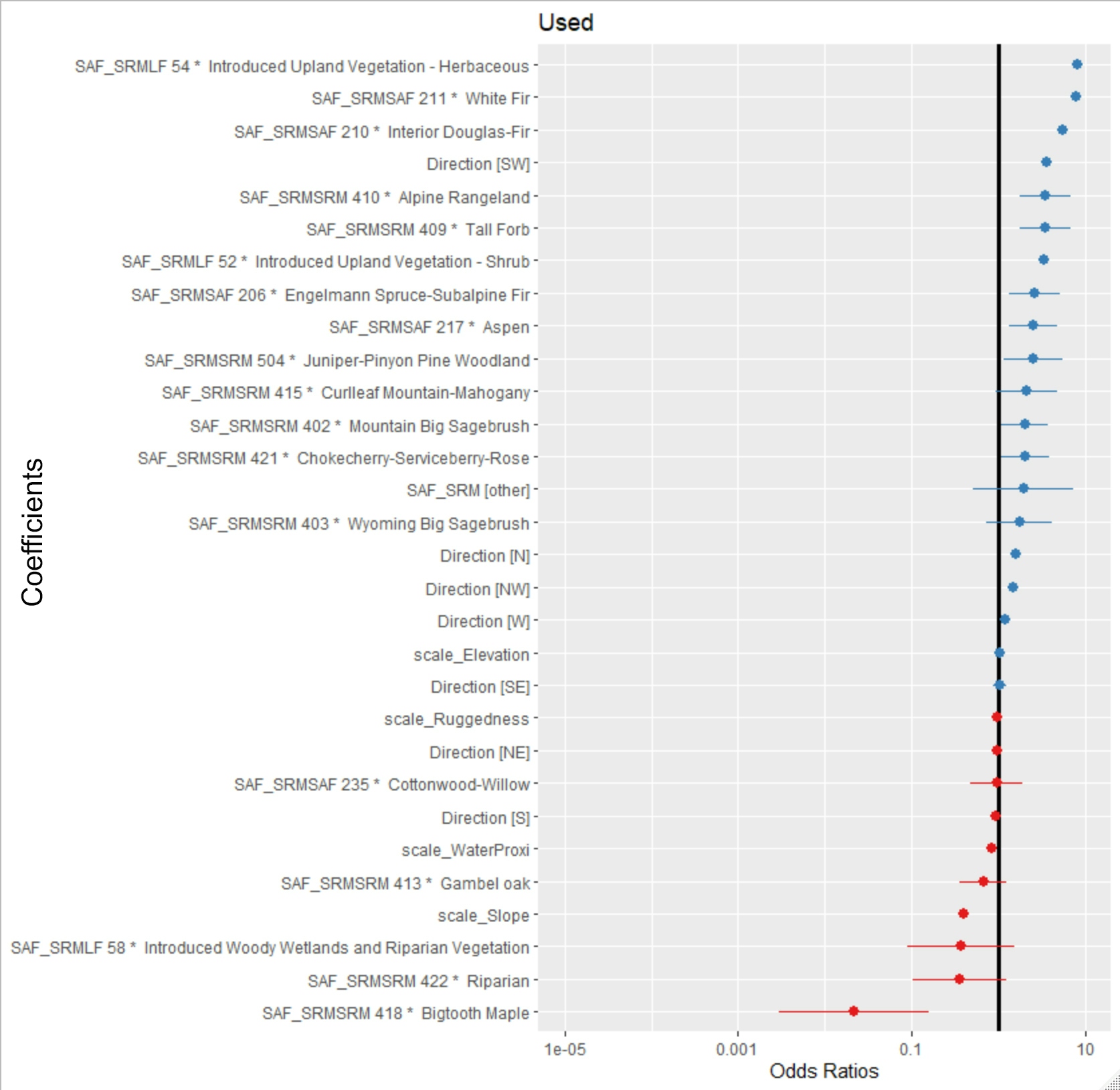
Used Society of American Foresters-Society for Range Management (SAF-SRM) cover type we grouped vegetation into 20 different groups based on dominant vegetation type.
ArcGIS Pro Model Builder Steps
Generated elevation data derivatives: slope, aspect, and ruggedness
Reclassified aspect into seven directions: north, northeast, northwest, south, southeast, southwest, and west.
Sampled all raster data layers at 10m intervals by creating point layer from DEM cell centers to use in the Extract MultiValues to Points tool
Best model selected based on AIC score.
Variable coefficients from the selected model were used with the variable values from the 10m sample grid (n=110,615) and yielded an RSF prediction score for each 10m cell.
Rasterized point layer and classified by prediction score.