

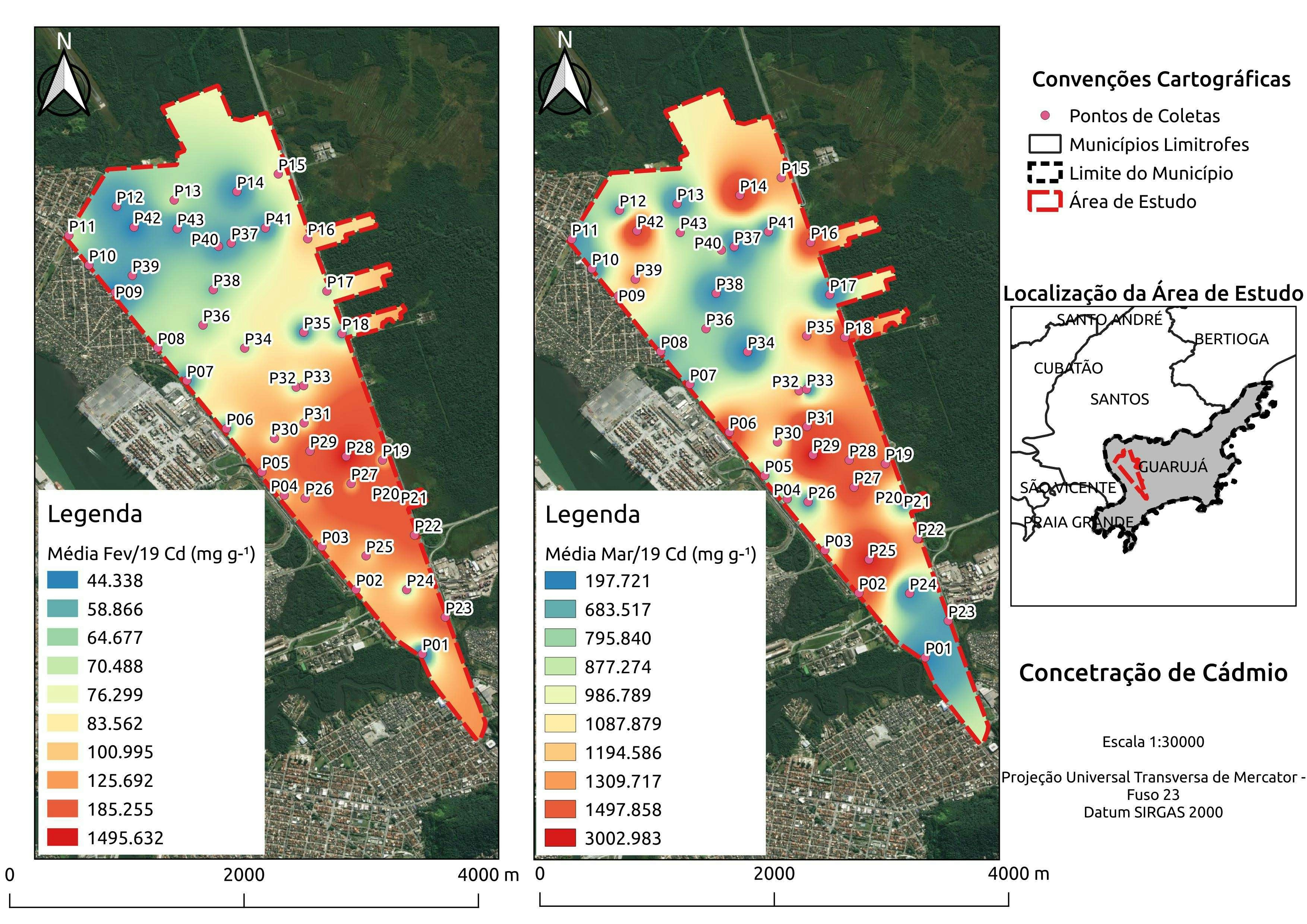
Geospatial model of Black Tern hatching success at St. Clair Flats, MI, showing decline in area of hatch success from 2014 to 2020 as average lake levels increased by 0.8 m (July maximum). Hatching success was based on geospatial variables from the final generalized linear model (GLM) in Fuller et al. 2021. 2013 and 2015 were not included due to insufficient local data. The two polygons delineate two sub-colonies: Bruckner’s (left) and Canoe (right), only including area with full imagery data for all years.
Modeled Black Tern Hatching Success
tags
HazardRemote SensingSpatial Modelling
You might also like


Join the community!
We're a place where geospatial professionals showcase their works and discover opportunities.