Sign up or log in to your Spatialnode account.

Takes less than a few seconds.

Profil topographique avec PyQGIS

Florian Cosse
Florian Cosse•

December 23, 2021

Profil topographique avec PyQGIS

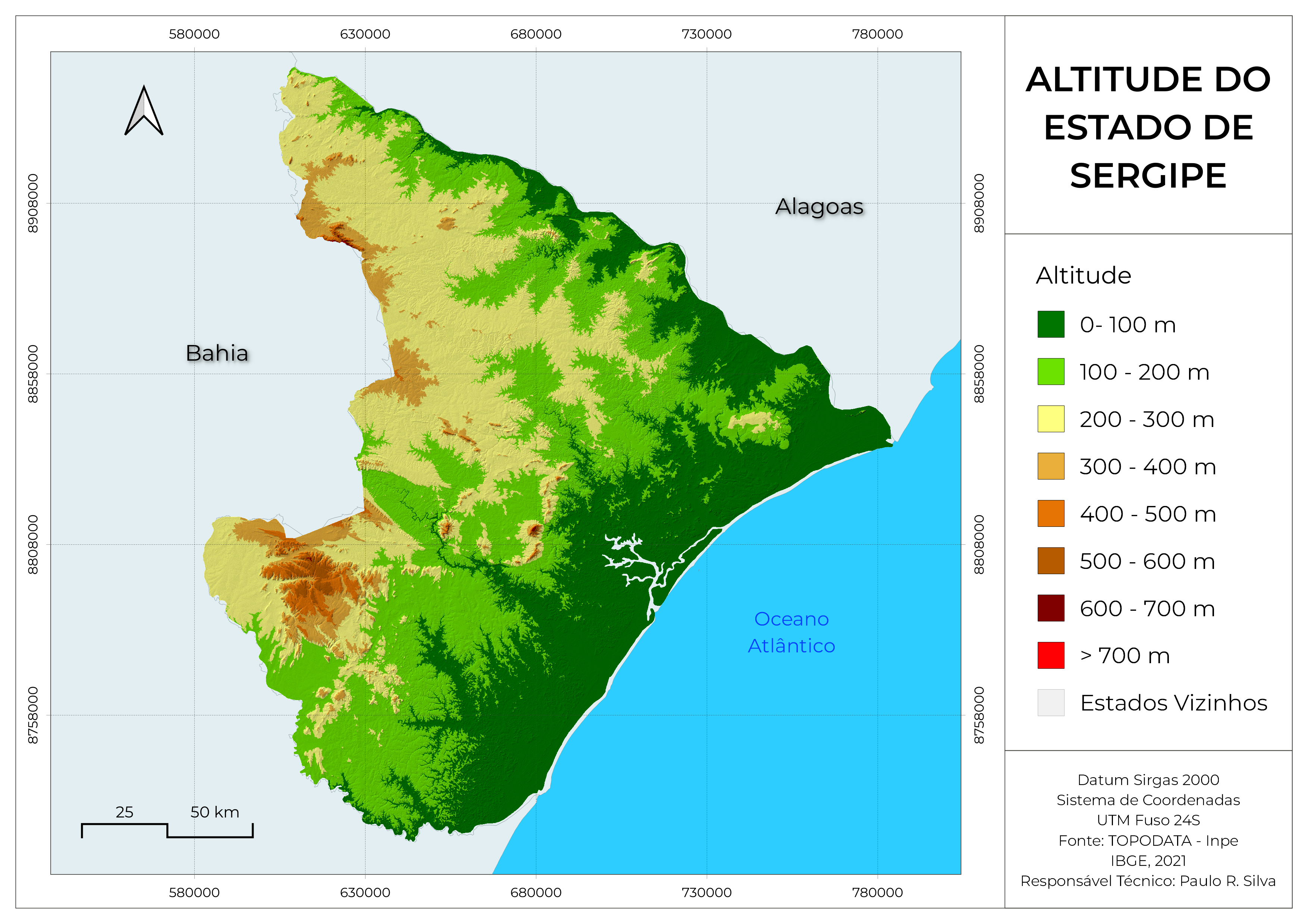
Relevés d'altitudes depuis un MNT avec QGIS et Python, puis modélisation du graphique avec Plotly.

https://github.com/flcosse/script/blob/main/profil.py

Demo

Tools used

Data VisualizationPythonQGIS

You might also like

Georeferencing Lord of the Rings
Luana Moraes Costa
Georeferencing Lord of the Rings
Luana Moraes Costa
46
3a: Demographics of Illinois
carson allen
3a: Demographics of Illinois
carson allen
10
Maryland Soybean and Corn
Keran Nkongolo
Maryland Soybean and Corn
Keran NkongoloPro
32
The Climates of the World
WILLIAN S. SANTOS 🇧🇷
The Climates of the World
WILLIAN S....
46
RSK Population Density
Hamza Bouarakia
RSK Population Density
Hamza Bouarakia
162
Polos Florestais SP
Augusto Fernandes
Polos Florestais SP
Augusto Fernandes
24
Projected Time Zones 🌐
Alexa Cristina
Projected Time Zones 🌐
Alexa Cristina
38
Species Distribution Model (Part 1)
Ali Mulla
Species Distribution Model (Part 1)
Ali Mulla
21
Mapa temático de declividade de Ipojuca
Luan Tomaz
Mapa temático de declividade de Ipojuca
Luan Tomaz
317
Rail System in the U.S.A.
Max Knight
Rail System in the U.S.A.
Max KnightPro
14
Red Dead Redemption Style Brasil Map
PATRICK MCGRANAGHAN
Red Dead Redemption Style Brasil Map
PATRICK MCGRANAGHAN
323
APA de Murici
Jardel Estevam Barbosa dos Santos
APA de Murici
Jardel Estevam...
36

Join the community!

We're a place where geospatial professionals showcase their works and discover opportunities.

Sign Up for free