
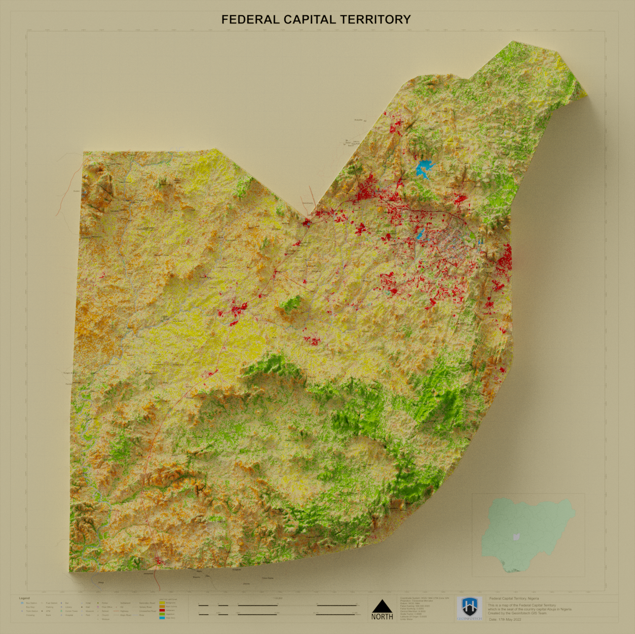
This map was prepared using Landsat 8 imagery for the year 2014 Image Classification was performed and exported as a picture format(png) and rendered using the Blender software using the Digital Elevation Model (DEM). It is available at the geoinfotechstore.com
3D Map of Federal Capital Territory 2014
Tools used
ArcMapBlenderQGIS
Plug-ins used
Blenderusgs
tags
AbujaBlender 3Dtopographic map
You might also like

.svg "Keran Nkongolo")


Join the community!
We're a place where geospatial professionals showcase their works and discover opportunities.