Sign up or log in to your Spatialnode account.

Takes less than a few seconds.

Cartographic products

Simone Greicy Cruz Moura
Simone Greicy Cruz Moura•

March 13, 2023

Cartographic products

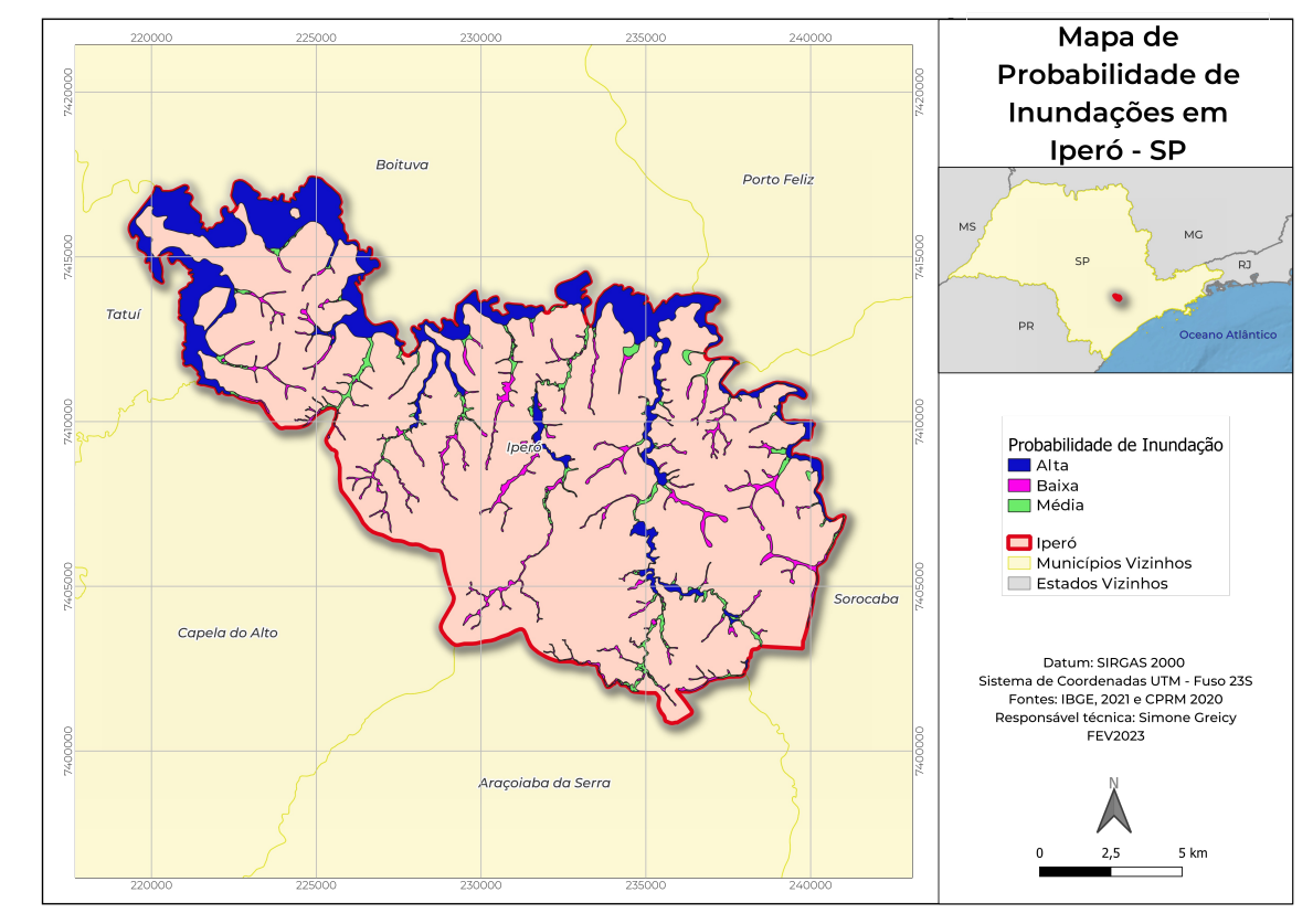
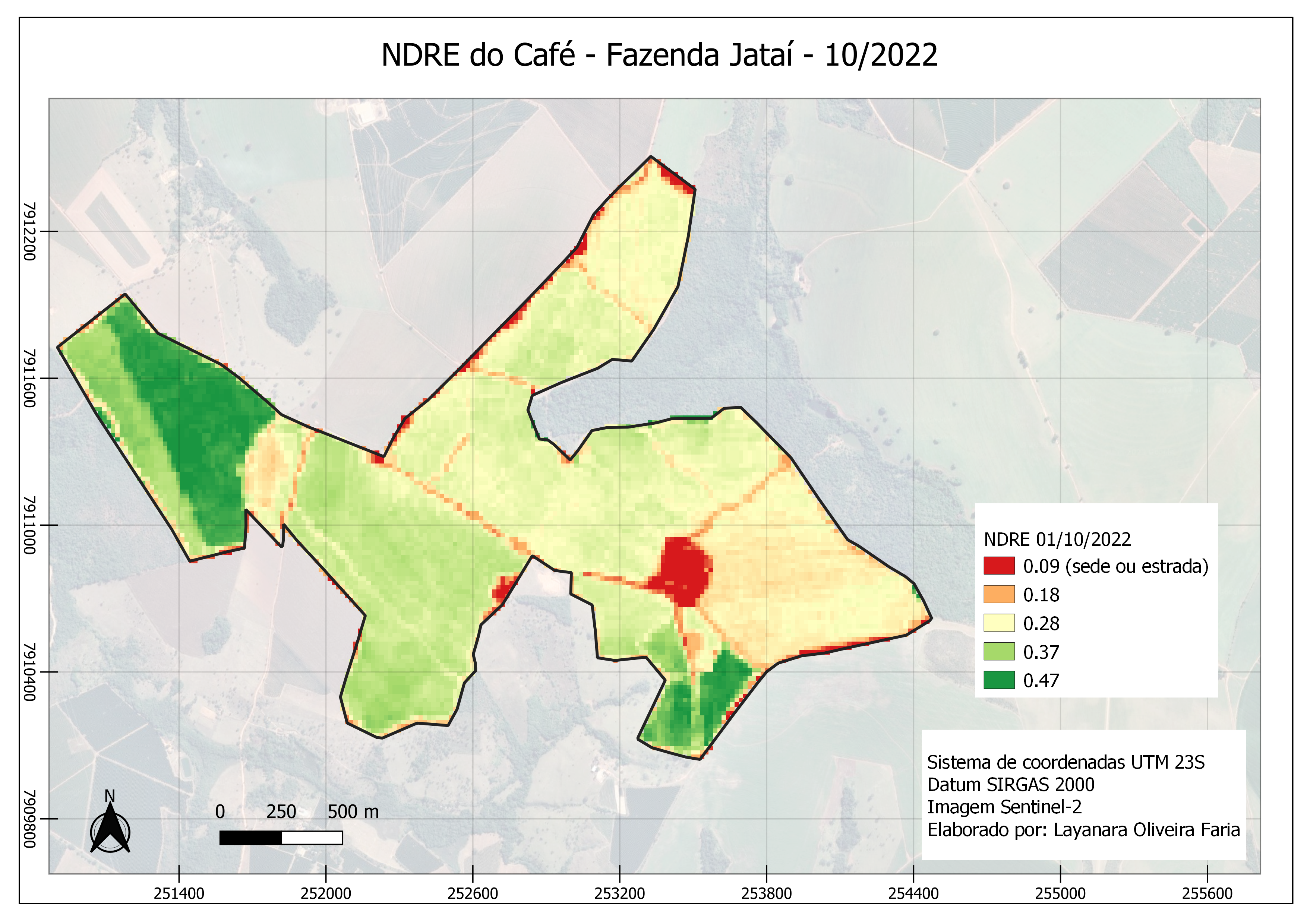
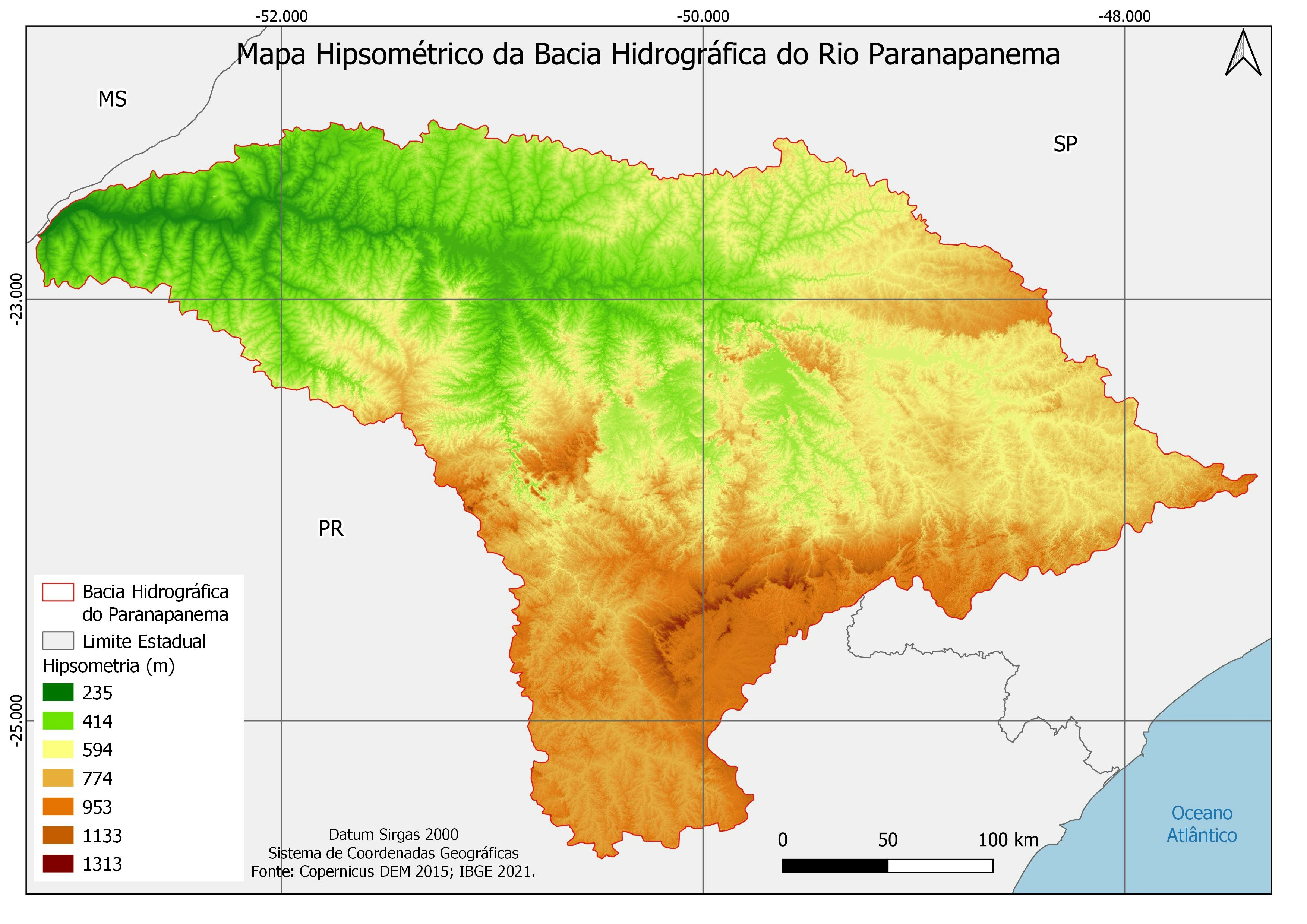
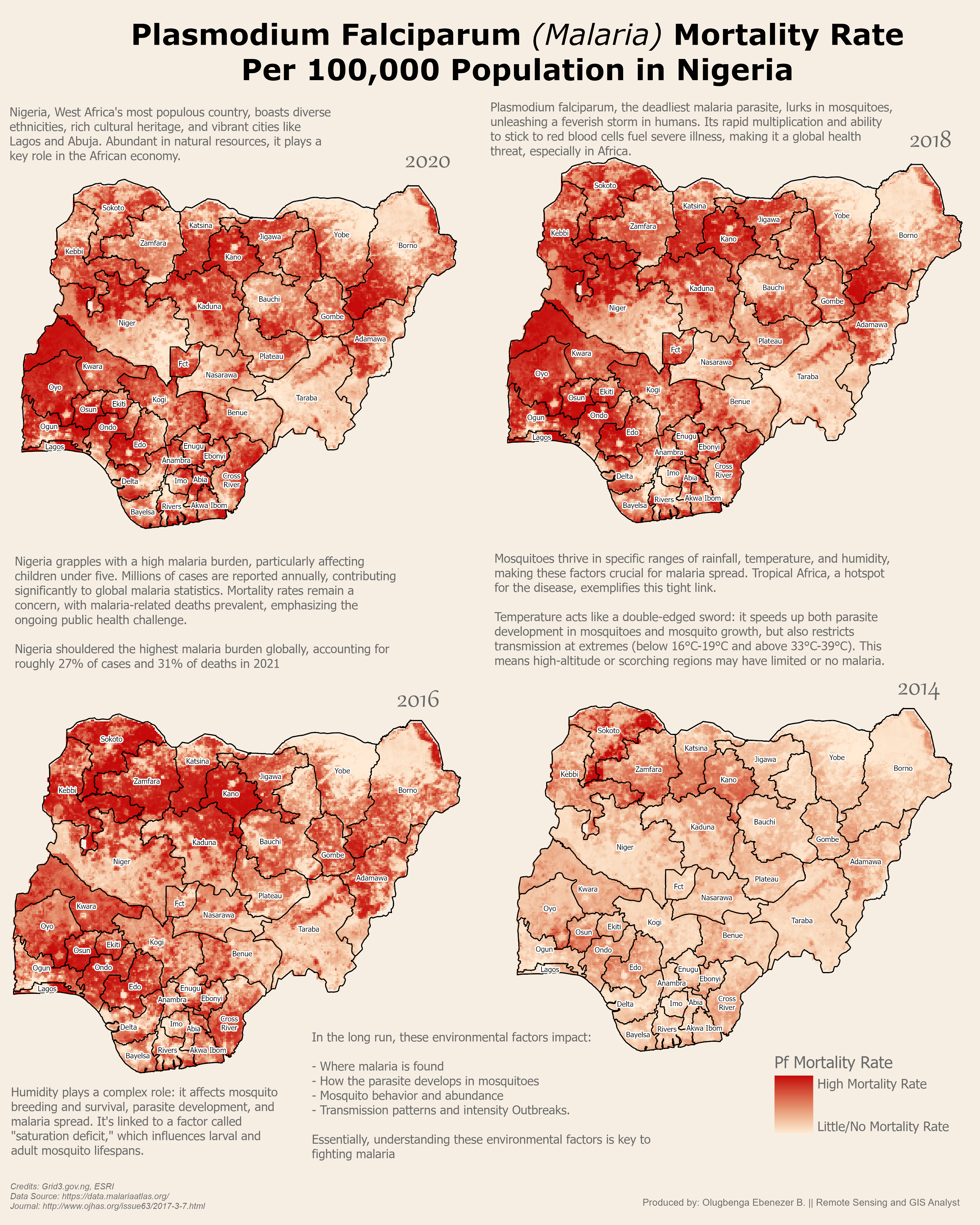
Mapa de Probabilidade de Inundações em Iperó e mapa de localização em Iperó - SP.


Tools used

QGIS

Plug-ins used

IBGE, CPRM

tags

Location and thematic maps.

You might also like

How to use proportional circles in Leaflet
Joseph Thuha
How to use proportional circles in Leaflet
Joseph Thuha
336
Planta - Sítio São José
João Alison Dionísio Mendonça
Planta - Sítio São José
João Alison...
13
Mapa NDVi  usando cbers 4
Paulo Ricardo Gomes de Souza
Mapa NDVi usando cbers 4
Paulo Ricardo...
163
Mapa de Índice Vegetativo (NDRE) do Café
Layanara Faria
Mapa de Índice Vegetativo (NDRE) do Café
Layanara Faria
29
Troy Mills
Washington, DC Public School Safety Map
Troy Mills
15
RAINFALL MAP OF OYO STATE.
Aderonke ADETORO
RAINFALL MAP OF OYO STATE.
Aderonke ADETORO
97
Top 10 Best Map Drawing Software
Stewart Berry
Top 10 Best Map Drawing Software
Stewart Berry
163
Mapa Hipsométrico da BH Rio Paranapanema
Ana Carolina Vizintim
Mapa Hipsométrico da BH Rio Paranapanema
Ana Carolina Vizintim
13
Malaria Mortality Rate in Nigeria Map
Olugbenga Ebenezer Bamidele
Malaria Mortality Rate in Nigeria Map
Olugbenga Ebenezer Bamidele
31
St. Joe County Contours
Seth Frame
St. Joe County Contours
Seth Frame
105
KERIO VALLEY AGROECOLOGICAL ZONES, Kenya
John Wahome Gathoni
KERIO VALLEY AGROECOLOGICAL ZONES, Kenya
John Wahome Gathoni
94
Population Density and Surface Area Map
Akor, Daniel Enechojo
Population Density and Surface Area Map
Akor, Daniel Enechojo
145

Join the community!

We're a place where geospatial professionals showcase their works and discover opportunities.

Sign Up for free