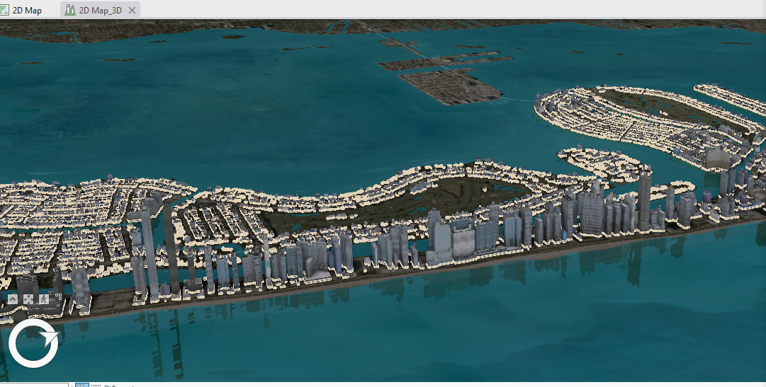
I used ArcGIS Pro to create a 3D model of Miami Beach, using three methods. these include: extruding, using attribute data to extrude, and adding 3D data layers. To extrude buildings in a 2D layer, I used the extrusion tools in ArcGIS Pro to select a height for the buildings in my layer, for example, 3 meters (approximately 10 feet). By extruding building footprints in the 2D layer, I created a 3D layer that I can then use to create a 3D model of the city.
However, since the attribute table for the buildings layer had no values for the height of the building, I joined the data from a separate table to the buildings layer and then added a multipatch layer to the map and symbolized it using an RPK file from ArcGIS Living Atlas of the World to give the building a more accurate 3D model of the city.
I added a water feature layer that gives movement to the water, as opposed to the the static image of the basemap as well as visual effects like illumination. With illumination, you can adjust a scene for time of day, shadows, and ambient light.