
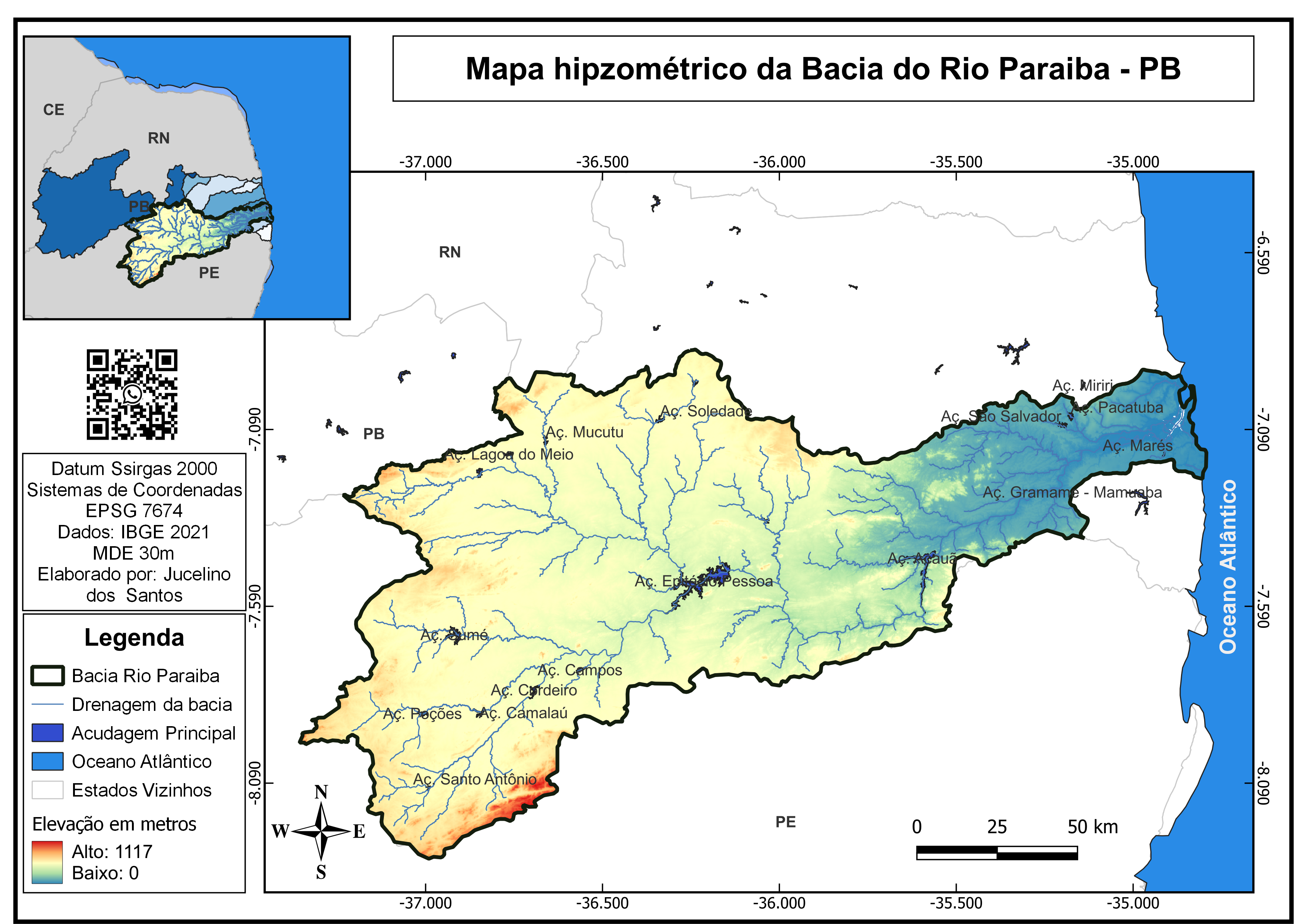
For this project, I located a DEM through the AZGeo Data Hub, made of 136 ESRI formatted GRID data sets representing elevations in meters for the state of Arizona for the year 2020. For the remainder of the project, I used ArcGIS Pro. I used the tool "Mosaic to New Raster" to combine all of the GRID data sets, then clipped the DEM to Cochise County's border. Next, I selected the color value seen on the map. Following this, I converted the DEM of Cochise County to a local scene, pivoted the terrain to a more horizontal view, changed the surface color to transparent, and unchecked show starts and halo. By doing these steps, I was able to isolate the 3D Cochise County map from the base maps. Then I edited the Ground layer to a vertical exaggeration of 6 and added a fairly transparent hillshade over the DEM. I did this to better emphasize the elevation change on the 3D model. Following this, I selected the polygon graphics option under the insert tab and went around both the bottom right and left portions of the model to further the 3D illusion. I applied a close-up image of sand as a picture fill for both of the polygon graphics I created and added a slightly transparent gradient fill as an overlay to help it match the color scheme of the map better. To create the final product, I inserted a new layout and added a map frame of both the 2D map and 3D local scene map. Then lastly, I added and edited the legend, scale bar, north arrows, and text boxes seen on the completed project.
DEM Map of Cochise County, AZ
Plug-ins used
None
tags
3d mapDEMDigital Elevation Model
You might also like


.png&w=3840&q=100)


Join the community!
We're a place where geospatial professionals showcase their works and discover opportunities.