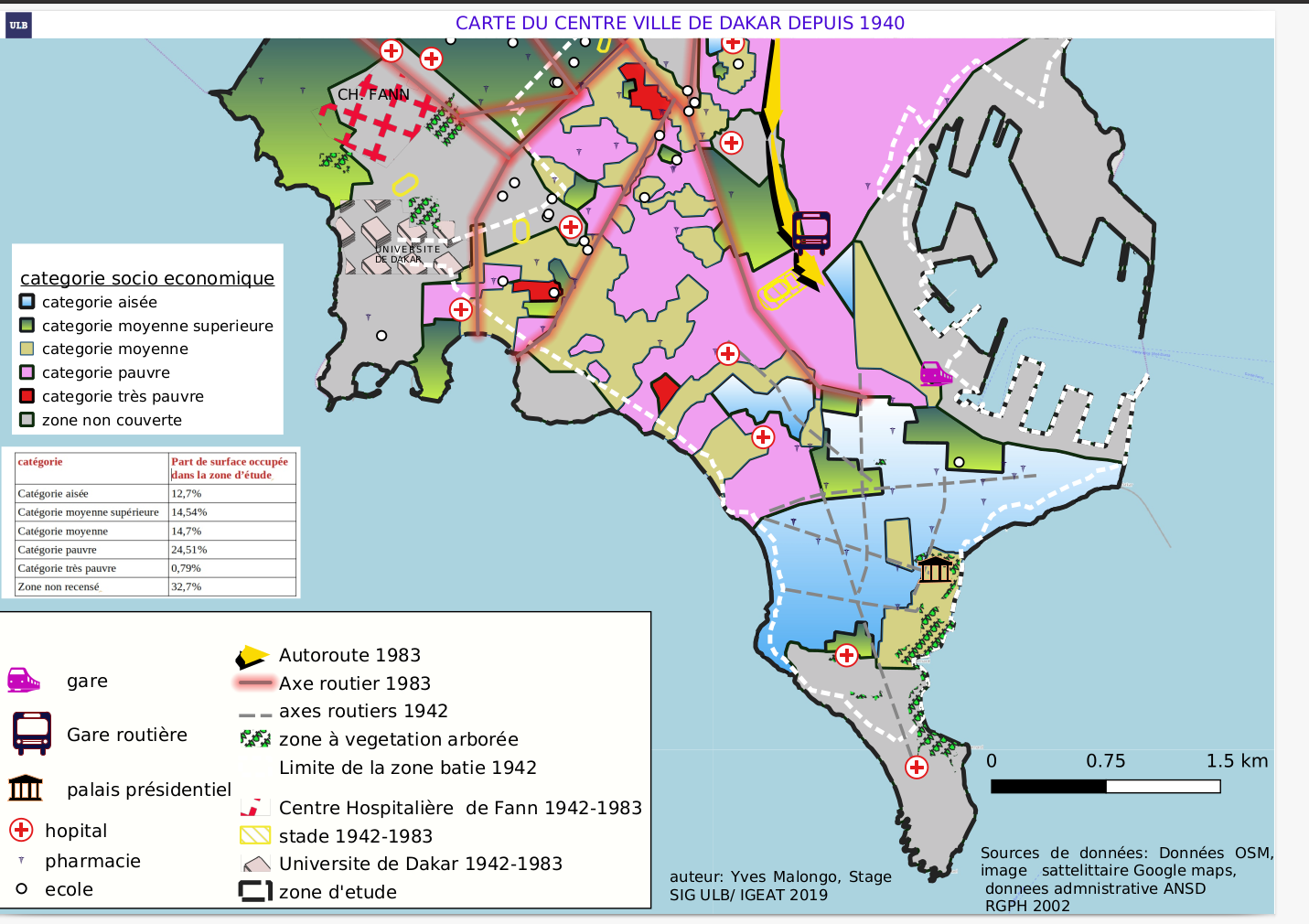
Evolution spatio-temporelle de la ville de dakar depuis 1983, 1945 à 2020

Tools used
GDALQGIS
Plug-ins used
GRASS GIS
tags
QGIS
More by IVES MALONGO KOKINAMBILI

You might also like


Join the community!
We're a place where geospatial professionals showcase their works and discover opportunities.