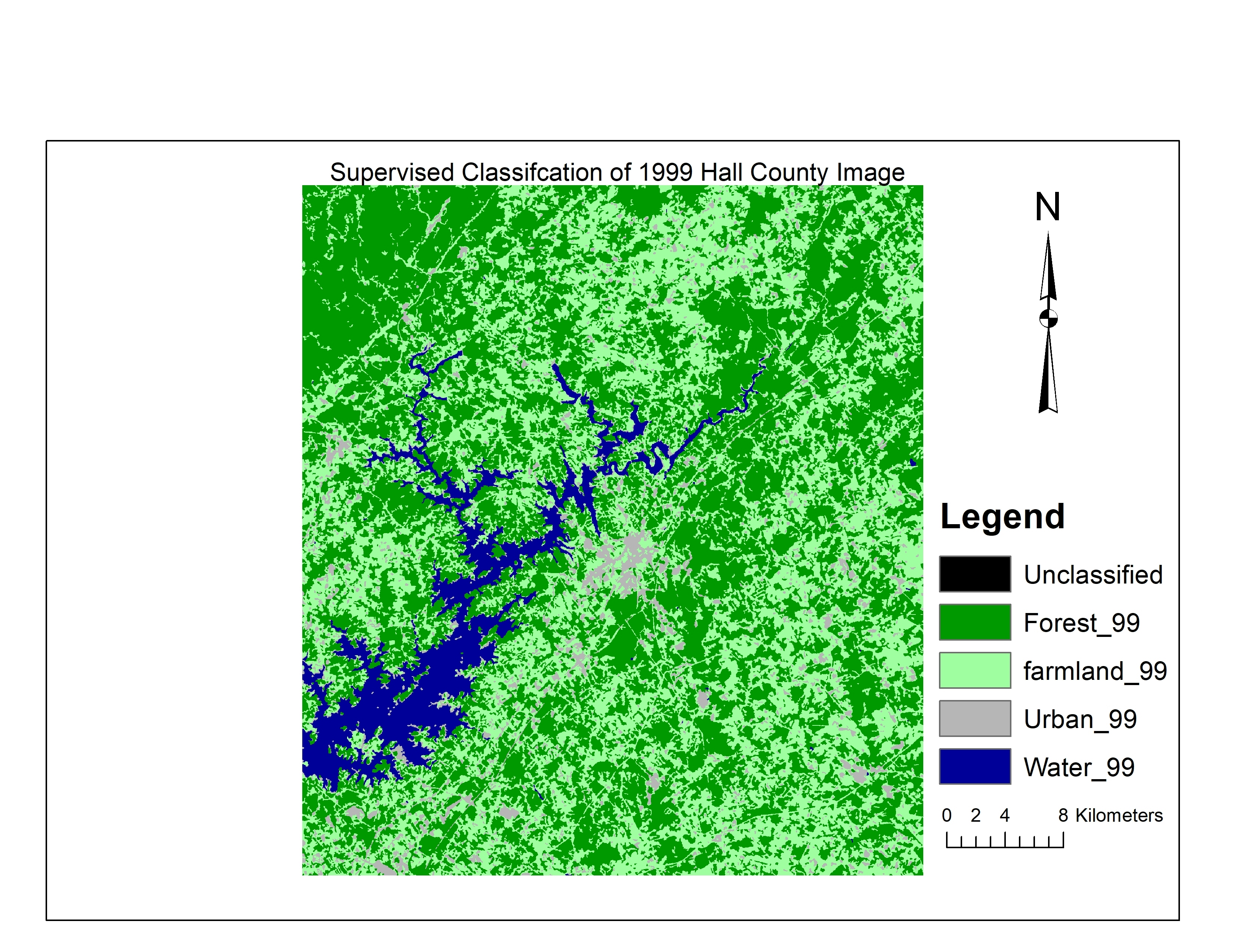
False Colour Composite of Urban Sprawl


tags
ENVIUrban Area
More by Christina Nedo


You might also like


Join the community!
We're a place where geospatial professionals showcase their works and discover opportunities.
False Colour Composite of Urban Sprawl
More by Christina Nedo
You might also like
We're a place where geospatial professionals showcase their works and discover opportunities.