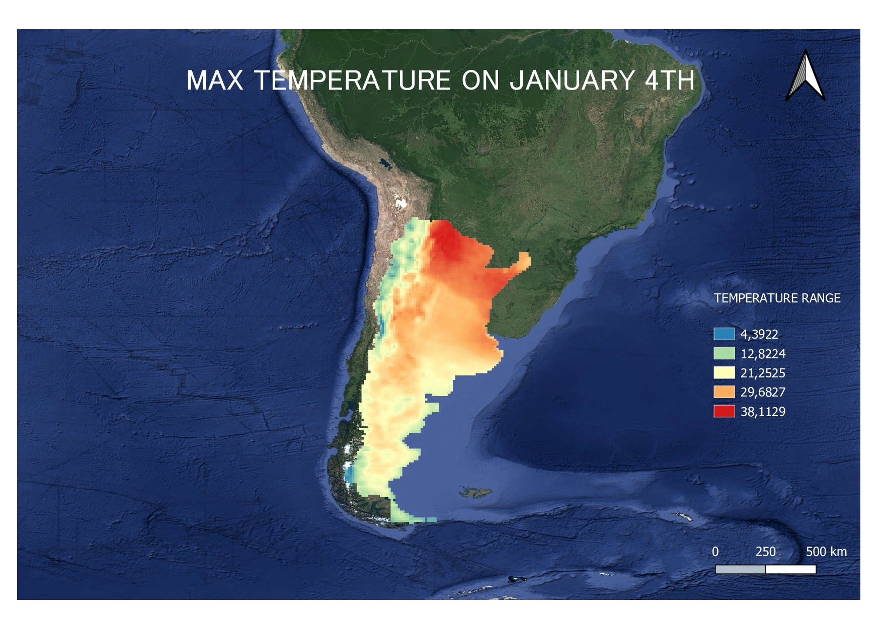
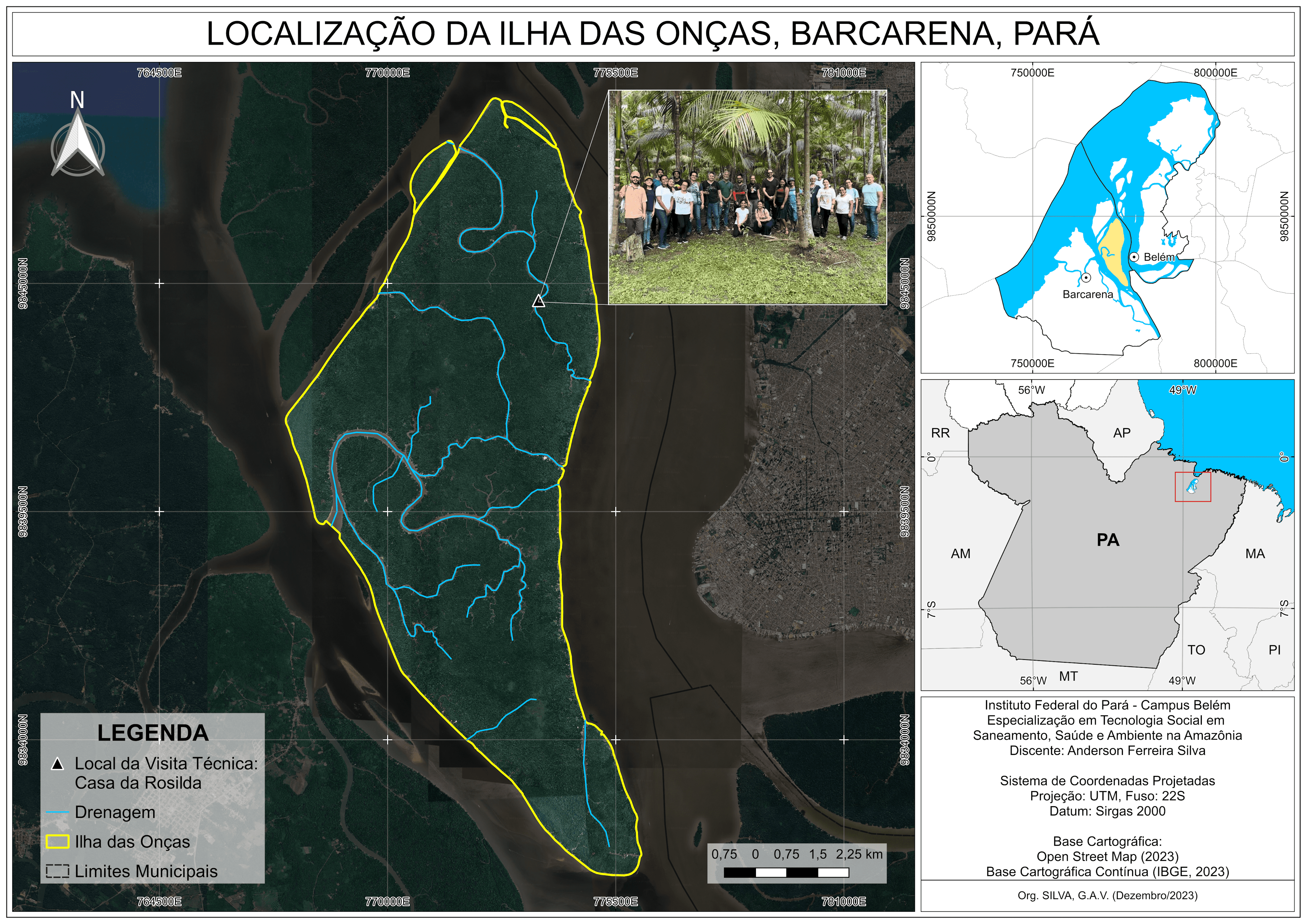
Watershed and Stream Network in Hamilton


tags
Hydrological modellingPythonRaster AnalysisSpatial Analysis
More by Christina Nedo


You might also like


Join the community!
We're a place where geospatial professionals showcase their works and discover opportunities.