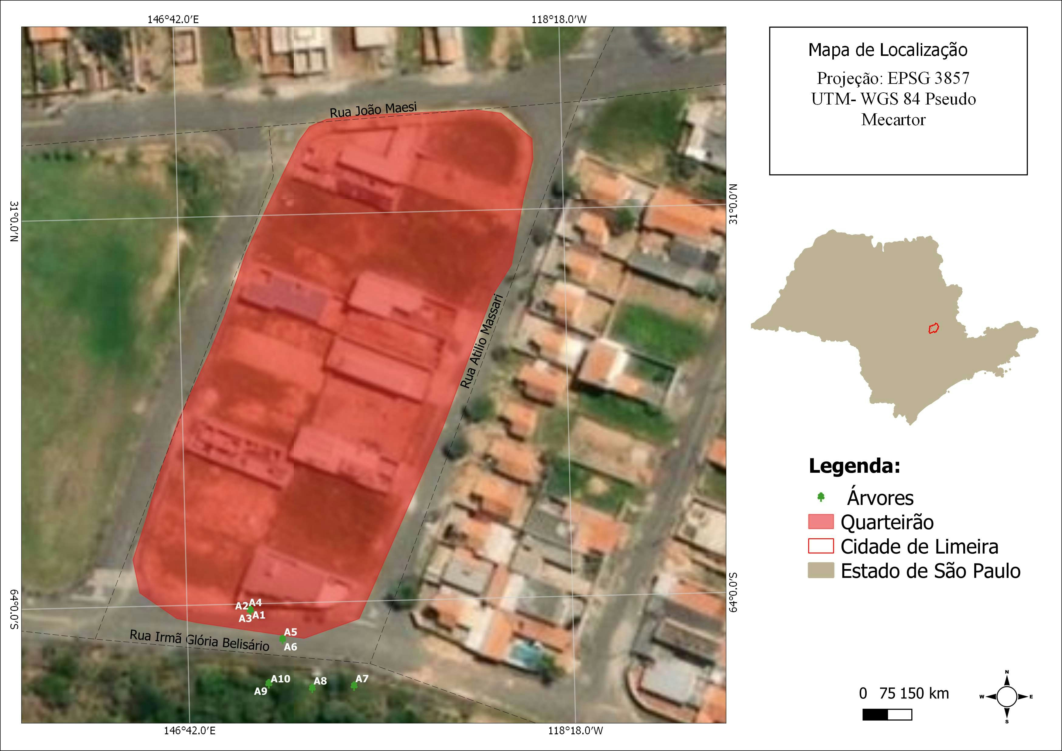
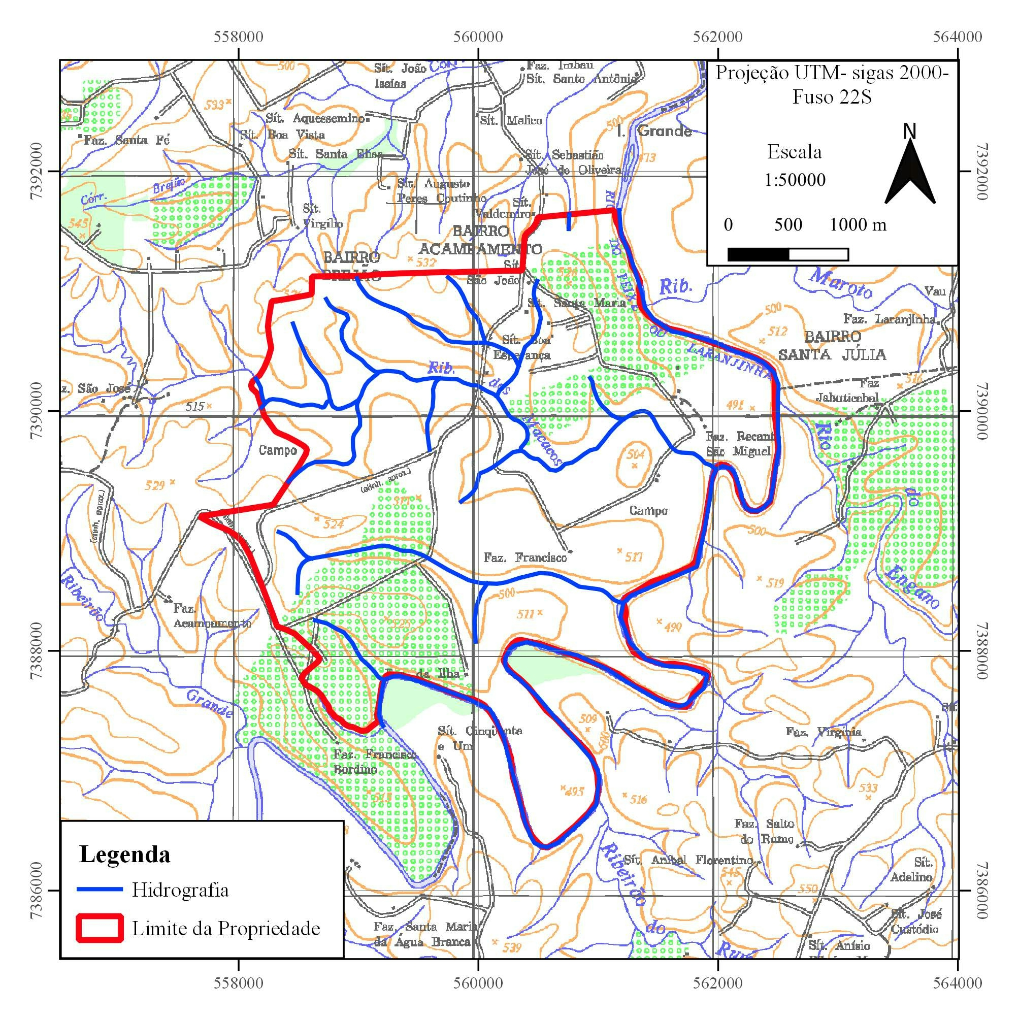
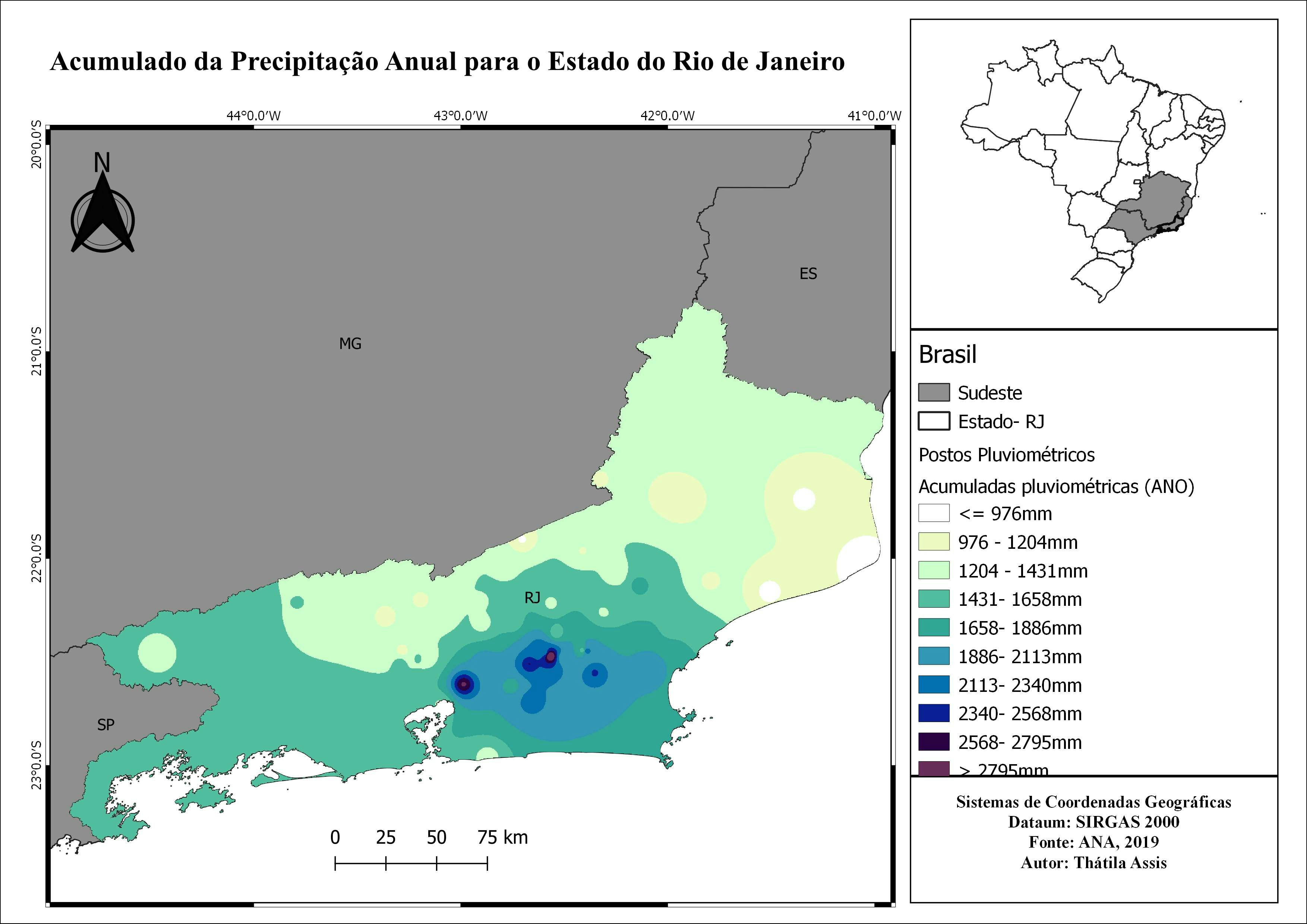
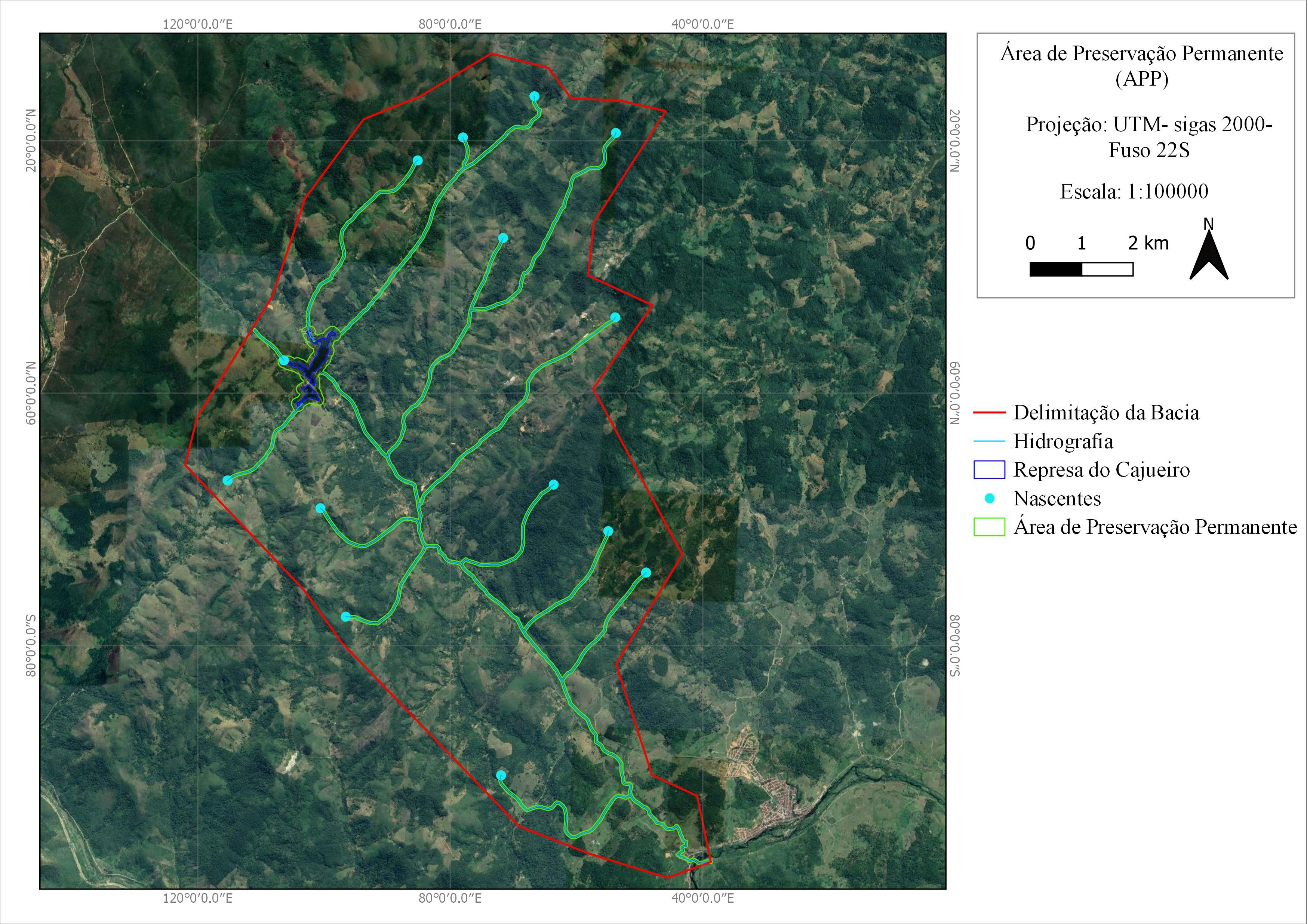
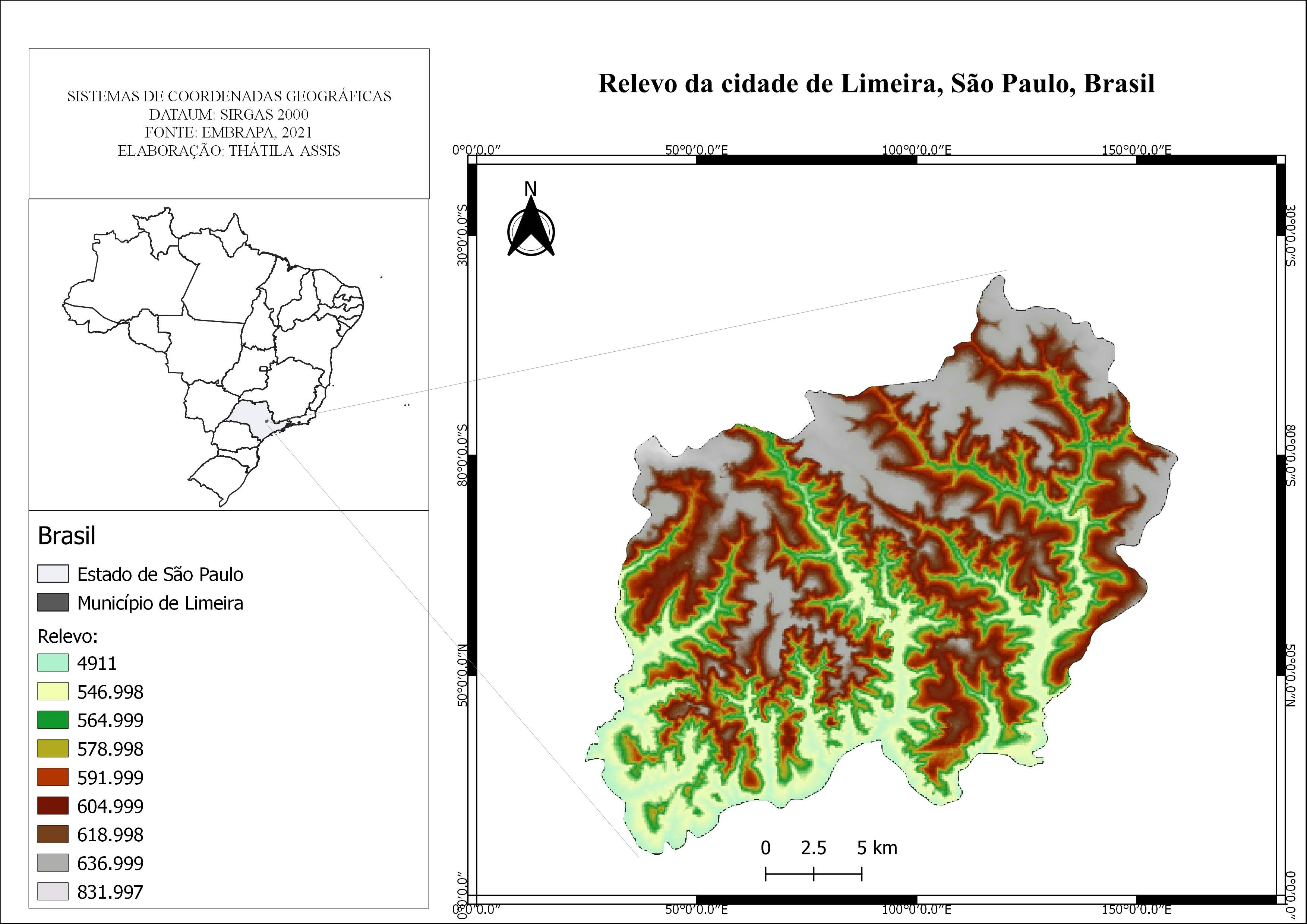
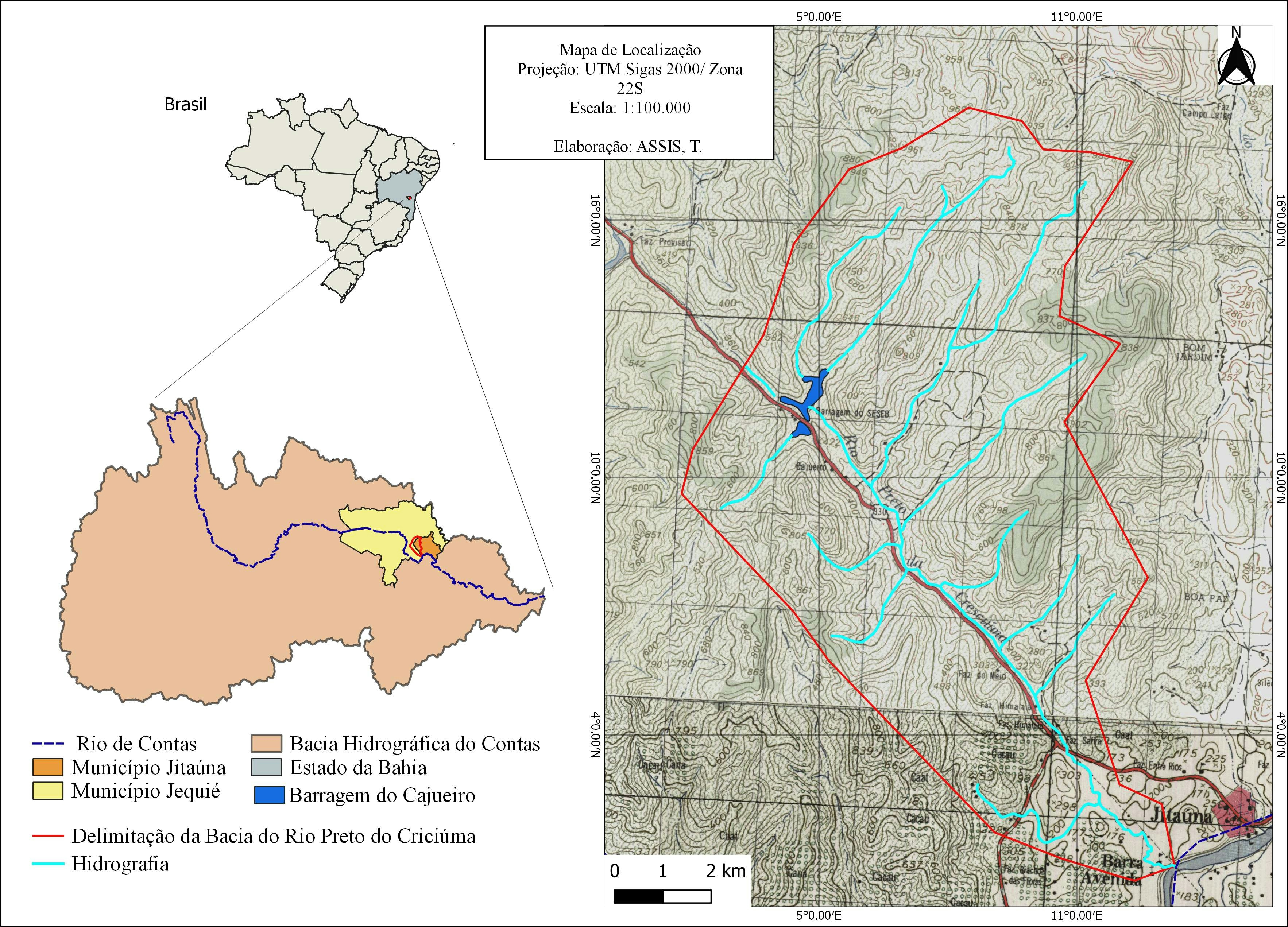
Sign up or log in to your Spatialnode account.

Takes less than a few seconds.

Mapa de Localização

Thátila de Jesus Assis
Thátila de Jesus Assis•

January 28, 2022

Mapa de Localização

Tools used

QGIS

Plug-ins used

QGIS

tags

QGIS

More by Thátila de Jesus Assis

Mapa de Área de Preservação Permanente
38
Mapa de Elevação
Mapa de Elevação
8
Mapa de Área de Preservação Permanente
8
Mapa de Precipitação
26
Mapa de Localização em carta
5
Mapa de Relevo
Mapa de Relevo
10
Mapa de Localização
Mapa de Localização
3
Mapa de Hierarquia fluvial
8
Mapa de Análise Espaço-temporal
21

You might also like

Hypsometric map of Curitiba, Brazil
ANGELO RAFAEL ANDRADE
Hypsometric map of Curitiba, Brazil
ANGELO RAFAEL ANDRADE
343
Mapping Wetland and Swampy Topography
Desmond Twum
Mapping Wetland and Swampy Topography
Desmond Twum
7
Active fire in the last 7 days
Balogun Temitope
Active fire in the last 7 days
Balogun Temitope
340
Tree Hight Inspector Application
Moez Labiadh
Tree Hight Inspector Application
Moez Labiadh
14
Data driven web application
Bertrand Lobo
Data driven web application
Bertrand Lobo
113
exercise 4
DrewOlenick
exercise 4
DrewOlenick
10
Non-native Unempl and Greenspace|Python
Nipun Kalra
Non-native Unempl and Greenspace|Python
Nipun KalraPro
24
Digital Elevation Model of Oyo State.
Olawuyi Abolade Pelumi
Digital Elevation Model of Oyo State.
Olawuyi Abolade Pelumi
32
Lithium potential & properties-MG-Brazil
Miriela Ulloa Santana
Lithium potential & properties-MG-Brazil
Miriela Ulloa Santana
64
3D Forested Ski Resort
Ryan Shields
3D Forested Ski Resort
Ryan Shields
23
Shaded relief map of Trinity River
Balogun Temitope
Shaded relief map of Trinity River
Balogun Temitope
541
Change Detection of Shrinking Lakes
Miranda Teats
Change Detection of Shrinking Lakes
Miranda Teats
13

Join the community!

We're a place where geospatial professionals showcase their works and discover opportunities.

Sign Up for free