Sign up or log in to your Spatialnode account.

Takes less than a few seconds.

Relative elevation model of NzoiaRiver

Atieno Owino
Atieno Owino•

November 28, 2022

Relative elevation model of NzoiaRiver

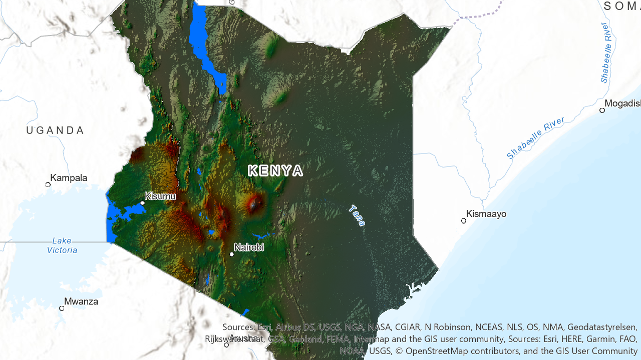
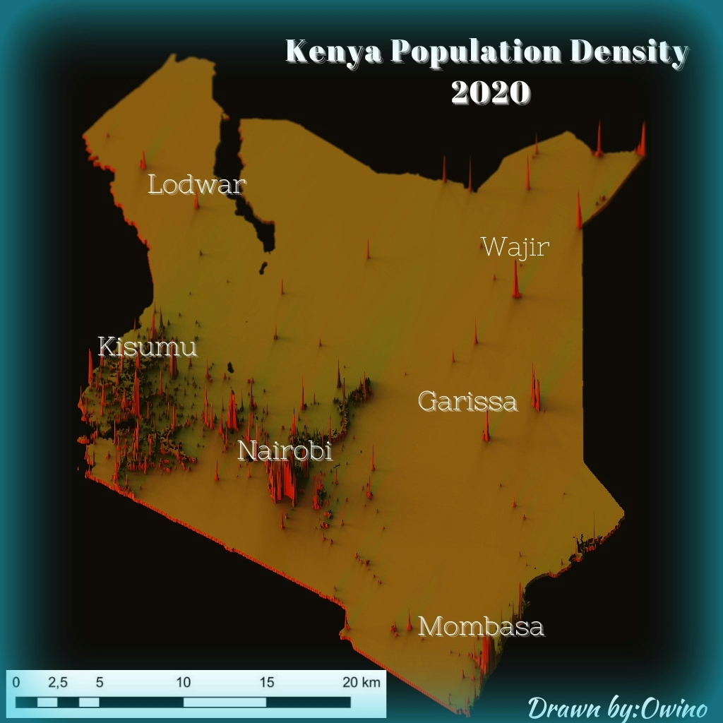
Digital elevation model data

USGS Lidar Explorer data
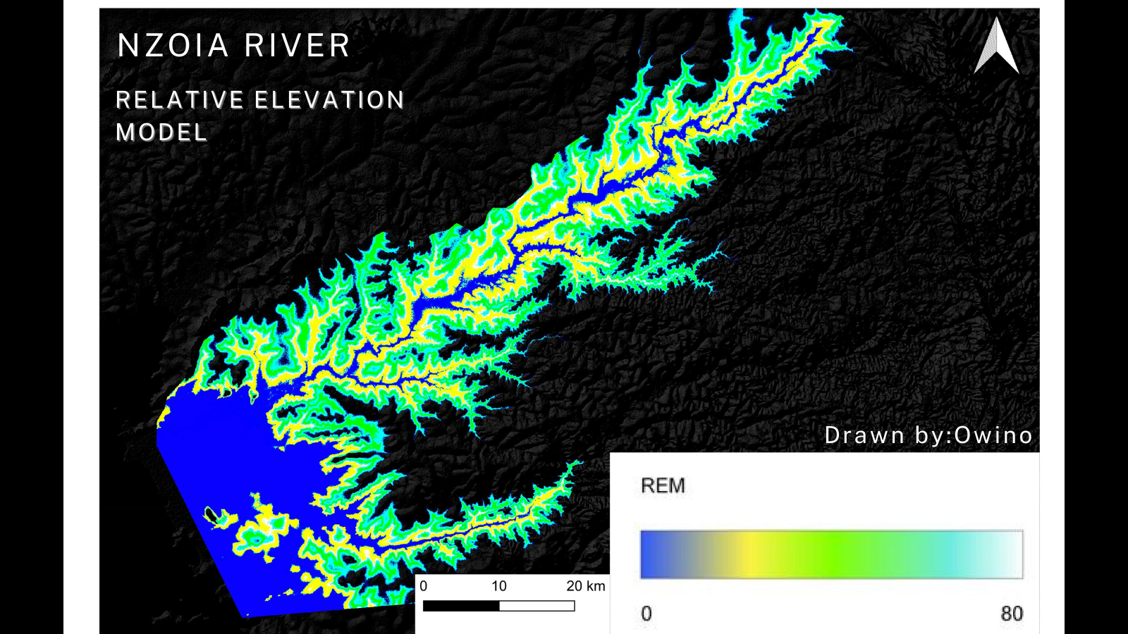

Tools used

IDW QGISUSGS Lidar Explorer

Plug-ins used

point sampling toolQchainage

tags

Digital Elevation ModelriverSpatial Modelling

More by Atieno Owino

Kenya Shaded Relief Map
50
Kenya Population Density 2020
68
Africa Fabric map
Africa Fabric map
127
3D Population Density
114
Nzoia River Relative Elevation Model
75
Child Marriage Cases
40

You might also like

Modelo Digital de Elevação - Alto Iguaçu
DOUGLAS HENRIQUE MANOEL PEREIRA
Modelo Digital de Elevação - Alto Iguaçu
DOUGLAS HENRIQUE...
18
Kilauea Summit Elevation
Marica di Girolamo
Kilauea Summit Elevation
Marica di Girolamo
26
GEOSPATIAL ANALYSIS OF ZOMATO
Durojaye Olusegun
GEOSPATIAL ANALYSIS OF ZOMATO
Durojaye Olusegun
209
2024 LULC, South-South Zone of Nigeria
Paul Ugbong
2024 LULC, South-South Zone of Nigeria
Paul Ugbong
9
Economic Growth or Decline from Imagery
Garett Donohew
Economic Growth or Decline from Imagery
Garett Donohew
12
Traverses of Geophysical Survey, Unilag
Emeka Ude
Traverses of Geophysical Survey, Unilag
Emeka Ude
10
Paradise Valley 5k, 10k
Jamaica De Luna
Paradise Valley 5k, 10k
Jamaica De LunaPro
20
Continuous Voter Registration Centers
Ismail Olayinka Olajide
Continuous Voter Registration Centers
Ismail Olayinka Olajide
16
Índice de Vegetação - NDVI
Carlos Joubert Sousa da Rocha
Índice de Vegetação - NDVI
Carlos Joubert...
198
Correlation between LST and NDVI
Ojo Aladesola Monica
Correlation between LST and NDVI
Ojo Aladesola Monica
51
ALFABETIZAÇÃO CARTOGRÁFICA - 6º ANO
Itamar Sateles de Sá
ALFABETIZAÇÃO CARTOGRÁFICA - 6º ANO
Itamar Sateles...
36
Projeto - Análise Espacial [2/2]
Matheus Ferreira Nunes Gresler
Projeto - Análise Espacial [2/2]
Matheus Ferreira...
20

Join the community!

We're a place where geospatial professionals showcase their works and discover opportunities.

Sign Up for free