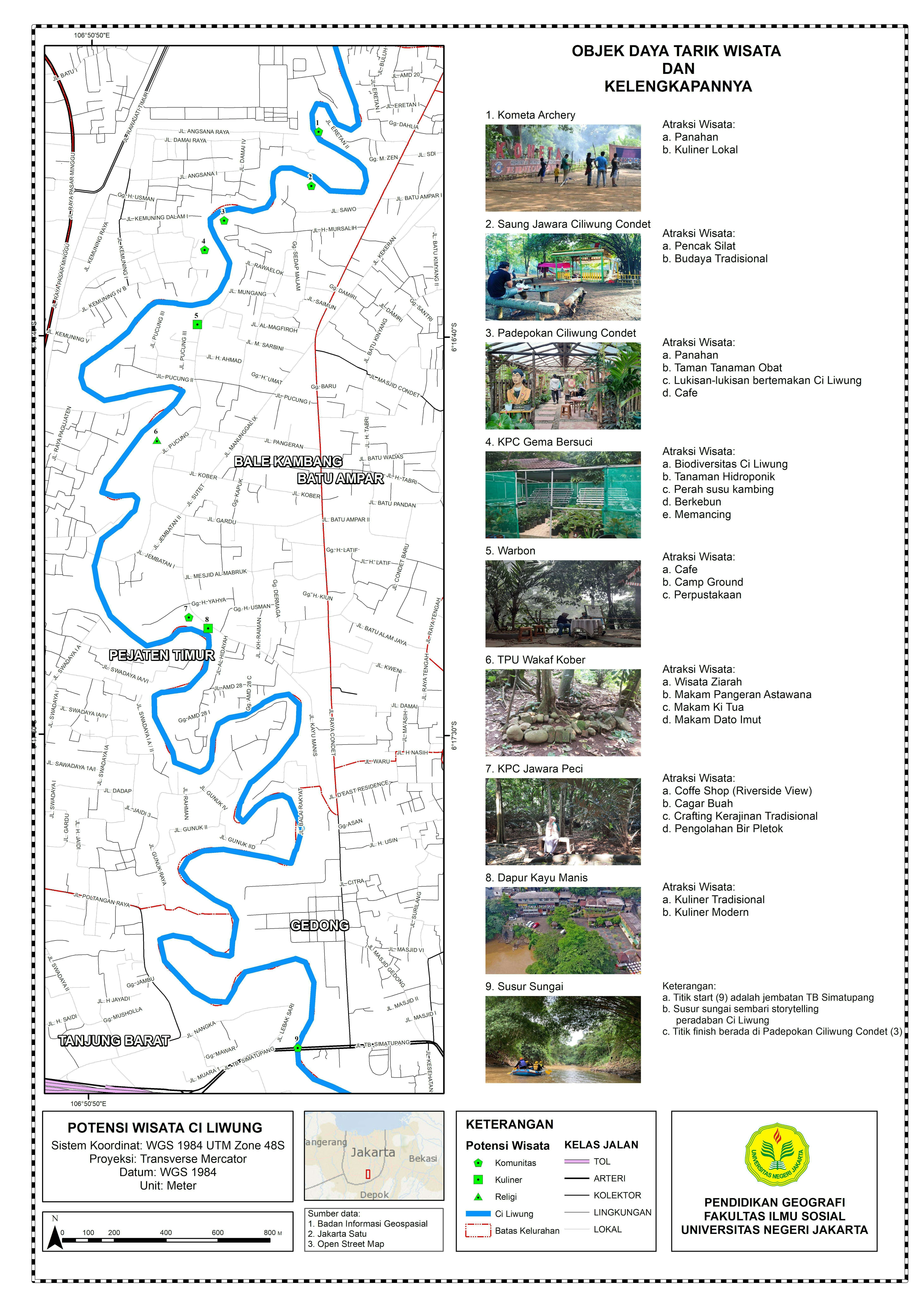
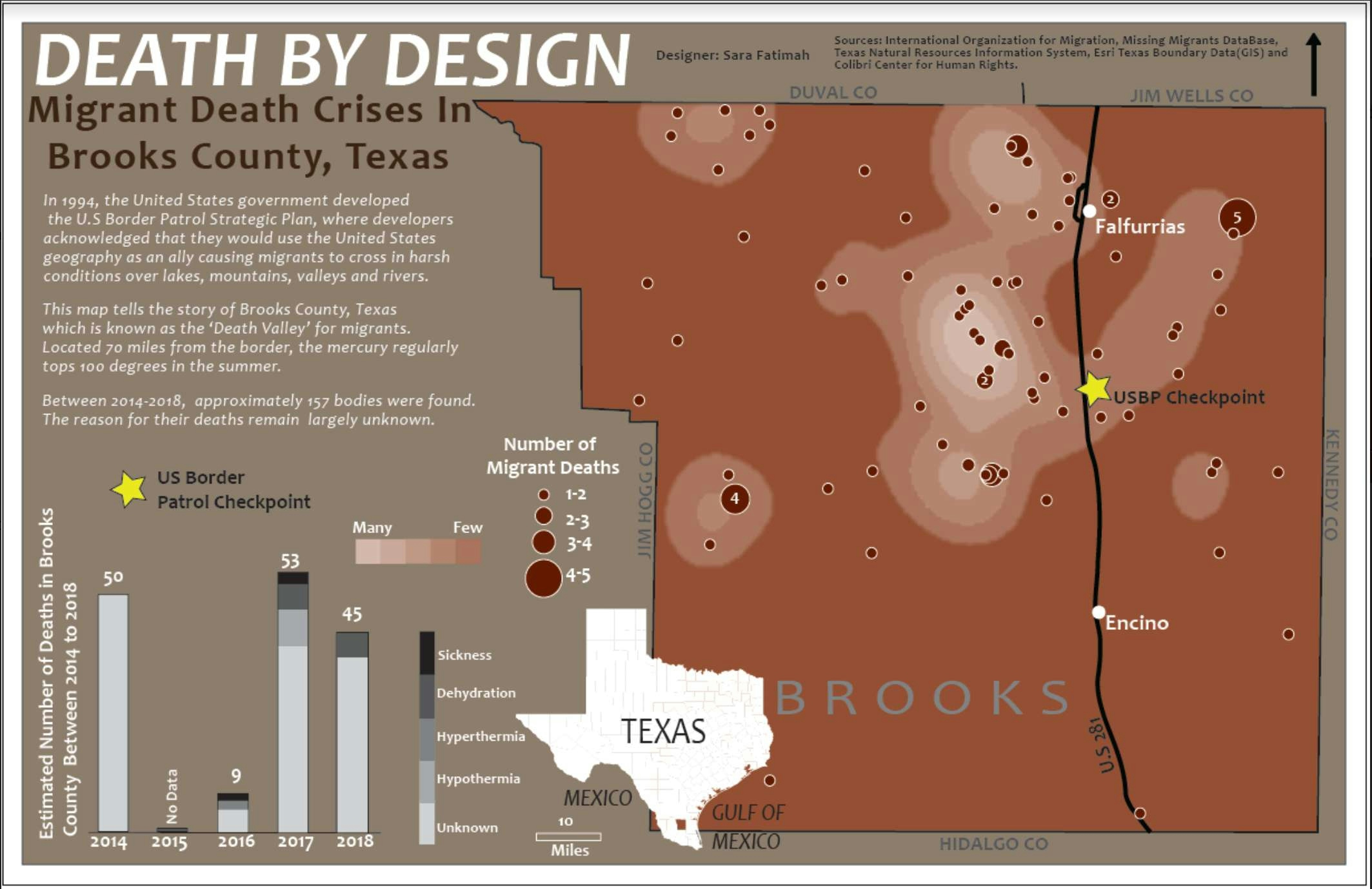
Tourist Attractions Map

Tools used
ArcMap
Plug-ins used
ArcMapOpenStreetMap
tags
GISTourismTourist Attraction
More by Adhira Riza Muqtadir


You might also like


Join the community!
We're a place where geospatial professionals showcase their works and discover opportunities.