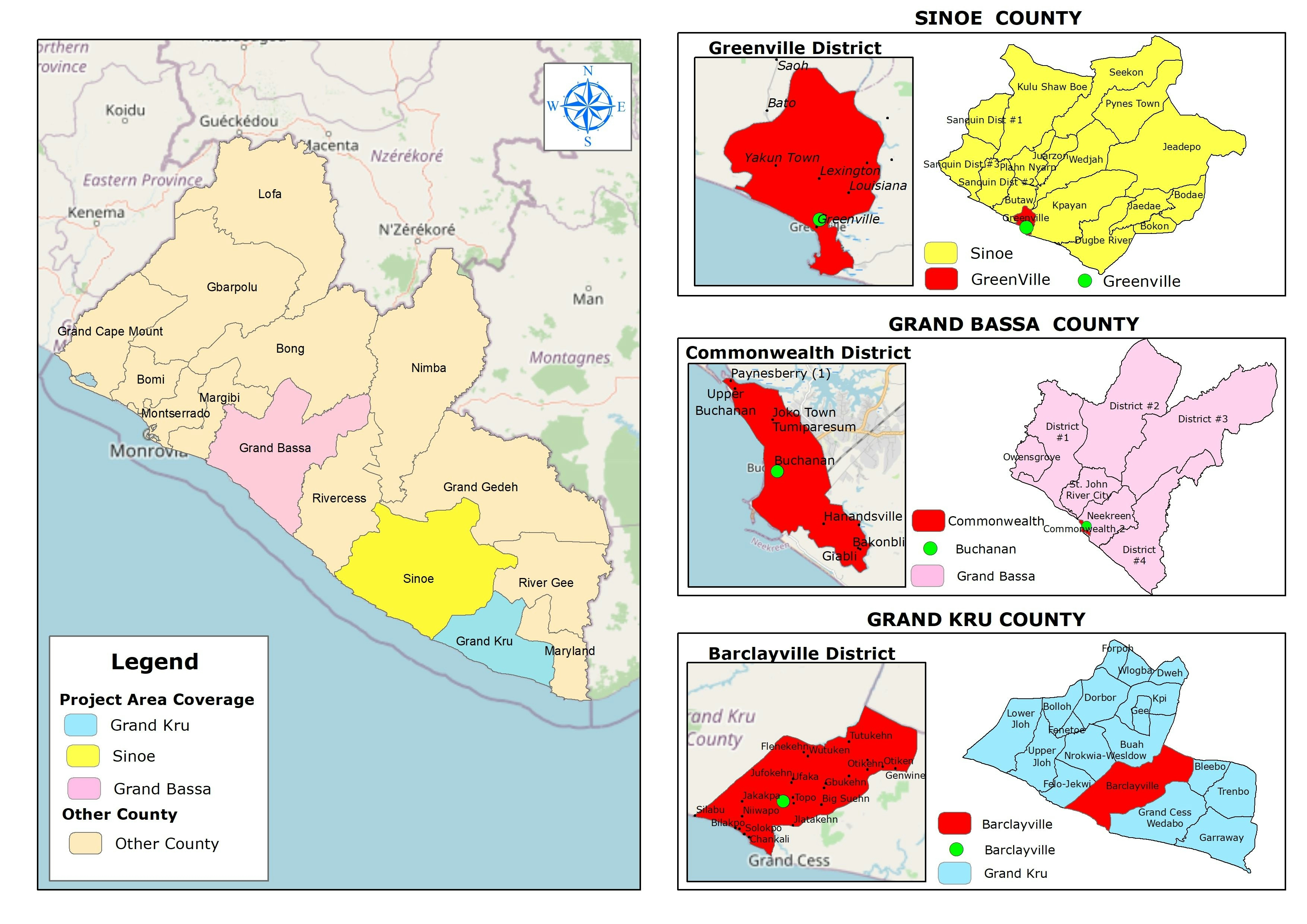
This is a compilation of all map layouts I ever created for various thematical use during 2019 to 2020 when I was a college student in Geodetic Engineering of Universitas Gadjah Mada.
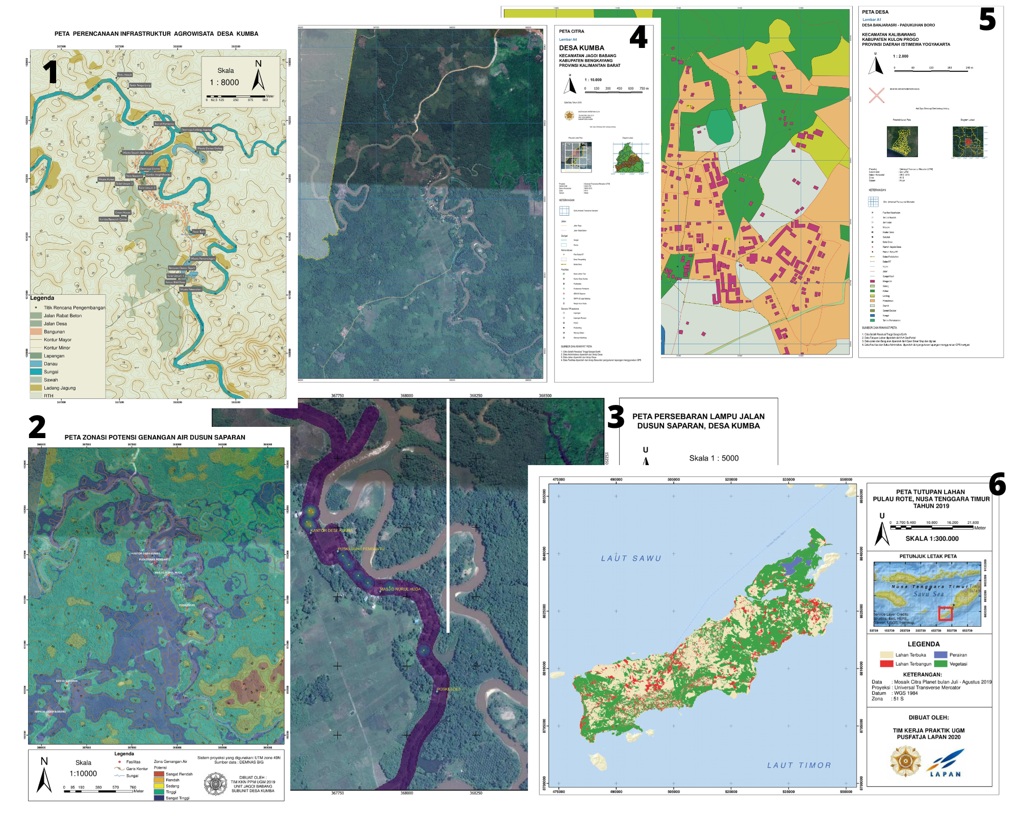
- Peta Perencanaan Infrastruktur Agrowisata Desa Kumba (Map of Agrotourism's Infrastructure Planning at Kumba Village); this map was the main product of Agrotourism Master Plan (which were a multidicipline project during my time in community service program (KKN)) at Desa Kumba. The map shows natural land cover around the village overlayed with topographic features (countour line) and pinpoints of designed agrotourism locations around the village.
- Peta Zonasi Potensi Genangan Air Dusun Saparan (Map of Flood Risk Zone Potential at Saparan Neighbourhood); Saparan is the main neighbourhood at Kumba Village which frequently being flooded every year during rainy season caused by the flooding of Saparan River. Demnas (Indonesian's DEM with high accuracy at 5 meters) was the main data processed using hydrological analysis for creating the flood risk zone in the neighbourhood, which showed most of it were in high risk of flood.
- Peta Persebaran Lampu Jalan Dusun Saparan (Map of Streetlight Distribution at Saparan Neighbourhood); Saparan is one of the most remote villages in Indonesia's country borderline with poor road access and street lighting making it hard for the villagers of having adequate lighting during the night. I collected all the pinpoints of existing streetlights around the village using GPS handheld and interpolated it using Kernel Density method to generate heatmap of streetlight.
- Peta Citra Desa Kumba (Map of Satellite Imagery at Kumba Village); Kumba as one of the most remote village in Indonesia need a proper overlook of the whole village within their administrative boundary, which can be fulfilled with adequate of geospatial information infrastructure availability such as map. This satellite imagery map was created with high layout standarization referring to Indonesian's National Qualification Framework for Geospatial Information (SKKNI BIG) using Google Satellite Imagery as the base map, thus this map could be an important assets for the village governor.
- Peta Desa Banjarasri (Land Cover Map of Banjarasri Village); This map was a paid project for a local villager in Yogyakarta who need a proper map to show the land cover around the neighbourhood of Boro. The map was layouted using standard of National Geospatial Information Agency for a legal purpose.
- Peta Tutupan Lahan Pulau Rote, NTT tahun 2019 (Land Cover Map of Rote Island, East Nusa Tenggara 2019); I created this map for my apprenticeship project in Indonesian National Institute of Aeronanutics and Space (LAPAN) using satellite image from Planetscope (high resolution in 3 meters). This project aim to identify climate land drought in the last 20 years on Rote Island, starting from 1999 to 2009 compared to the current year (2019).


_2067263.png&w=3840&q=100)