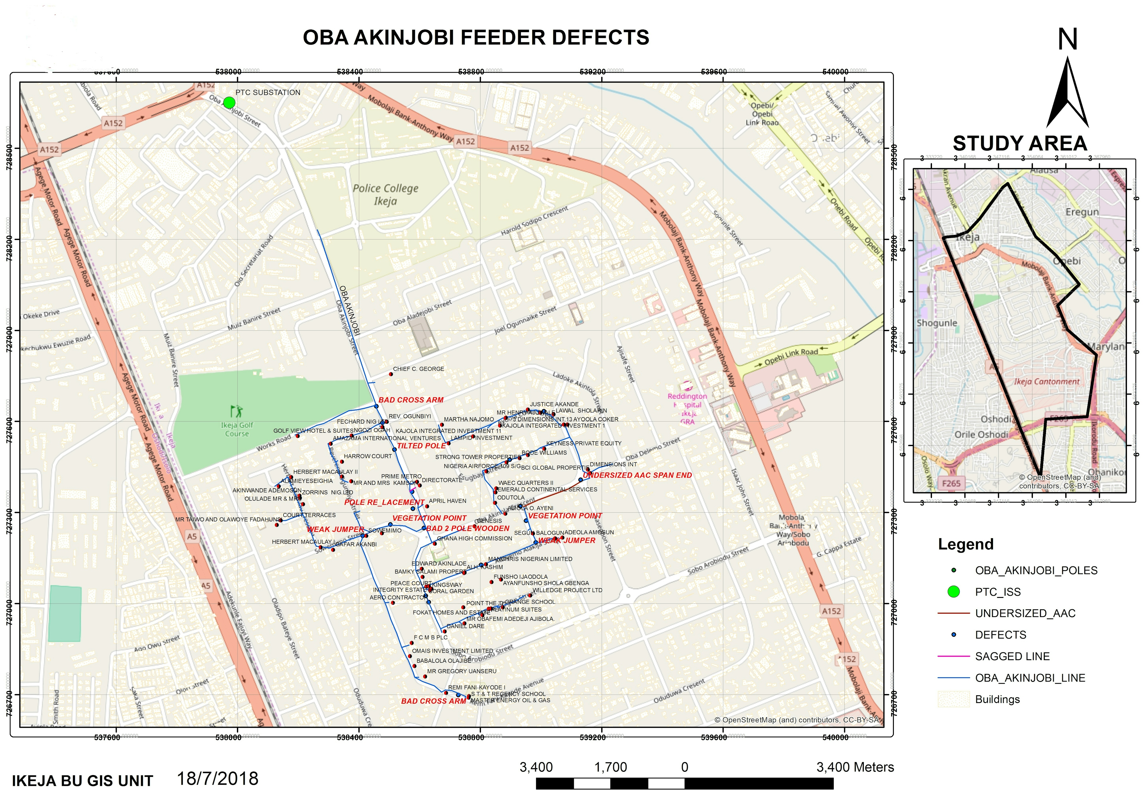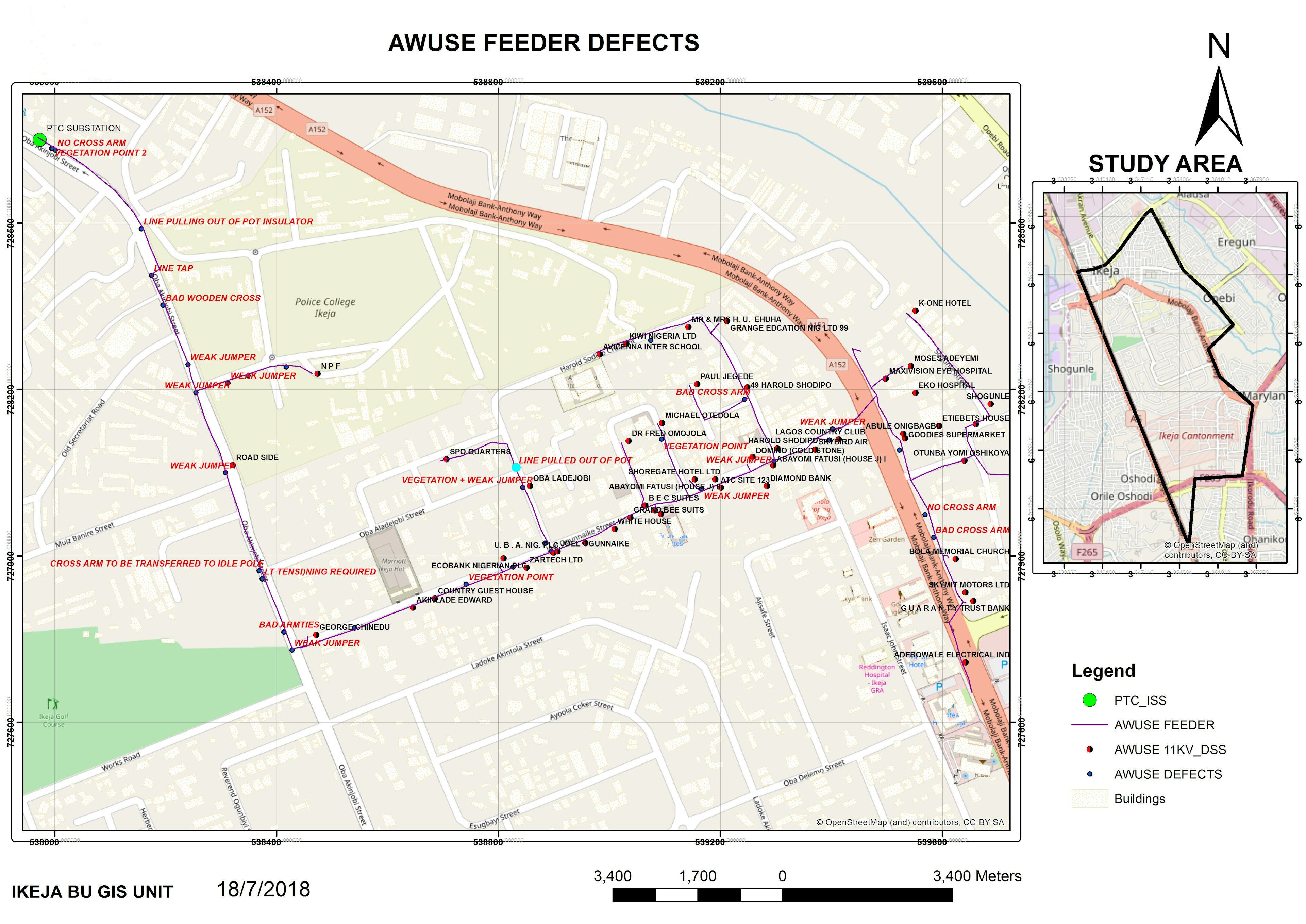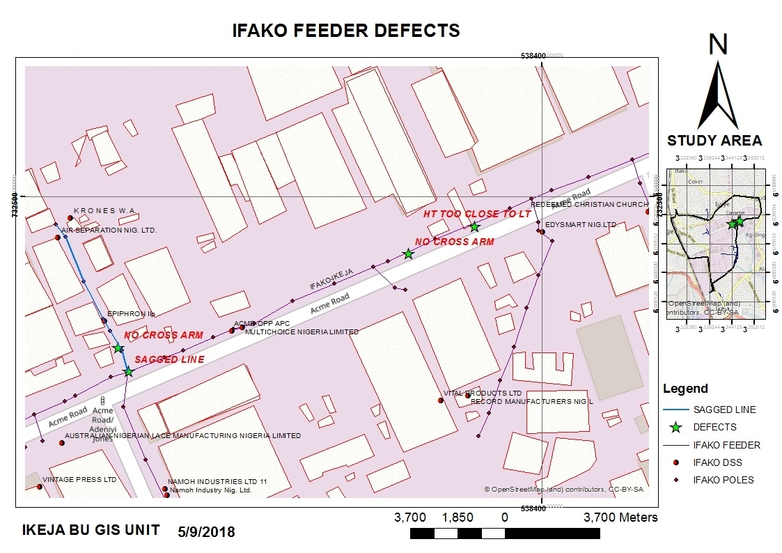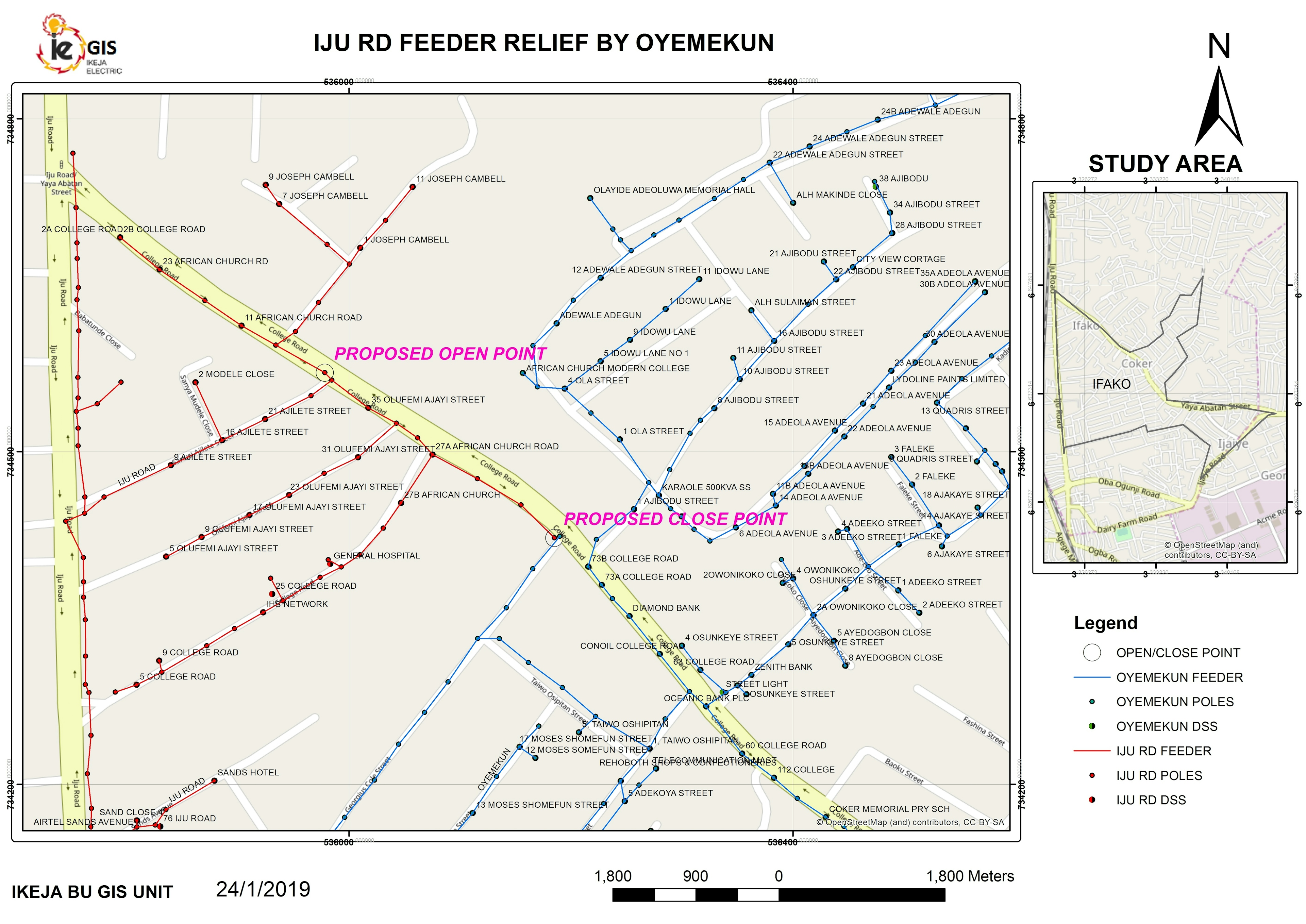
This was a project I embarked on as part of my contribution to the company core values of ensuring exceptional service delivery. To solve a long standing problem at Ikeja Electric Plc, I proffered a sustainable technology-based solution using available GIS-based tools and technology. The existing customer database had a lot of issues such as wrong tariff classifications, incorrect customer-to-feeder alignments, incomplete customer records such as regards correct addresses, phone numbers, etc. Enumerated below were major challenges I intended to tackle:
1) mapping customers correctly to appropriate distribution transformers to ensure proper billing of customers
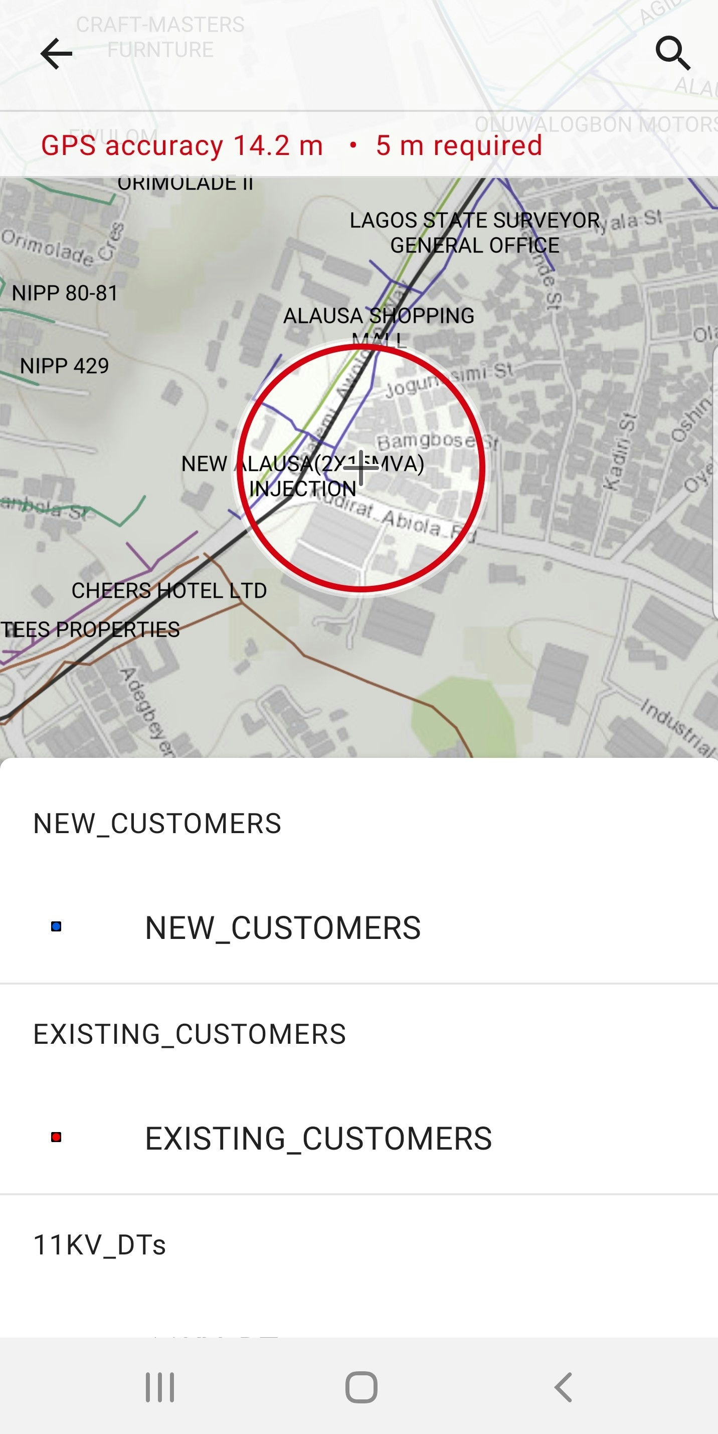
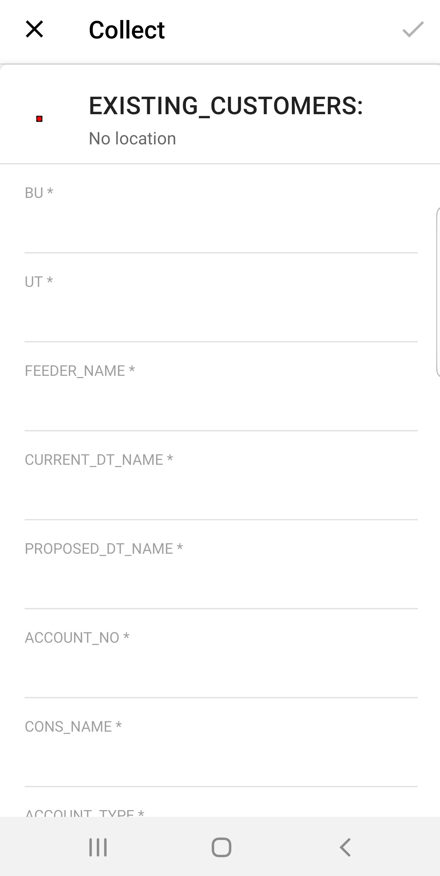
2) knowing the exact location (coordinates) of all new and existing customers
3) having an accurate database that comprises of newly added customers (with all their details correctly captured) and up-to-date existing customer records
4) eliminating paper-based data gathering method
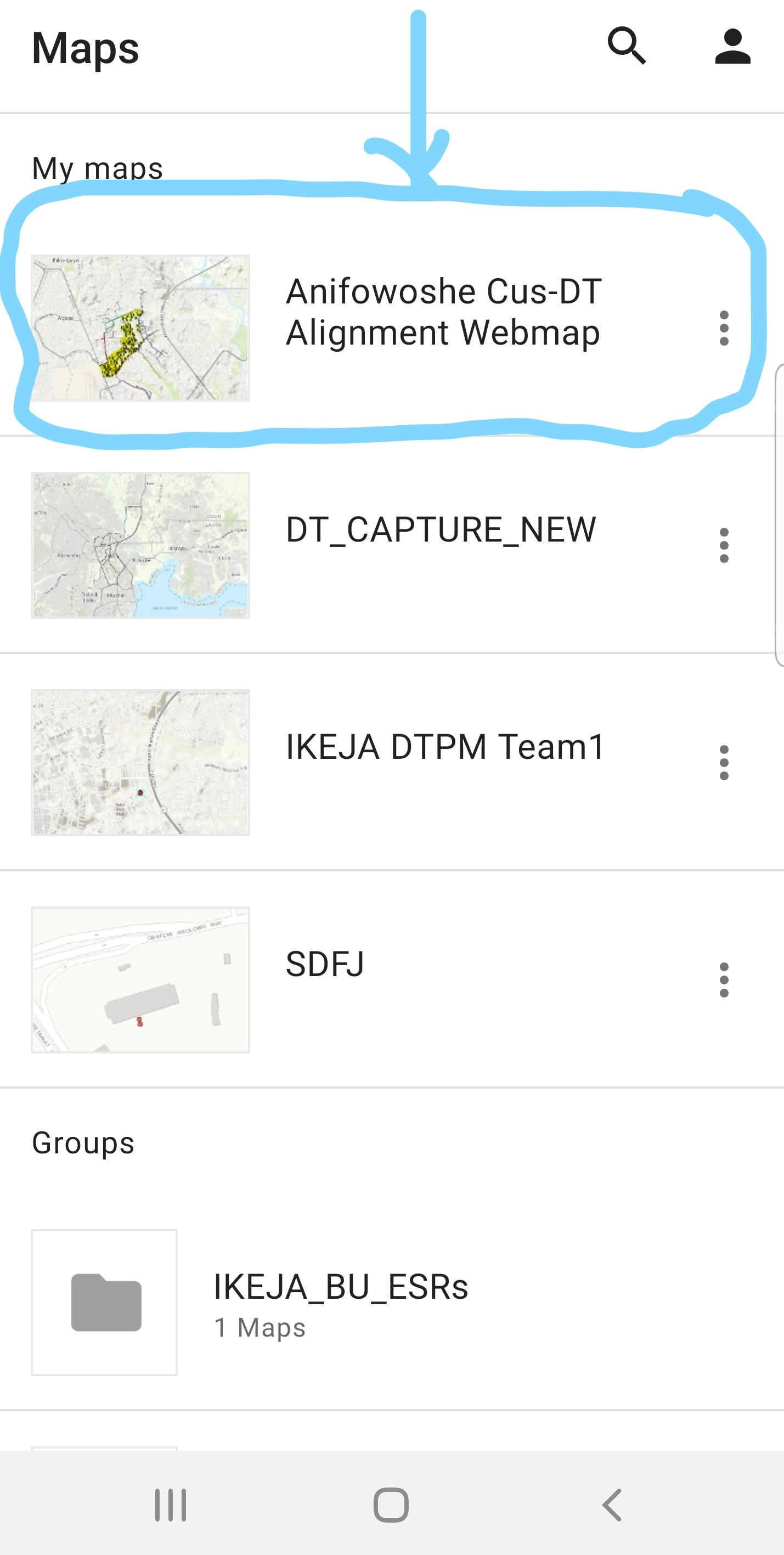
I employed a combination of several GIS methods using tools like ArcMap, ArcGIS online, ArcGIS Collector to come up with the solution in an AGILE environment where feedback from involved stakeholders were duly incorporated into this solution. The stakeholders/professionals exhibited high level of commitment and discipline during and after the app development to adopt a company-compliant standardized template, which was eventually implemented.
Having done a thorough job studying the existing database, I customized the app, incorporated data validation methods and implemented it using the afore-mentioned tools.
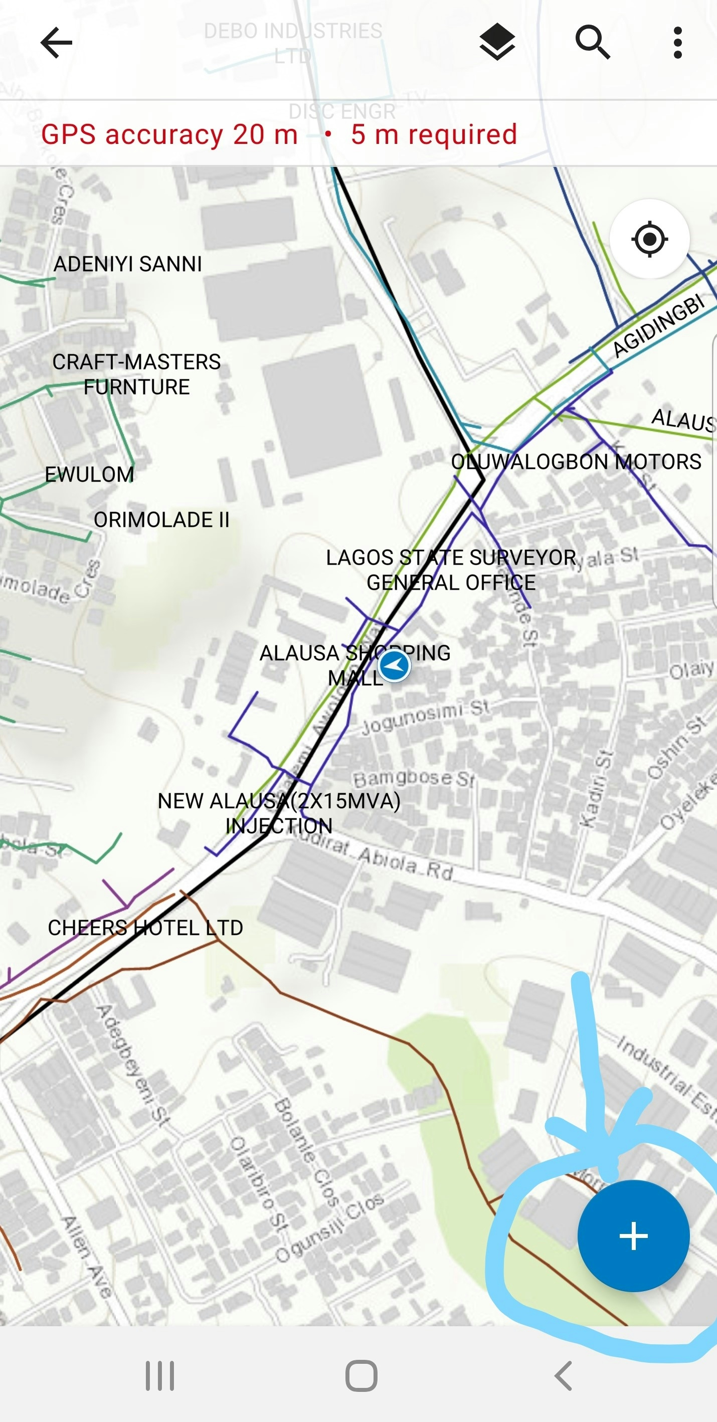
I trained the front-end users which happen to be the Energy Sales Representatives located in the 8 offices located within my business unit on the use of the Collector app. Thereafter, it was tested and later fully deployed after little adjustments were made based on their feedback. I would monitor their activities at the backend and provide support where necessary.
Subsequently, collected field data was compiled via the backend, analyzed and shared in different formats with necessary stakeholders to update billing records.
This ensured the elimination of the existing error-prone and time-wasting manual process of updating customer records.
The result of this GIS-based solution was evident within a month of deployment. The business unit achieved reduction in company Aggregate Technical Commercial & Collection losses by 5%.
Another side benefit derived from the deployment of the app is that, it helped to track the field officers in the following ways:
1) higher efficiency: they were on their toes as the number and quality of daily data submissions from each of them was higher than before the app deployment
2) whether they actually pay visit to the customers location before submission can be determined using the embedded coordinate feature of the app. The time of submission or editing of records is also known.
3) In addition, their assigned individual login credentials gives room for datanon-repudiation.
This innovative solution of mine earned me the CEO Best Technical Staff Member award for year 2020.