
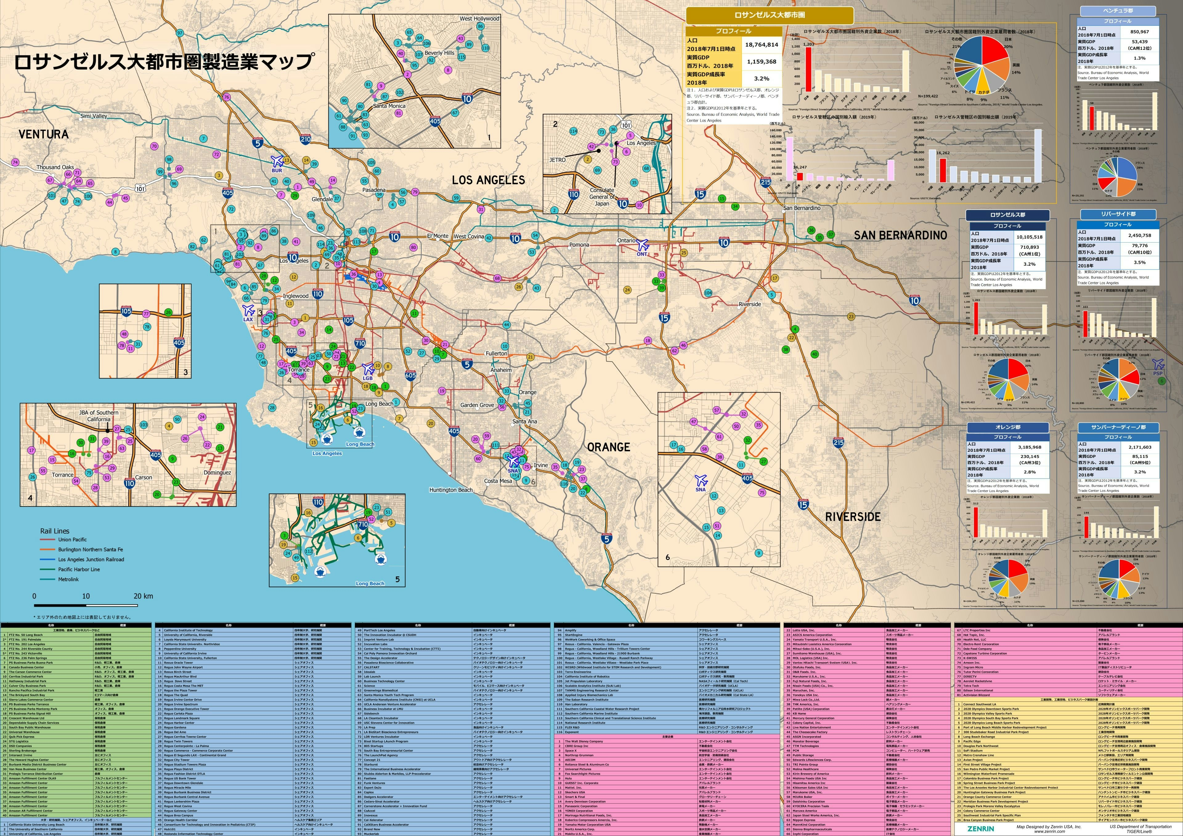
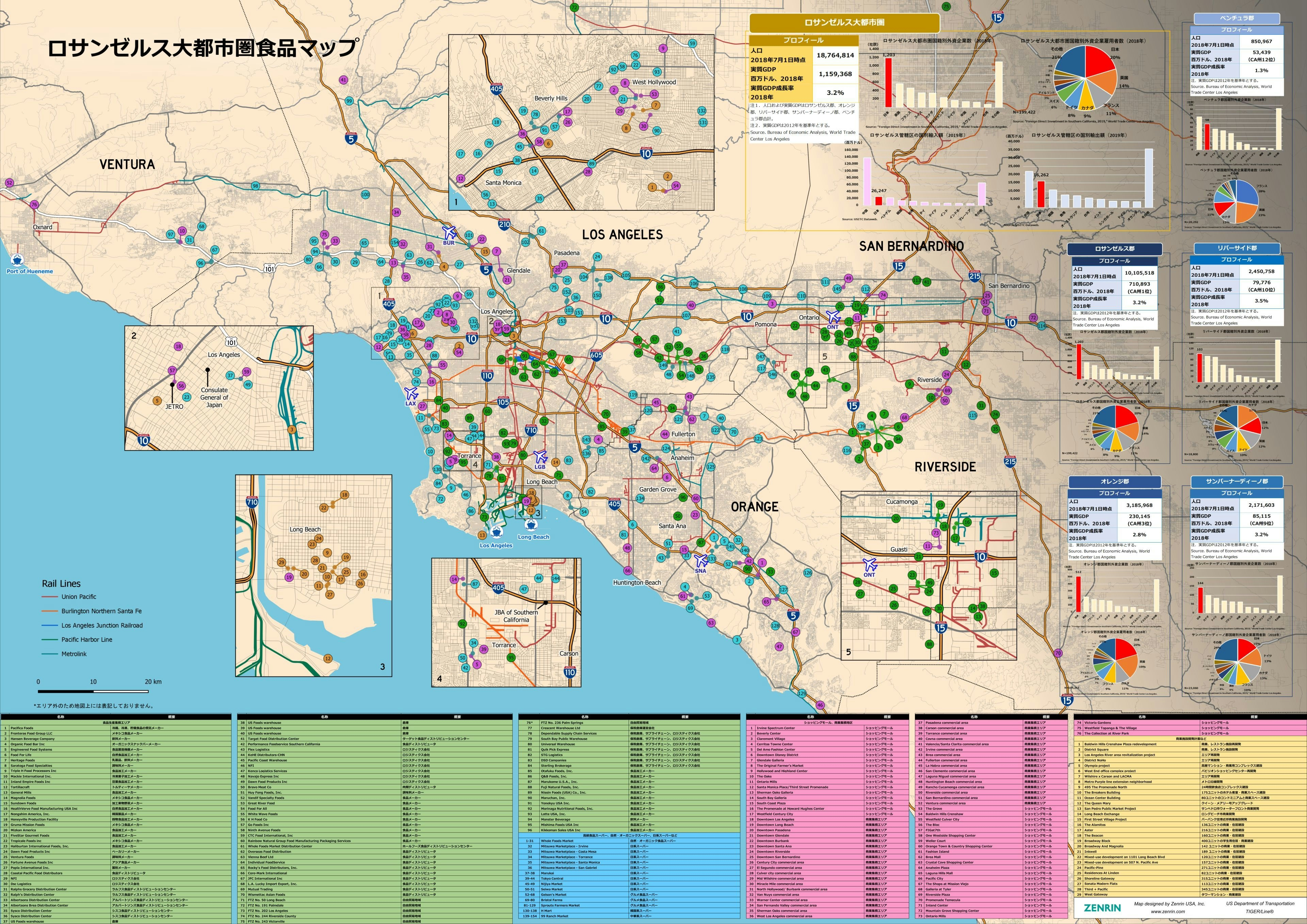
Two custom maps for the Japan External Trade Organization (JETRO) in the Los Angeles area. The purpose of the map was to show prospective japanese companies the viability of starting a business in the area by showing already established Japanese businesses as well as transportation and shipping nodes. The maps were designed to be printed and displayed at conferences.
JETRO Interests in Los Angeles
Tools used
InkscapeQGIS
Plug-ins used
mergeSpatial Join
tags
GIS
More by Timothy Brink


You might also like


.png&w=3840&q=100)

.svg "Alec Soltes")


Join the community!
We're a place where geospatial professionals showcase their works and discover opportunities.