

This map displays the state of Massachusetts in the United States, highlighting its major cities and towns, as well as its natural features such as rivers, lakes, and forests. The map provides a visual representation of the state's diverse geography, including the Atlantic coastline to the east and the Berkshire Mountains to the west. This map can be a helpful resource for exploring the many unique regions and attractions that Massachusetts has to offer."
Massachusetts
Tools used
ArcGIS Pro
Plug-ins used
Geoprocessing Tools
tags
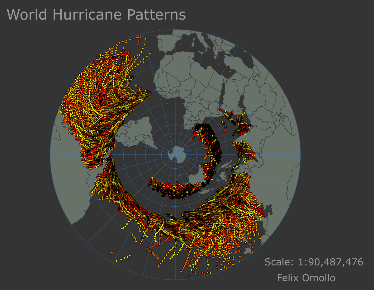
CARTOcatographyMAPPINGMassachusetts
More by FELIX OMOLLO


You might also like


.svg "Keran Nkongolo")


Join the community!
We're a place where geospatial professionals showcase their works and discover opportunities.