
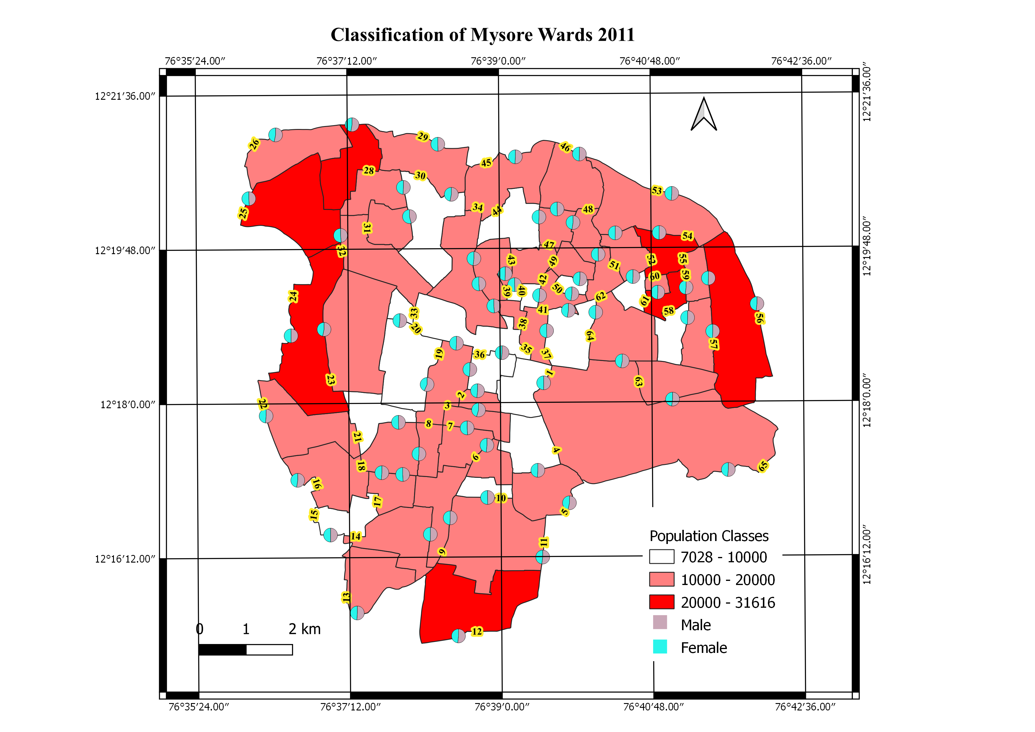
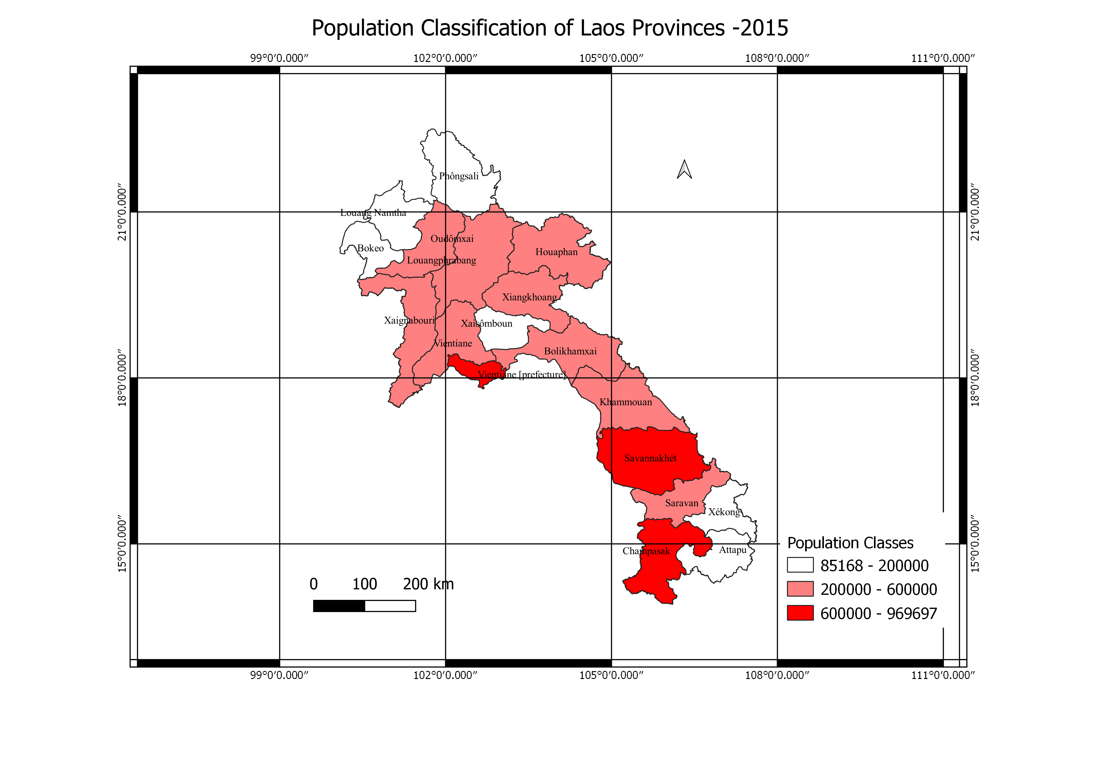
This project was done to determine the classification of the population along all the wards in Mysore and also to know the ration of Male to Female genders in each ward.
Population Classification Map
Plug-ins used
EsriOpenStreetMap
tags
Data VisualizationPopulationDensityQGISStreet Mapping
More by Oswald Onimhawo
You might also like


Join the community!
We're a place where geospatial professionals showcase their works and discover opportunities.