
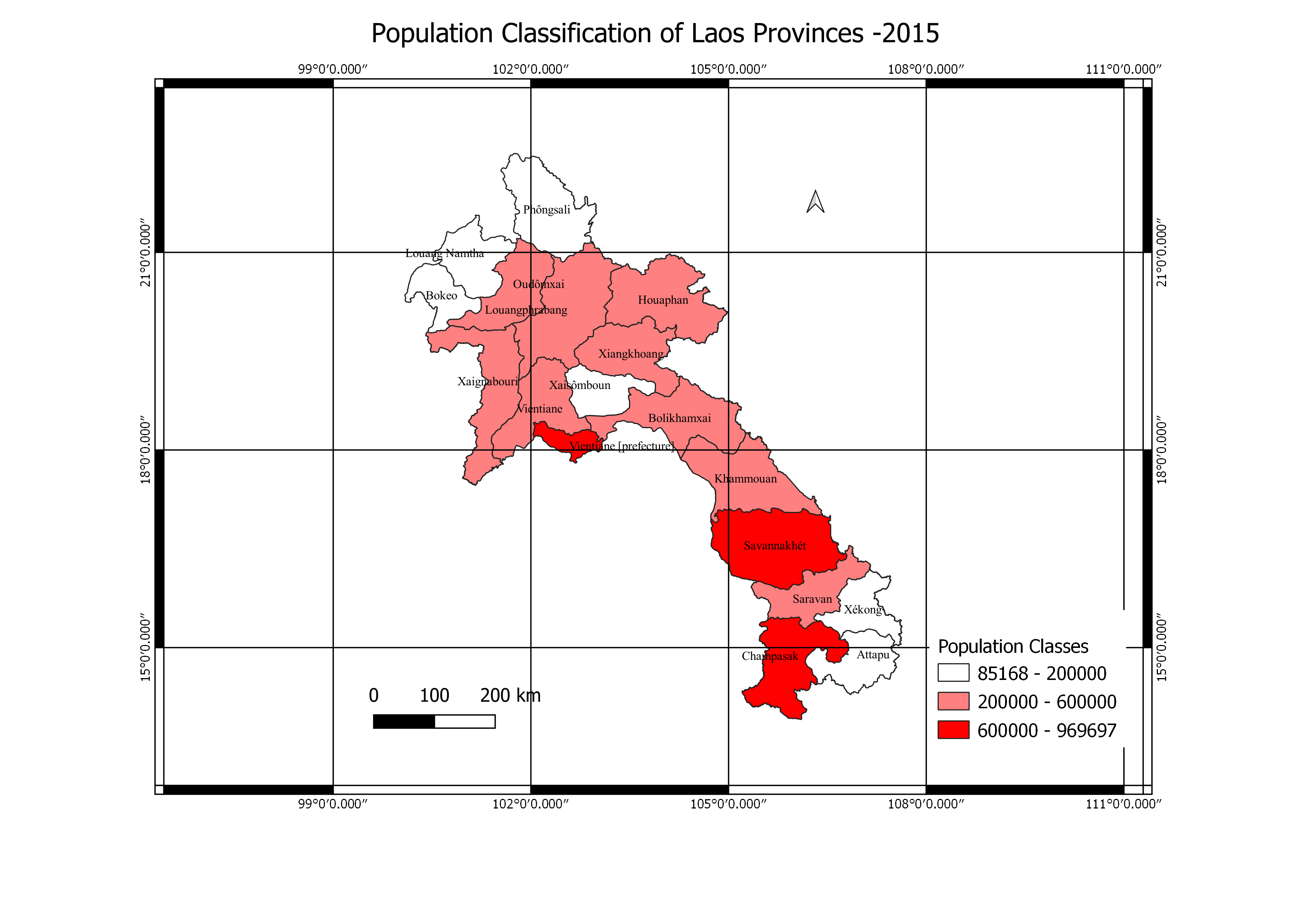
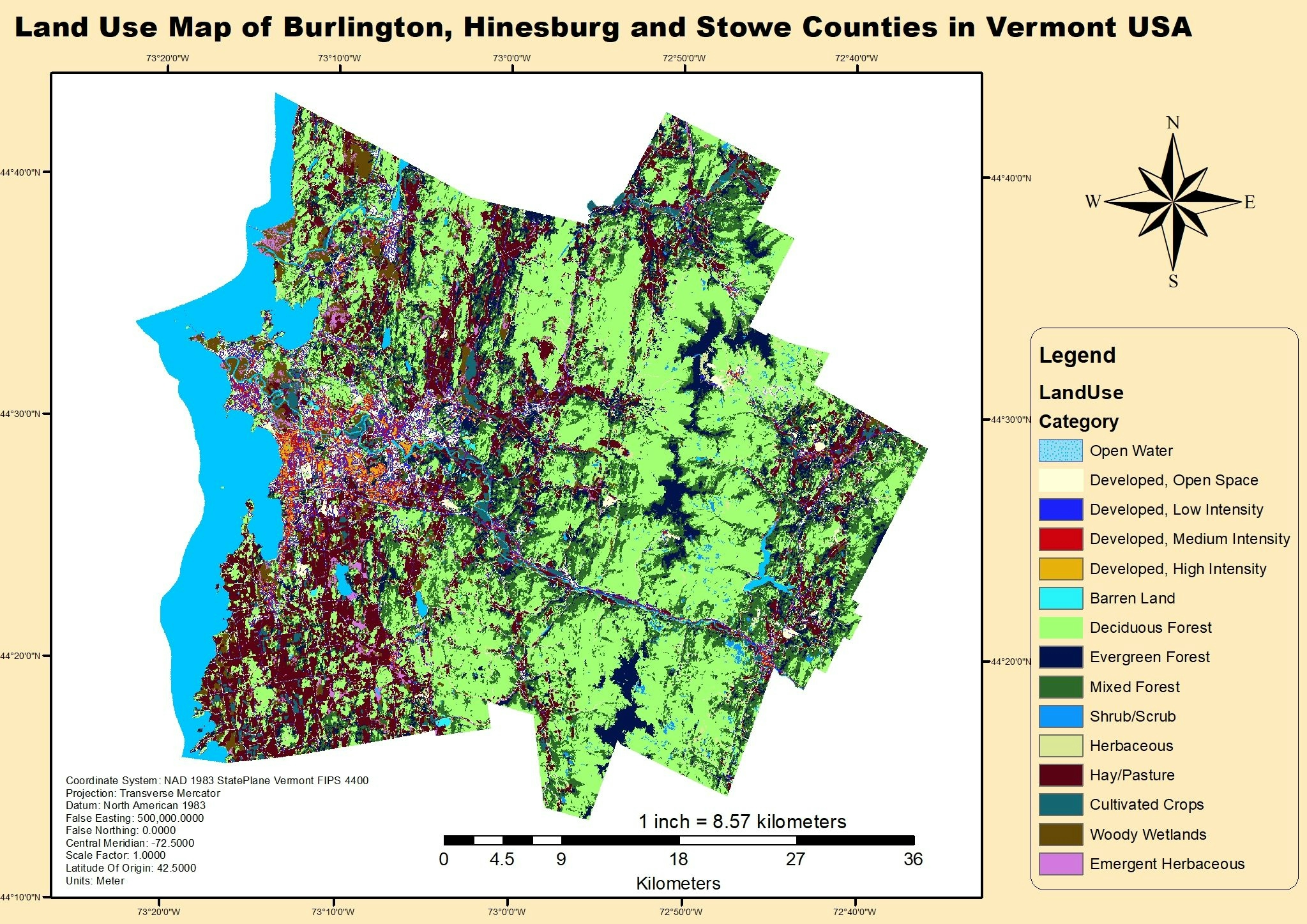
This project investigated the geospatial Classification of population of the citizens of Loas Province in the year 2015.
Population Classification Map
Tools used
ExcelGoogle MapQGIS
Plug-ins used
QGIS
tags
CartographyPopulationDensityQGIS
More by Oswald Onimhawo
You might also like


.jpg&w=3840&q=100)


Join the community!
We're a place where geospatial professionals showcase their works and discover opportunities.