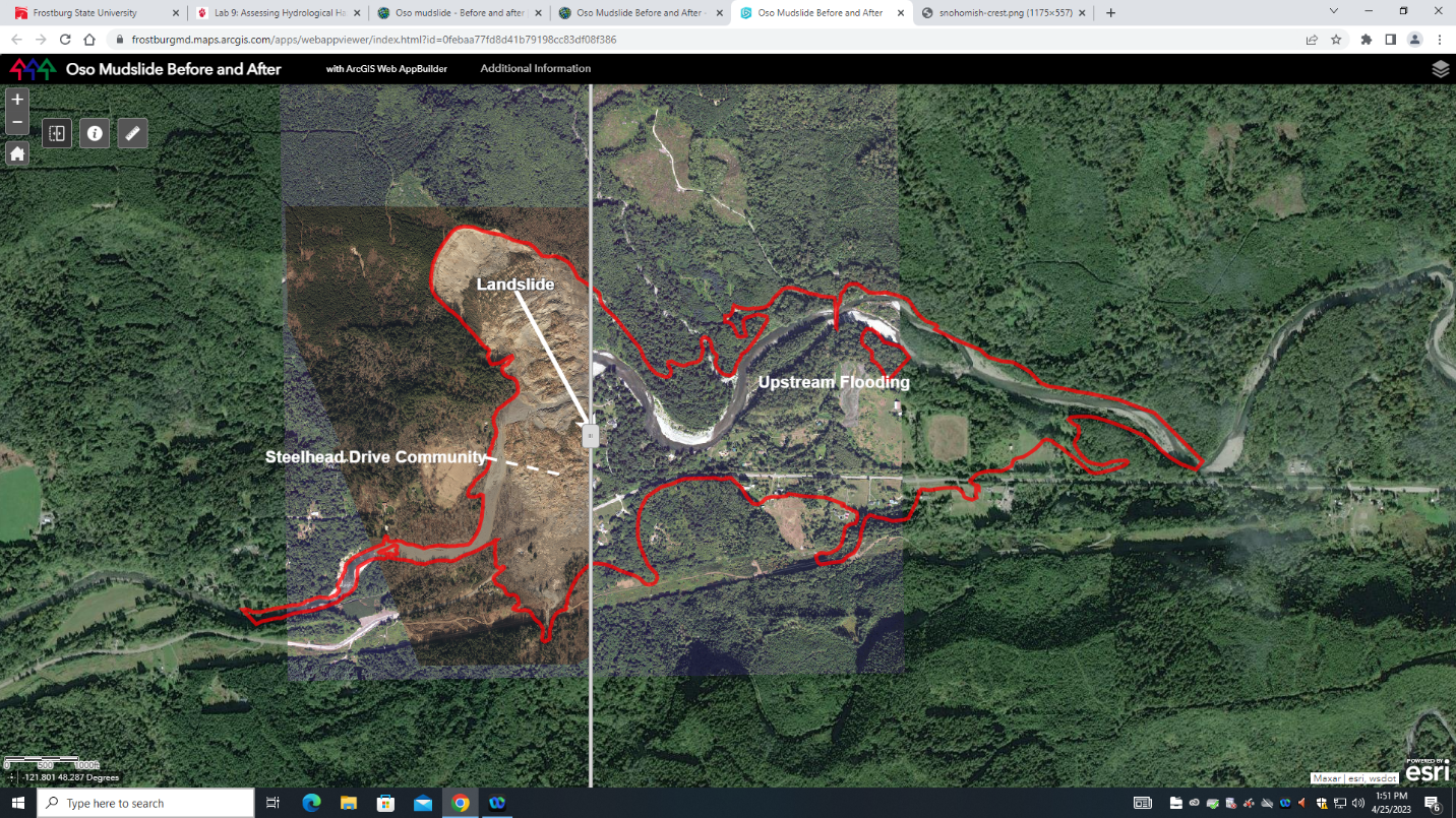
This project consisted of creating an app, web map, and scene on ArcGIS Online to allow for others to either add data or interactively view engaging materials as well as constructing 3D scenes. The study area was the Oso, Washington landslide from March 22, 2014. Satellite imagery from before and after the event were used as well as LiDAR elevation data to create 2D and 3D interactive maps.
This project was completed using the 'Oso mudslide - Before and after' tutorial from Learn ArcGIS.