
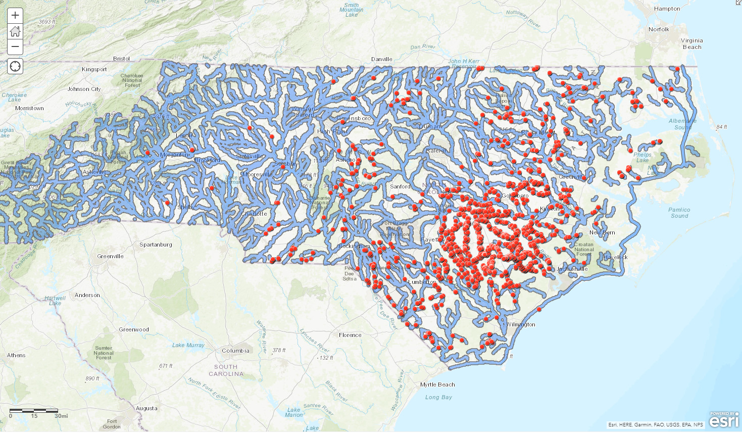
The goal of this project was to identify large scale hog farms in North Carolina that would be at risk for waste lagoon overflow in the case of flooding due to natural events. The project consisted of summarizing data, creating buffers, and the overlay/intersect of data layers. The result was a map of large scale hog farms in North Carolina that are within 1 mile of waterways and therefore at a higher risk of flooding and contaminating the surrounding land with hog waste.
This project was completed using instructions by Esri author Kathryn Keranen.


1_1537132.png&w=3840&q=100)


.gif&w=3840&q=100)


