
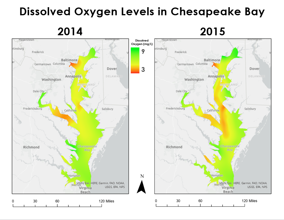
This project involved modelling water quality using interpolation. I examined the statistics behind the average measurements of the entire bay to make sure further statistical analysis was appropriate. After finding that the summers of 2014 and 2015 did not show a trend, it was determined that those time periods could be used for further statistical study. Then, I examined the measurements more closely and found that there were areas of the bay where dissolved oxygen was at a dangerous level. Then, I used kernel interpolation to create statistical and visual models of dissolved oxygen in the entire bay from the summers of 2014 and 2015. Lastly, I created a layout of the two maps to better communicate the issue.
Dissolved Oxygen in The Chesapeake Bay
Tools used
ArcGIS Pro
Plug-ins used
None
tags
chesapeake bayinterpolationwater quality
More by Miranda Teats
You might also like


Join the community!
We're a place where geospatial professionals showcase their works and discover opportunities.