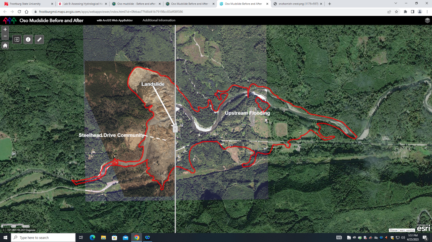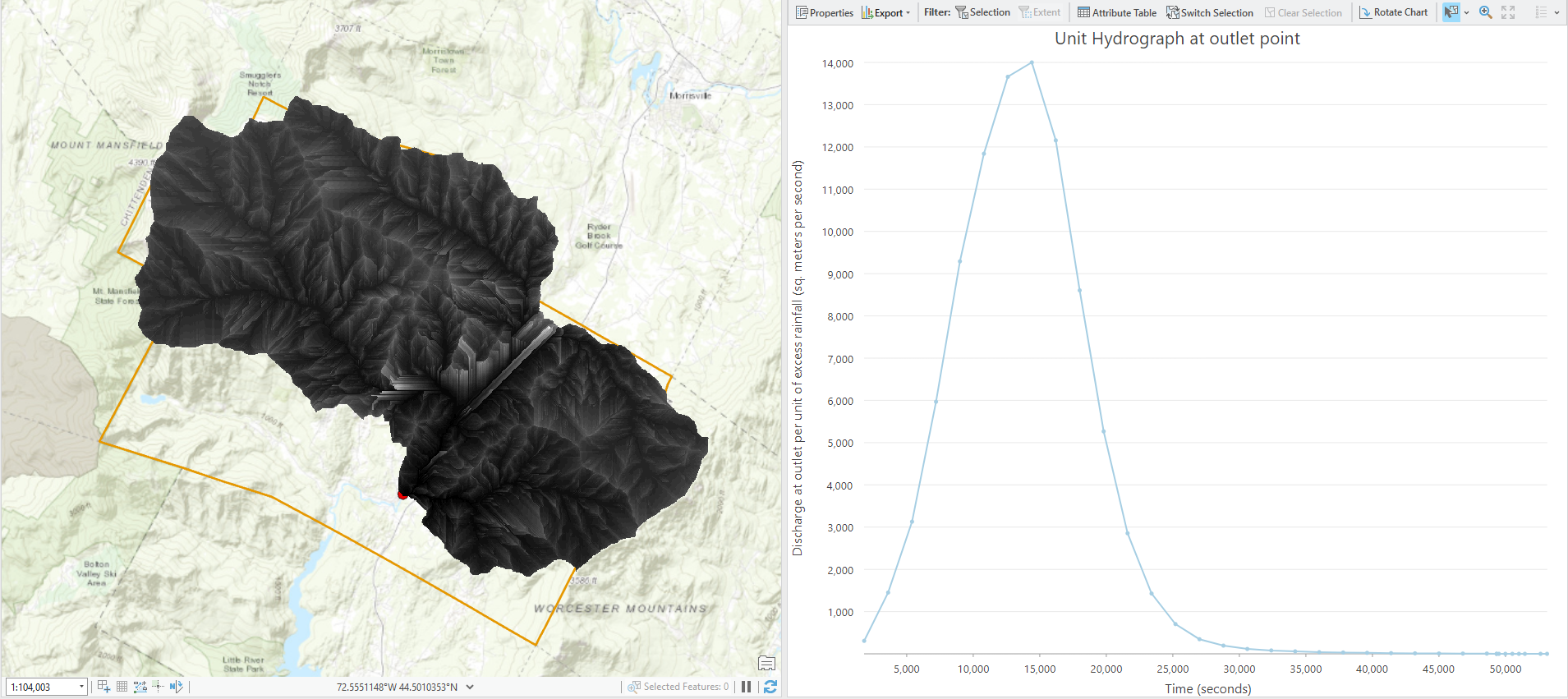
This project estimated stream runoff during a predicted rainstorm in Vermont using hydrographs. The project consisted of creating a velocity field to calculate the speed of flowing water, creating an isochrome map to assess the time it takes water to follow the flow path, and creating a unit hydrograph based on the isochrome map for the outlet of the river.
This project was completed using the 'Predict floods with unit hydrographs' tutorial on Learn ArcGIS.