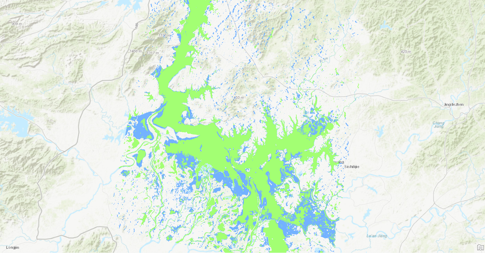
I classified landcover using Landsat imagery of Lake Poyang to understand how much the lake's area has changed over time. My findings indicate a severe problem: the lake has lost thousands of hectares in only 30 years. My calculations don't reveal the causes of Lake Poyang's reduction, but they do provide factual evidence of a serious problem and provide a starting point for environmental scientists and others to conduct further research.
Paraphrased from and completed using the 'Classify land cover to measure shrinking lakes' tutorial on Learn ArcGIS.