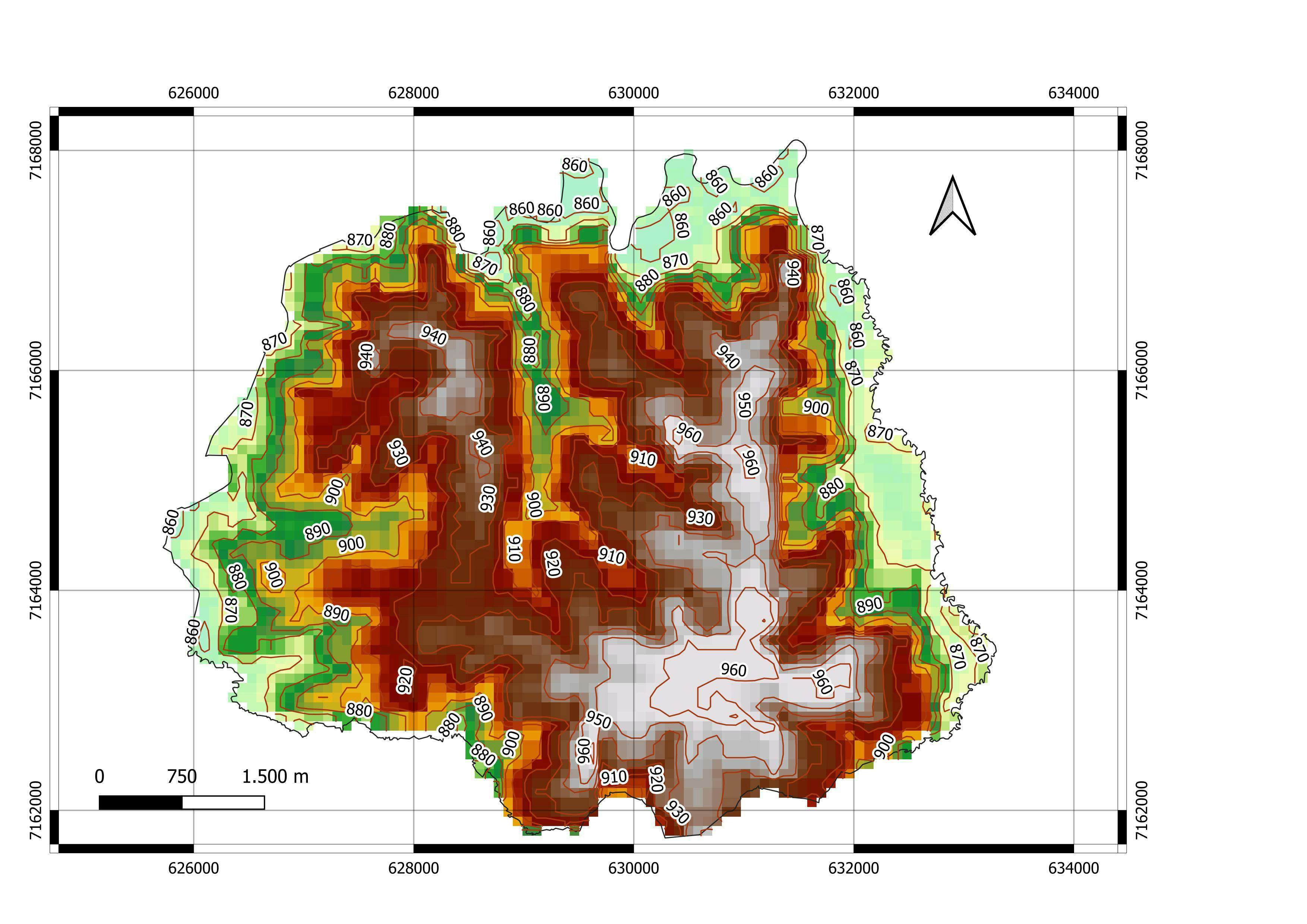
Result from the Esri course: Creating and Sharing GIS Content Using ArcGIS Online.
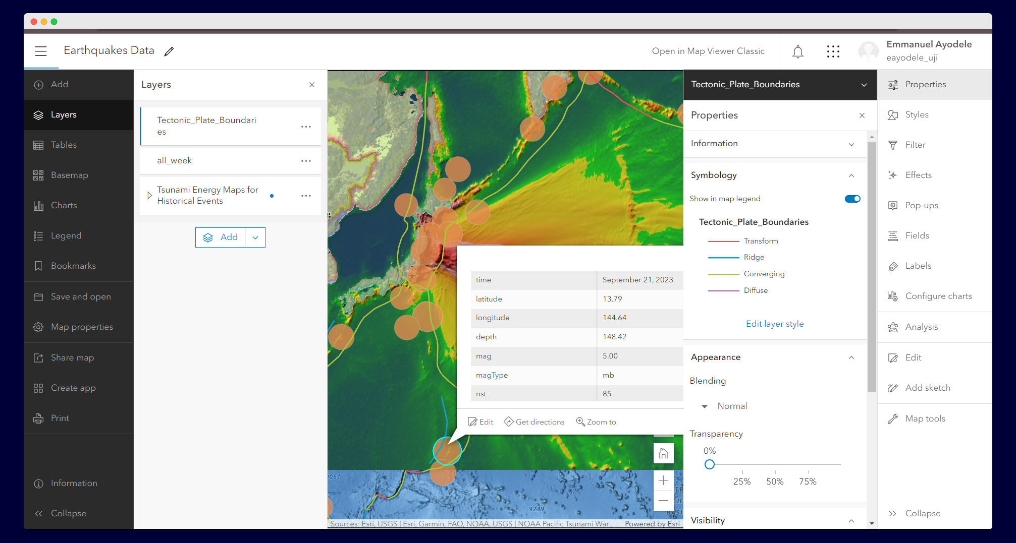
This app shows evacuation routes and demographic data by census tract for Houston, Texas. The darker blue tracts have a higher percentage of households without a vehicle. This pattern helps answer the question: Where in Houston should we provide evacuation assistance during a hurricane?
Use the map legend and feature pop-ups to learn more about the data shown in the map. Click individual census tracts to see pop-up information, including the percentage of households without a vehicle.
The map in this app contains a Living Atlas layer of Houston evacuation routes and a layer of Houston demographic data. The demographic layer is styled using an Arcade expression that calculates the percentage of households without a vehicle. This information is also provided in pop-ups.
Disclaimer:
The content above are from the course materials. Only the web map was developed by me.


.svg "Keran Nkongolo")