
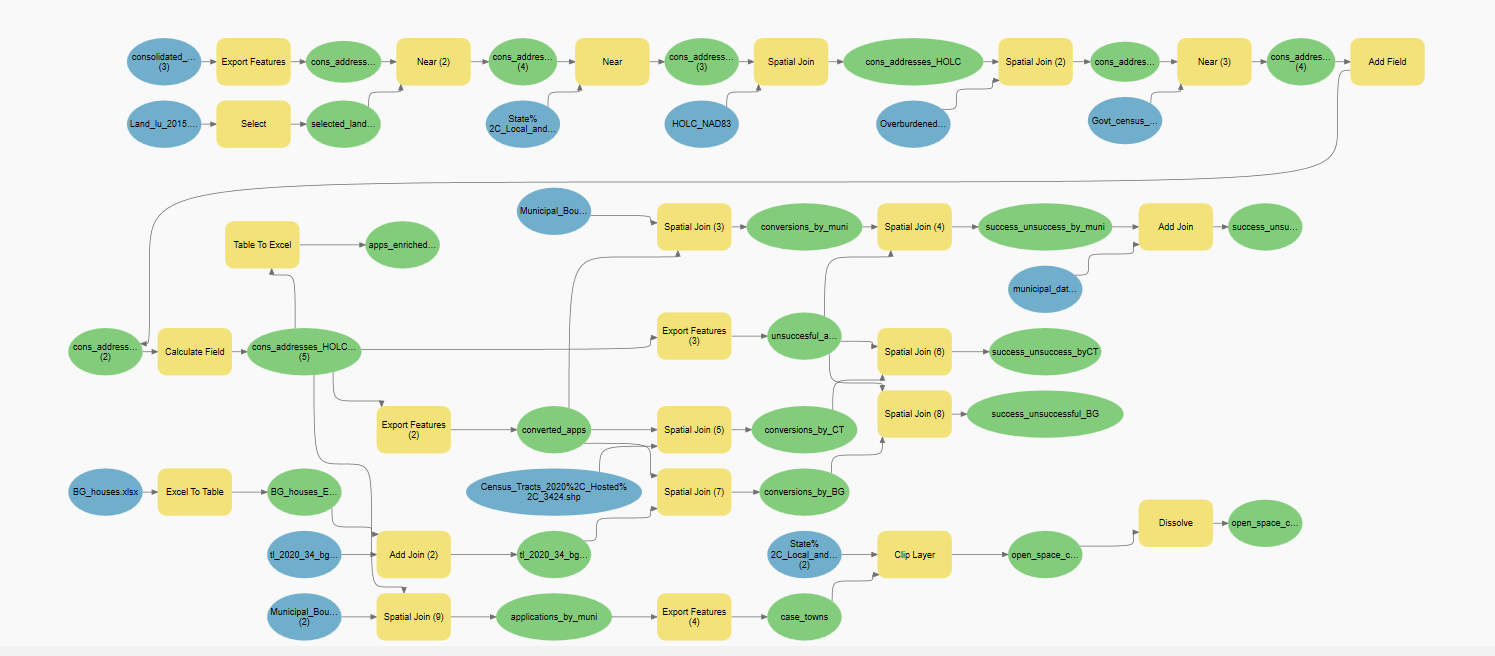
The New Jersey Department of Environmental Protection wanted to analyze the equity of its Blue Acres program, which offers to buy flood-prone houses to convert them into open spaces for flood protection. I used ArcGIS Pro to map the spatial distribution of converted houses and pending applications to see whether there is spatial inequality in applications. I also used Excel and R to identify any demographic indicators that may correlate with successful applications.
Blue Acres Home Buyouts in New Jersey
Plug-ins used
dplyrggplot2
tags
flood riskNew Jersey
You might also like


Join the community!
We're a place where geospatial professionals showcase their works and discover opportunities.