
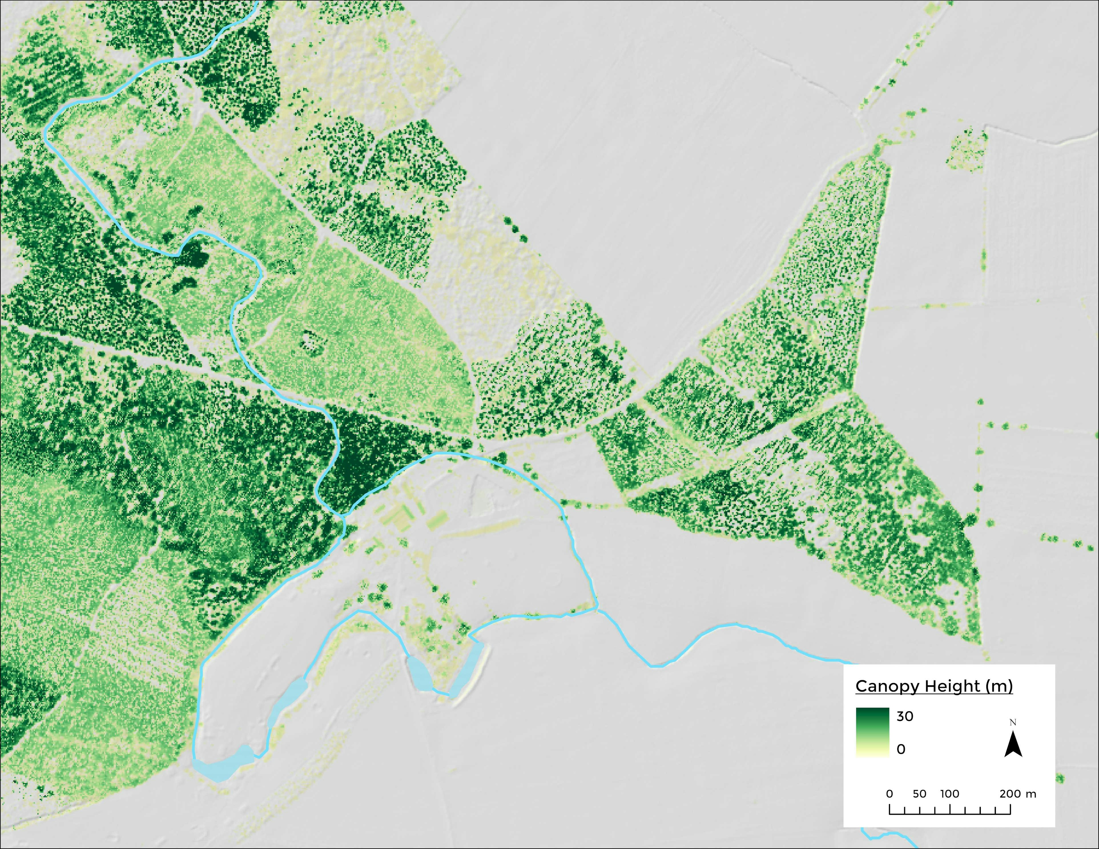
I have wanted to try the UK's Environment Agency LiDAR data for a long time. For this map, I used DTM and DSM downloaded from data.gov.uk at 2 meters resolution. The visualization involves a hillshade derived from DTM and the canopy height layer is generated by subtracting the DTM from the DSM
Canopy Height Model, Selby, UK
Tools used
ArcGIS Pro
Plug-ins used
ArcGIS Pro
tags
canopy-heightdsmforestyorkshire
More by Adriana Calderon
_2239484.png&w=3840&q=100)


You might also like


Join the community!
We're a place where geospatial professionals showcase their works and discover opportunities.