Story
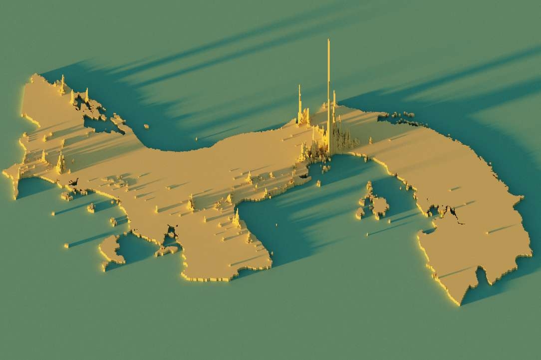
While scrolling on Twitter, I saw an eye-catching worldwide population map and lucky me, it offered a tutorial on how to recreate the technique for any country in the world. In this case, I chose Panama. As you can see on the map, the high peaks to the south represent Panama city, and to the north, the Atlantic city of Colon. The country has a total population of around 4 million inhabitants, with 43% of the population concentrated in the country's capital city and main urban centre.
Technique
For this map, I used the tutorial available here, with population data from worldpop.org at 1 km resolution in raster format. I used QGIS for the pre-processing of the image before transferring to Aerialod software, then I customized the settings to achieve this 3D visual effects.

_2239484.png&w=3840&q=100)